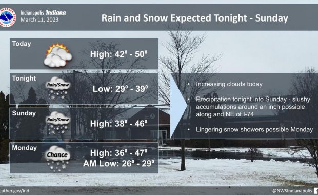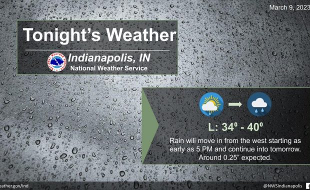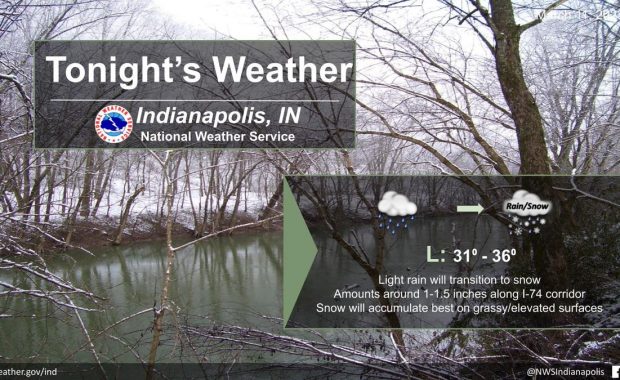
(Via @NWSIndianapolis.) Rain will transition to snow tonight with light accumulations of 1-1.5 inches along the I-74 corridor. Snow will accumulate best on grassy and elevated surfaces, but there may be a few slick spots going into the morning hours. #INwx https://t.co/W8kKAJVxhm My Huge Radar has real-time weather tracking, current temperatures, and severe weather watches […]
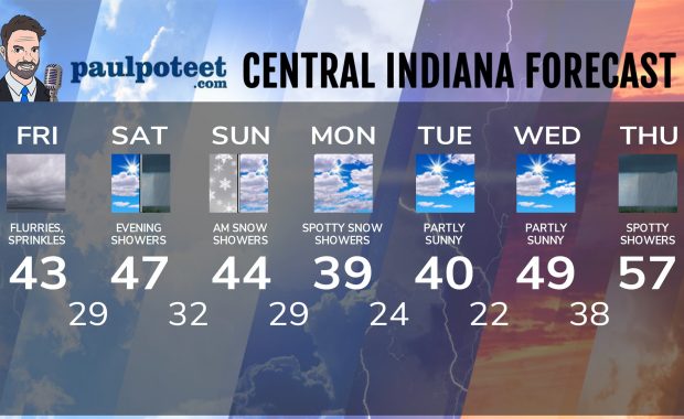
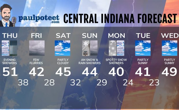
Never miss me! Subscribe for free. My Huge Radar has real-time weather tracking, current temperatures, and severe weather watches and warnings. Get detailed Indiana conditions by clicking here. Click here to see my central Indiana 7-Day Forecast. Follow these links to get my forecasts for Lafayette, Muncie, Hendricks County, and Hamilton County. Need a second opinion? Click here for central Indiana National Weather Service forecasts. (Some charts via WeatherBELL.)