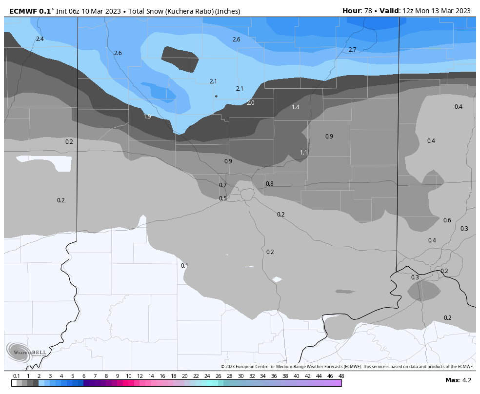
The biggest snow chances in over a month are on the way this weekend! We could get dusted Sunday morning. Areas around Lafayette to Kokomo north could get around an inch.
FUN FACT: The last measurable snowfall officially in Indy was the 30th of January.
Never miss me! Subscribe for free. My Huge Radar has real-time weather tracking, current temperatures, and severe weather watches and warnings. Get detailed Indiana conditions by clicking here. Click here to see my central Indiana 7-Day Forecast. Follow these links to get my forecasts for Lafayette, Muncie, Hendricks County, and Hamilton County. Need a second opinion? Click here for central Indiana National Weather Service forecasts. (Some charts via WeatherBELL.)
INDY SEVEN DAY FORECAST
Friday: Patchy morning fog. Cloudy, with a few flurries or sprinkles. Wind gusts to 30 mph in the afternoon. High 43.
Friday Night: Mostly cloudy evening. Partly cloudy overnight. Low 29.
Saturday: Partly sunny. High 47.
Saturday Night: Clouds thicken. Evening rain, then snow showers. Low 32.
Sunday: Morning snow showers, with a dusting possible. Mostly cloudy afternoon. High 44.
Sunday Night: Mostly cloudy. Spotty snow showers late. Low 29.
Monday: Mostly cloudy, with a few flurries or spotty snow showers. High 39.
Monday Night: Partly cloudy. Low 24.
Tuesday: Partly sunny. High 40.
Tuesday Night: Partly cloudy. Low 22.
Wednesday: Partly sunny. High 49.
Wednesday Night: Mostly cloudy. Low 38.
Thursday: Mostly cloudy. Spotty showers. High 57.

Never miss me! Subscribe for free. My Huge Radar has real-time weather tracking, current temperatures, and severe weather watches and warnings. Get detailed Indiana conditions by clicking here. Click here to see my central Indiana 7-Day Forecast. Follow these links to get my forecasts for Lafayette, Muncie, Hendricks County, and Hamilton County. Need a second opinion? Click here for central Indiana National Weather Service forecasts. (Some charts via WeatherBELL.)


