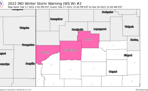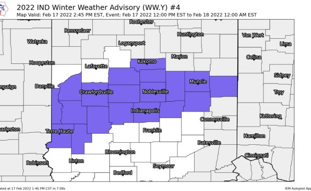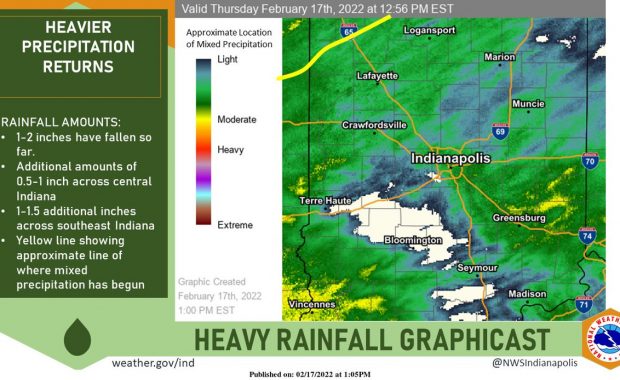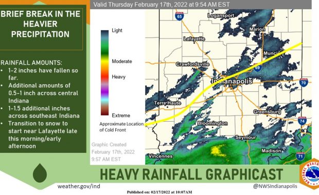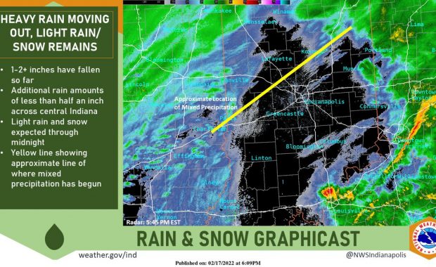
(Via @NWSIndianapolis.) Heavier rain is moving off to the east. Light rain transitioning to snow will move through central Indiana through midnight. Highest snow amounts will be over NW portions of the forecast area. #INwx https://t.co/ZMVQxsA9bu My Huge Radar has real-time weather tracking, current temperatures, and severe weather watches and warnings. Get detailed Indiana conditions […]
Never miss me! Subscribe for free. My Huge Radar has real-time weather tracking, current temperatures, and severe weather watches and warnings. Get detailed Indiana conditions by clicking here. Click here to see my central Indiana 7-Day Forecast. Follow these links to get my forecasts for Lafayette, Muncie, Hendricks County, and Hamilton County. Need a second opinion? Click here for central Indiana National Weather Service forecasts. (Some charts via WeatherBELL.)