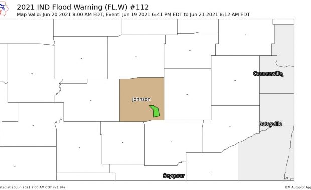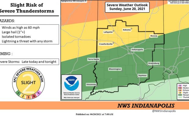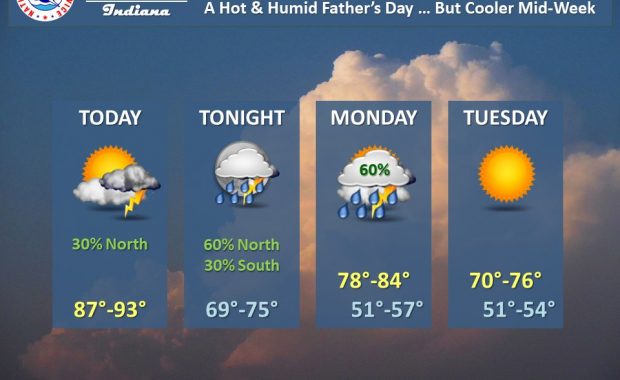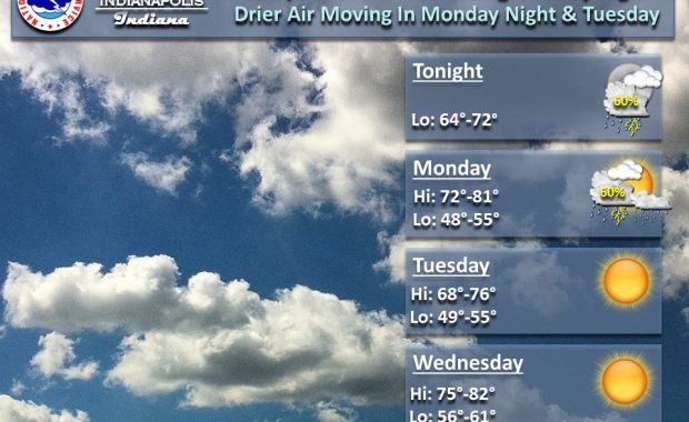
(Via @NWSIndianapolis.) Up to 60% chance of showers/t-storms thru Mon. Severe storms possible this eve/overnight. T-storms end Mon, rain ending Mon night. Drier air moving in Mon night/Tue. Sunny Tue & Wed, making for pleasant weather. Thru Wed night high temps 68-82°, lows 48-72°. #INwx #nwsind https://t.co/oZolV8680Z My Huge Radar has real-time weather tracking, current […]
Never miss me! Subscribe for free. My Huge Radar has real-time weather tracking, current temperatures, and severe weather watches and warnings. Get detailed Indiana conditions by clicking here. Click here to see my central Indiana 7-Day Forecast. Follow these links to get my forecasts for Lafayette, Muncie, Hendricks County, and Hamilton County. Need a second opinion? Click here for central Indiana National Weather Service forecasts. (Some charts via WeatherBELL.)