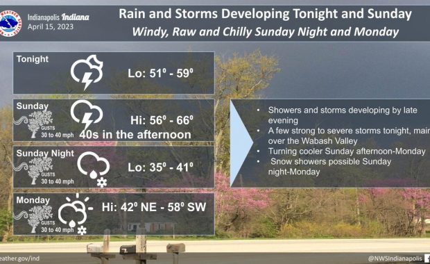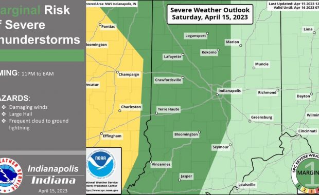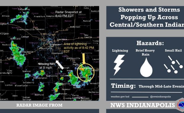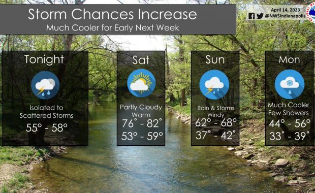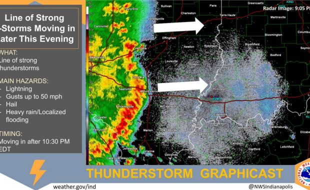
(Via @NWSIndianapolis.) A line of strong thunderstorms is approaching central #inwx this evening, and the storms will move into mainly southwest portions of the area after 10:30 PM EDT. The storms will be capable of producing wind gusts around 50 mph, hail, heavy rain, and lightning. https://t.co/liNjgaS90W My Huge Radar has real-time weather tracking, current […]
Never miss me! Subscribe for free. My Huge Radar has real-time weather tracking, current temperatures, and severe weather watches and warnings. Get detailed Indiana conditions by clicking here. Click here to see my central Indiana 7-Day Forecast. Follow these links to get my forecasts for Lafayette, Muncie, Hendricks County, and Hamilton County. Need a second opinion? Click here for central Indiana National Weather Service forecasts. (Some charts via WeatherBELL.)