After this morning the trend is your friend if you’ve been waiting for Spring temps to stay awhile.
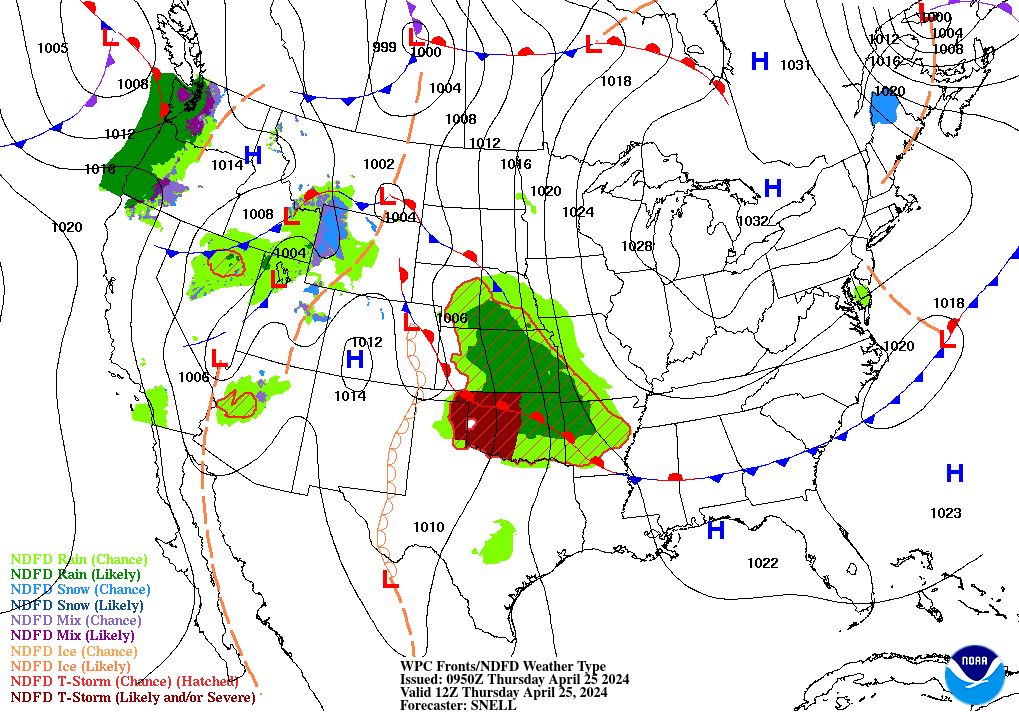
Surface high pressure takes over for the day in central Indiana. Enjoy the sun!
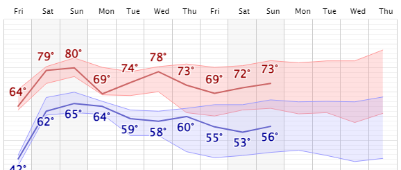
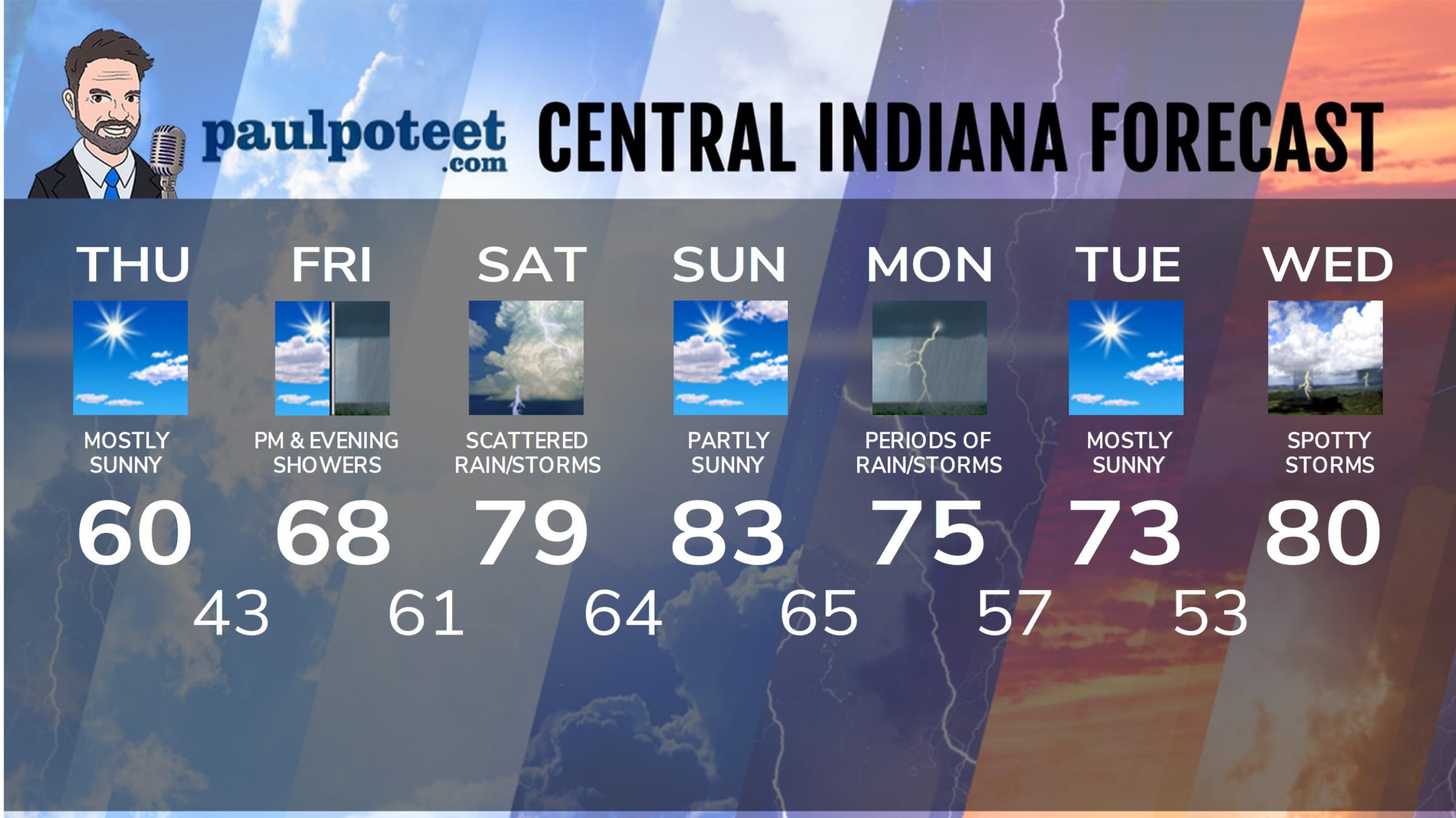
INDY SEVEN DAY FORECAST
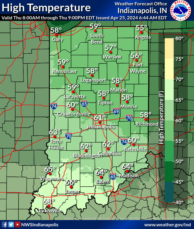
Today: Patchy morning frost. Mostly sunny. High 60.
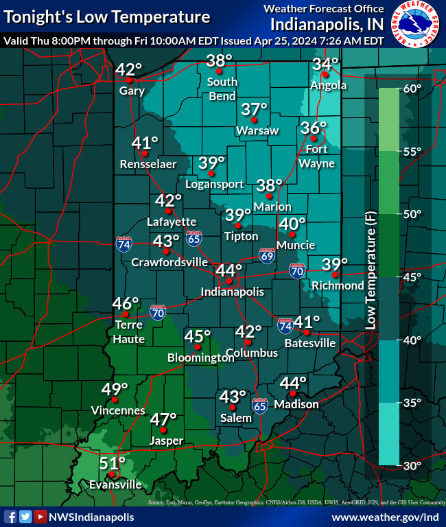
Tonight: Mostly clear evening. Partly cloudy overnight. Low 43.
Friday: Partly sunny. Scattered showers in the afternoon. High 68.
Friday Night: Scattered showers. Low 61.
Saturday: Partly to mostly cloudy, with scattered showers and storms. Breezy. High 79.
Saturday Night: Partly to mostly cloudy, with a spotty shower or storm possible. Low 64.
Sunday: Partly sunny. Breezy. High 83.
Sunday Night: Partly to mostly cloudy, with scattered showers and storms after midnight. Low 65.
Monday: Mostly cloudy. Periods of showers and storms. High 75.
Monday Night: Evening showers and storms. Partly cloudy late. Low 57.
Tuesday: Sunshine returns. High 73.
Tuesday Night: Partly cloudy. Low 53.
Wednesday: Partly to mostly cloudy, with spotty showers and storms. High 80.
Never miss me! Subscribe for free. My Huge Radar has real-time weather tracking, current temperatures, and severe weather watches and warnings. Get detailed Indiana conditions by clicking here. Click here to see my central Indiana 7-Day Forecast. Follow these links to get my forecasts for Lafayette, Muncie, Hendricks County, and Hamilton County. Need a second opinion? Click here for central Indiana National Weather Service forecasts. (Some charts via WeatherBELL.)


Leave a Reply