It’s the last of the red-hot Summer-ish days for awhile in central Indiana. Blame that blue line you see to the west on the map below. It’s a cold front bringing possibly severe storms tonight, and colder-than-average temperatures tomorrow.

I think storms will start cranking after sunset, and will finish by about 3am.


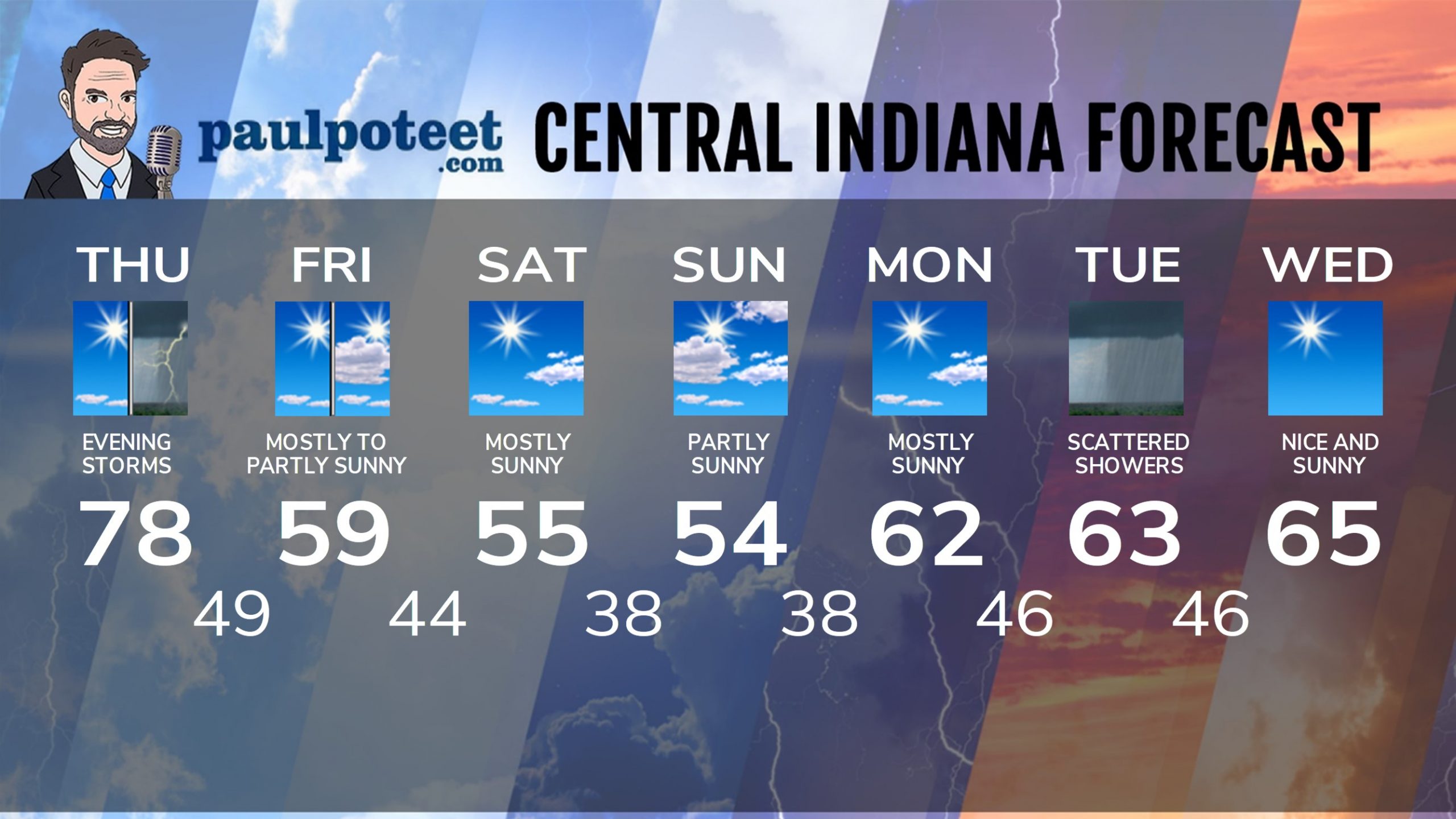
INDY SEVEN DAY FORECAST
Today: Mostly to partly sunny, and warm one last time. High 78.
Tonight: Showers and storms, possibly severe. Wind gusts to 25 mph. Low 49.
Friday: Mostly sunny morning. Partly sunny afternoon. Much cooler.Wind gusts to 25 mph. High 59.
Friday Night: Partly cloudy. Low 44.
Saturday: Mostly sunny. High 55.
Saturday Night: Partly cloudy. Low 38.
Sunday: Partly sunny. High 55.
Sunday Night: Mostly clear. Low 38.
Monday: Mostly sunny. High 62.
Monday Night: Partly cloudy. Low 46.
Tuesday: Partly to mostly cloudy, with scattered showers. High 63.
Tuesday Night: Evening shower chances, then clearing. Low 46.
Wednesday: Sunny. High 65.


Never miss me! Subscribe for free. My Huge Radar has real-time weather tracking, current temperatures, and severe weather watches and warnings. Get detailed Indiana conditions by clicking here. Click here to see my central Indiana 7-Day Forecast. Follow these links to get my forecasts for Lafayette, Muncie, Hendricks County, and Hamilton County. Need a second opinion? Click here for central Indiana National Weather Service forecasts. (Some charts via WeatherBELL.)


Leave a Reply