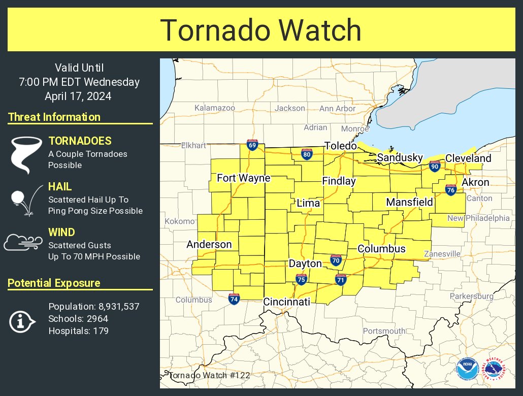
The NWS Storm Prediction Center has issued a
* Tornado Watch for portions of
Eastern Indiana
Western and Central Ohio
Lake Erie
* Effective this Wednesday afternoon and evening from 1220 PM
until 700 PM EDT.
* Primary threats include…
A couple tornadoes possible
Scattered damaging wind gusts to 70 mph possible
Scattered large hail events to 1.5 inches in diameter possible
SUMMARY…Thunderstorm coverage is expected to increase over the
next several hours. Environmental conditions support the potential
for a few supercells capable of tornadoes, large hail 1″ to 1.5″ in
diameter, and damaging gusts from 50 to 60 mph.
Never miss me! Subscribe for free. My Huge Radar has real-time weather tracking, current temperatures, and severe weather watches and warnings. Get detailed Indiana conditions by clicking here. Click here to see my central Indiana 7-Day Forecast. Follow these links to get my forecasts for Lafayette, Muncie, Hendricks County, and Hamilton County. Need a second opinion? Click here for central Indiana National Weather Service forecasts. (Some charts via WeatherBELL.)


Leave a Reply