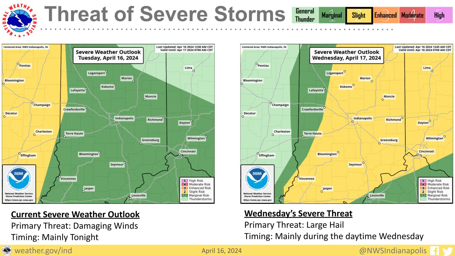
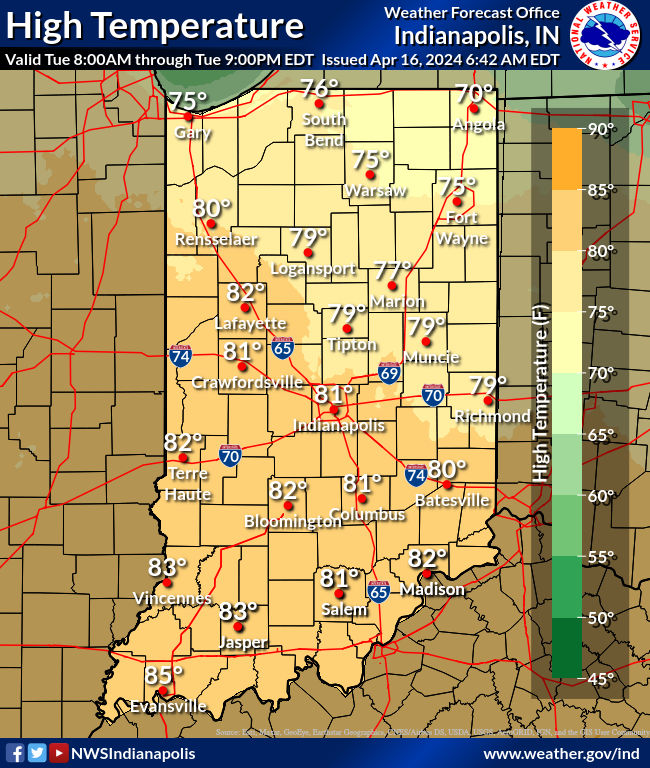
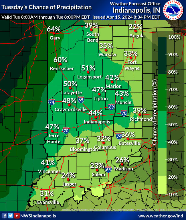
When we last left our wandering frontal boundary yesterday…it was drifting southward toward the Ohio River. That meant highs “only” in the 70s yesterday north of Indy, but today the 80s will return. Enjoy, but keep an eye to the sky. A random, isolated storm is possible, and if anything develops it might produce some damaging wind gusts. Showers and storms will be more widespread late tonight and tomorrow. Expect one round in the morning and one in the afternoon Wednesday. Large hail is the biggest threat, but damaging straight-line winds and a tornado are also possible.
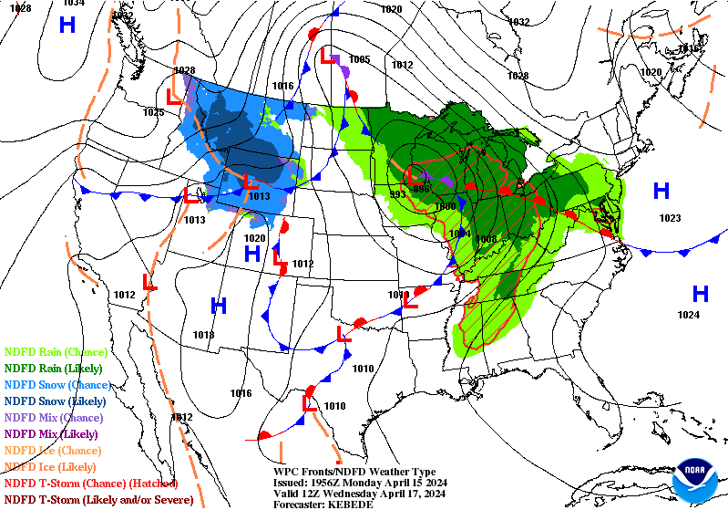
As the cold front (in blue on the Wednesday morning map below) sweeps through the storms will end by sunset Wednesday.
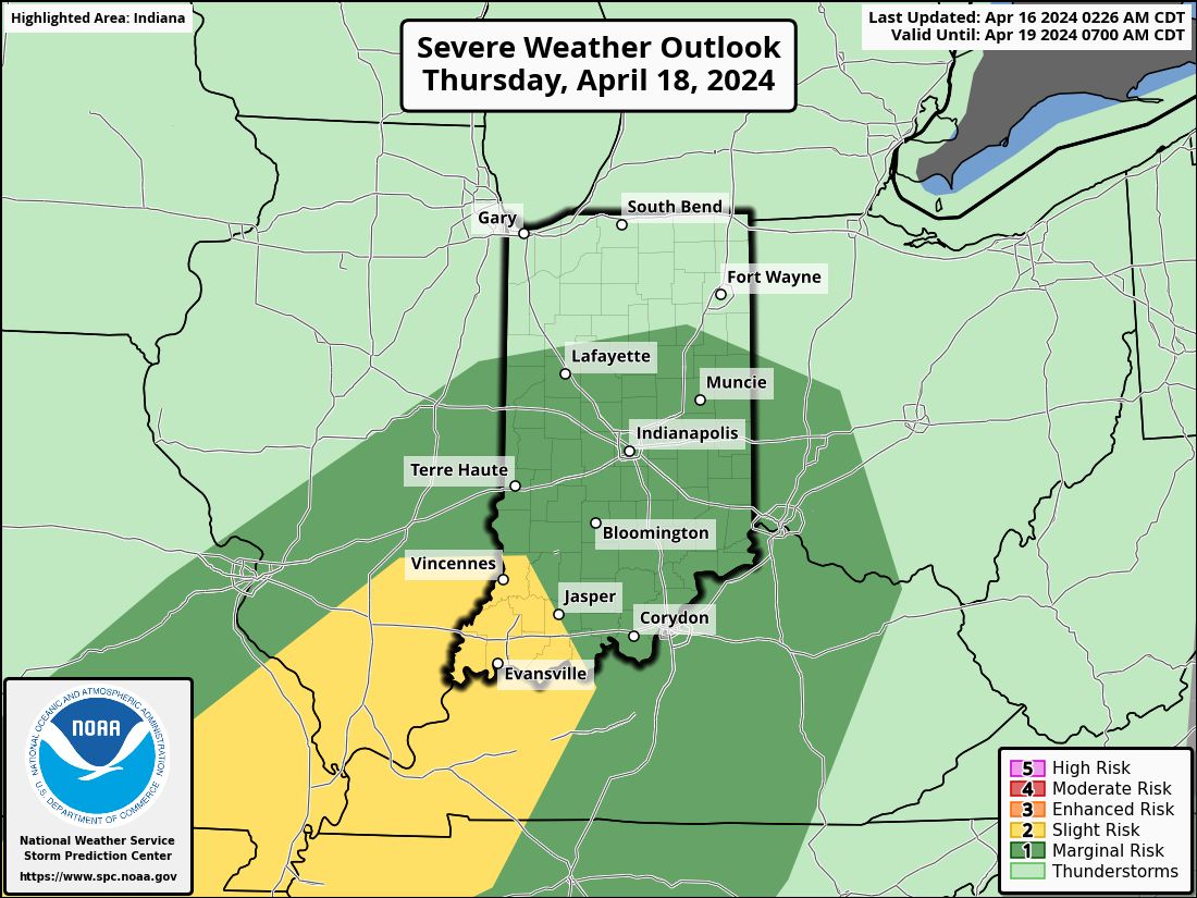
Thursday looks nice, but showers and storms will return again along another cold front Thursday evening. Once again a few could be severe.
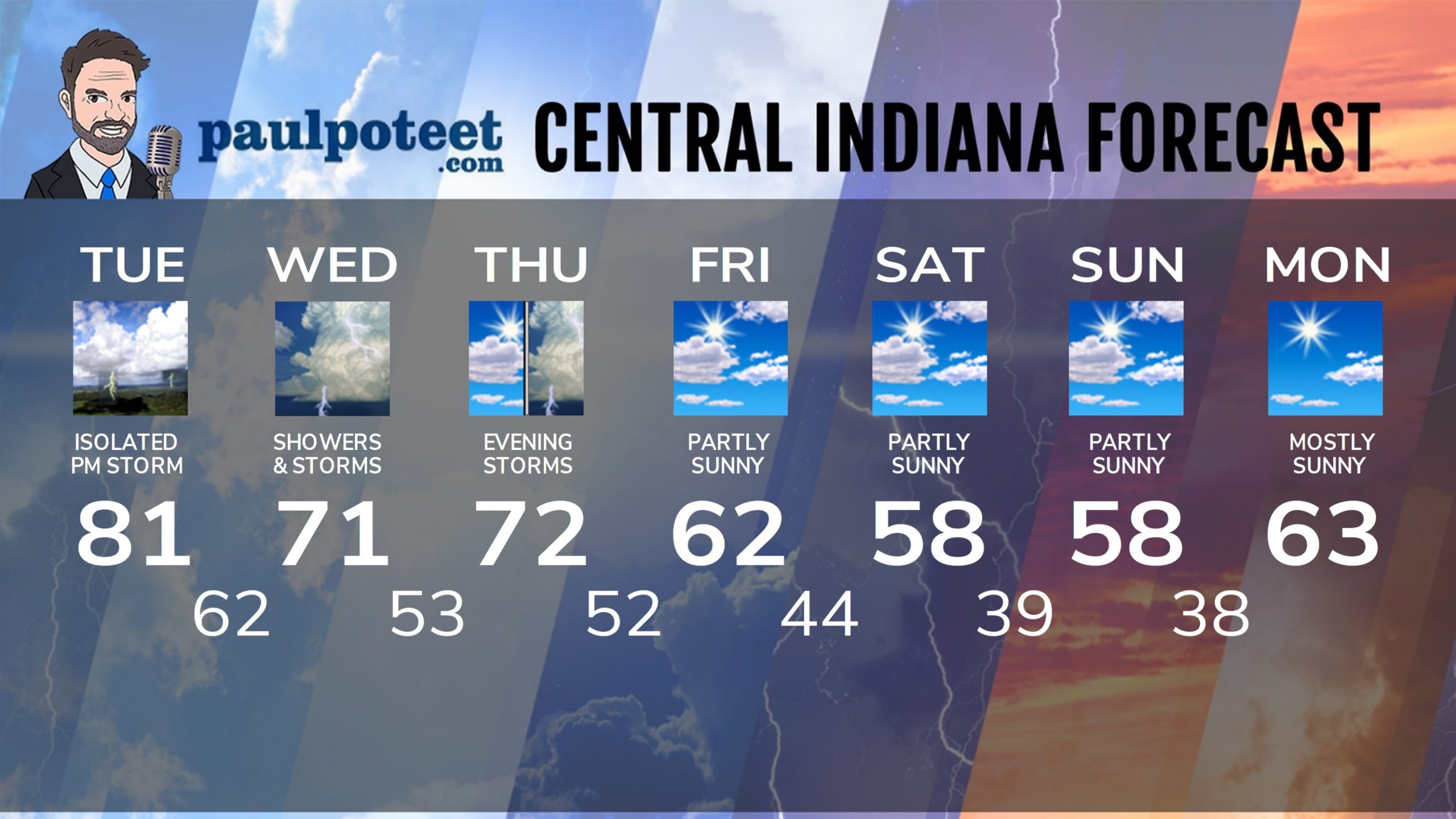
INDY SEVEN DAY FORECAST
Today: Partly sunny and very warm again. An isolated shower or storm possible in the afternoon. High 81.
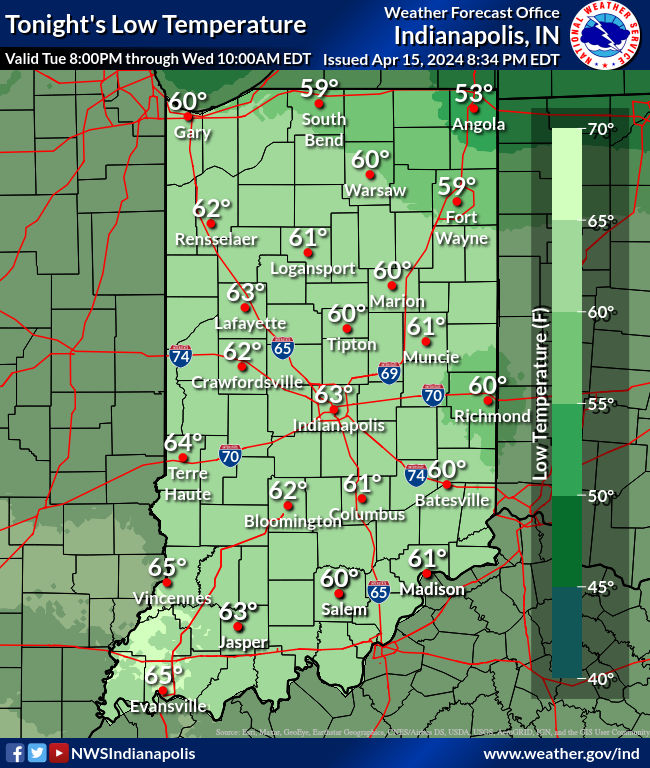
Tonight: Scattered showers and storms, mainly after midnight. A few could be severe. Low 62.
Wednesday: Periods of showers and storms, possibly severe. High 71.
Wednesday Night: Partly cloudy. Low 53.
Thursday: Partly sunny. High 72.
Thursday Night: Showers and storms, possibly severe. Low 52.
Friday: Partly sunny. High 62.
Friday Night: Partly cloudy. Low 44.
Saturday: Partly sunny. High 58.
Saturday Night: Partly cloudy. Low 39.
Sunday: Partly sunny. High 58.
Sunday Night: Mostly clear. Low 38.
Monday: Mostly sunny. High 63.
Never miss me! Subscribe for free. My Huge Radar has real-time weather tracking, current temperatures, and severe weather watches and warnings. Get detailed Indiana conditions by clicking here. Click here to see my central Indiana 7-Day Forecast. Follow these links to get my forecasts for Lafayette, Muncie, Hendricks County, and Hamilton County. Need a second opinion? Click here for central Indiana National Weather Service forecasts. (Some charts via WeatherBELL.)


Leave a Reply