Another round of Winter weather is on the way tomorrow, but THIS will end up being the biggest event of the Winter of 2021-2022.
From the morning hours of Wednesday February 2nd through the morning hours on Friday February 4th, a strong winter system moved through central Indiana initially bringing heavy rain to the area which then transitioned to a mix of sleet and freezing rain before becoming all snow. Snow began across the Lafayette area Wednesday morning with the heaviest snow during the day. The transition line spread to a line roughly from Muncie to Terre Haute before slowing down significantly. Heavy snow then impacted the I-70 corridor and points south on Thursday with additional light snow through the morning hours Friday.
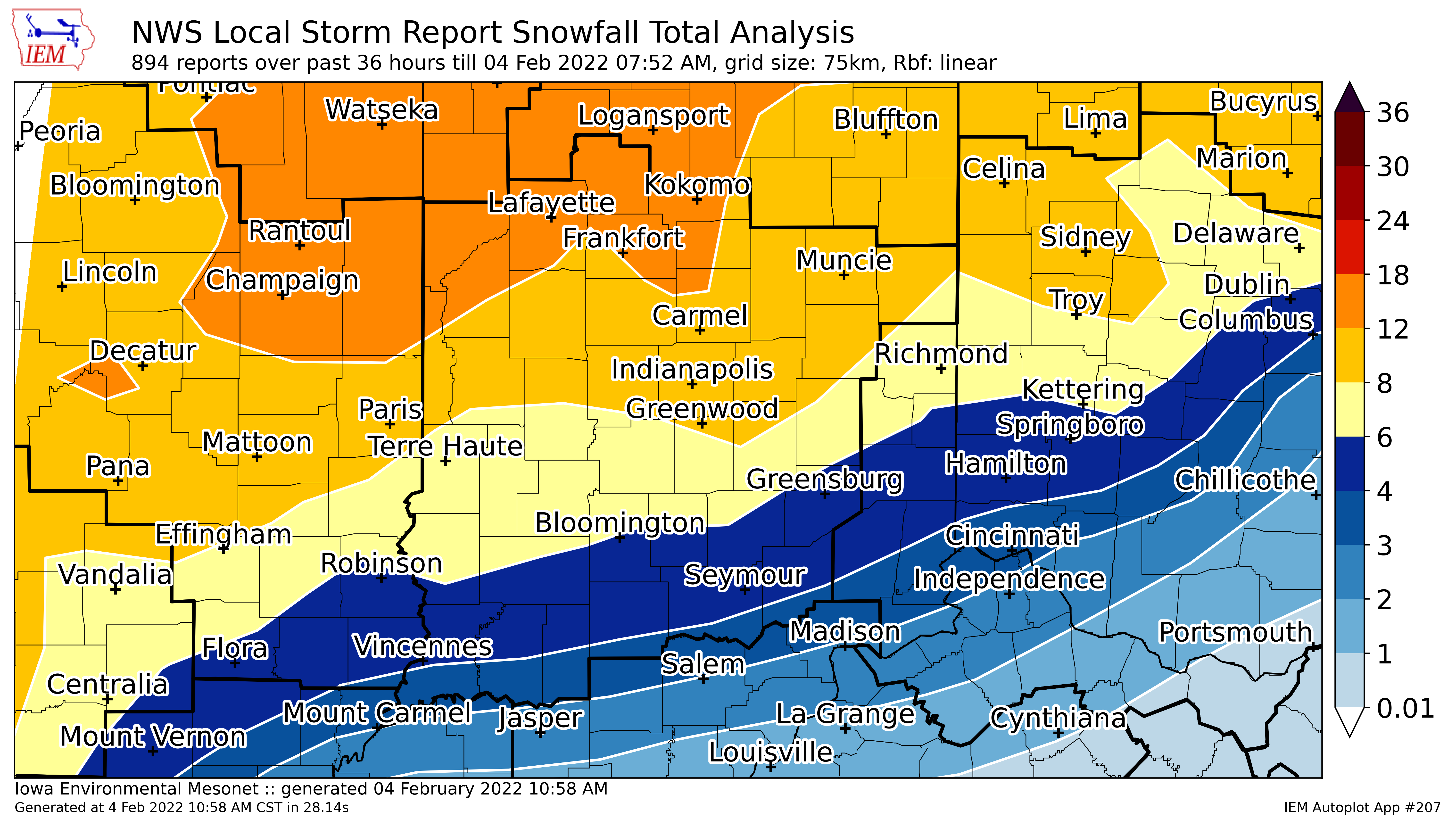
Here is the complete review of the ice and snow via the National Weather Service.
Never miss me! Subscribe for free. My Huge Radar has real-time weather tracking, current temperatures, and severe weather watches and warnings. Get detailed Indiana conditions by clicking here. Click here to see my central Indiana 7-Day Forecast. Follow these links to get my forecasts for Lafayette, Muncie, Hendricks County, and Hamilton County. Need a second opinion? Click here for central Indiana National Weather Service forecasts. (Some charts via WeatherBELL.)


About had a heart attack when I saw us under 6 inches of snow (thinking we were going to get that again… https://t.co/EnWPLUP7Vs
no this will not, the biggest event will be when you no longer see your shadow till next yr
No more my back says no