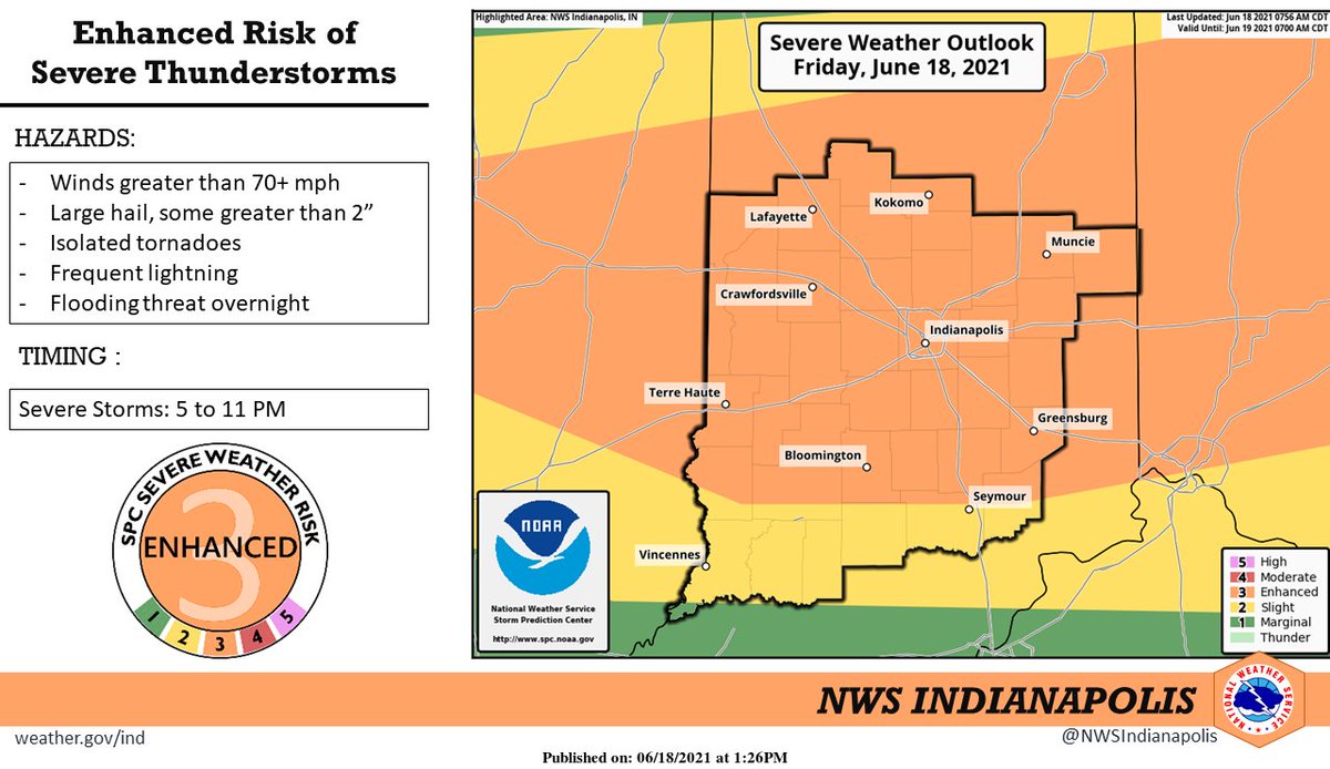
(Via @NWSIndianapolis.) T-storms expected this afternoon, but best chance for severe t-storms from 5 to 11PM. Severe winds, large hail will be the primary threat, although an isolated tornado cannot be ruled out. Multiple hours of heavy rain overnight will also lead to flooding concerns. #INwx https://t.co/LelY1xgNw1
My Huge Radar has real-time weather tracking, current temperatures, and severe weather watches and warnings. Get detailed Indiana conditions by clicking here. Follow these links to get my forecasts for Lafayette, Muncie, Hendricks County, and Hamilton County. Need a second opinion? Click here for central Indiana National Weather Service forecasts.
Never miss me! Subscribe for free. My Huge Radar has real-time weather tracking, current temperatures, and severe weather watches and warnings. Get detailed Indiana conditions by clicking here. Click here to see my central Indiana 7-Day Forecast. Follow these links to get my forecasts for Lafayette, Muncie, Hendricks County, and Hamilton County. Need a second opinion? Click here for central Indiana National Weather Service forecasts. (Some charts via WeatherBELL.)


@NWSIndianapolis Dang it sure got hot FAST