(Via @NWSIndianapolis.)
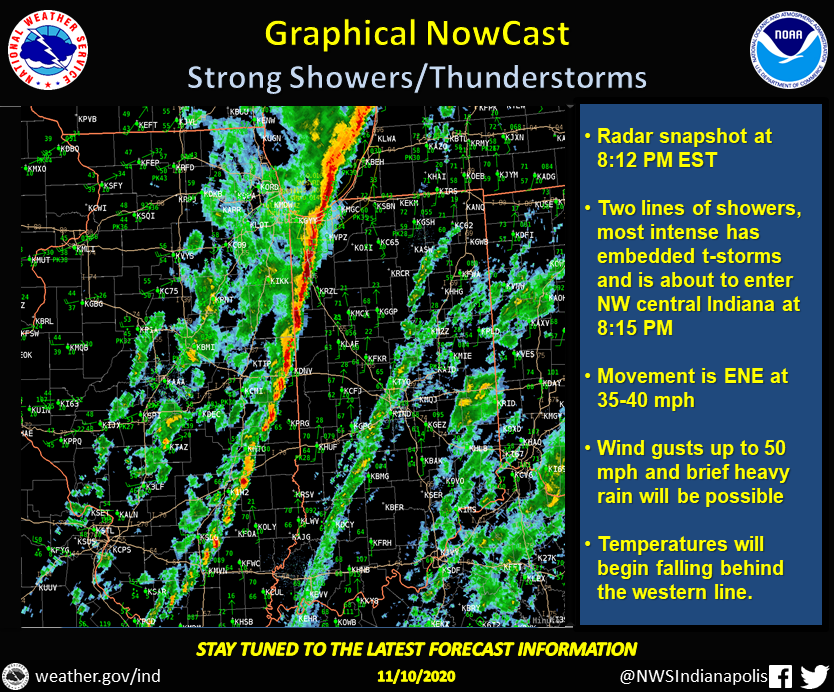
At 8:12 PM EST two lines of showers were affecting Indiana, the western line entering NW central IN with embedded t-storms, up to 50 mph winds, & heavy rain. Movement is ENE at 35-40 mph. Temps will be falling & winds shifting to the west behind this line. #INwx #nwsind https://t.co/nhUM28I4LB
Follow these links to get my forecasts for Lafayette, Muncie, Hendricks County, and Hamilton County. My Huge Radar has real-time weather tracking, current temperatures, and severe weather watches and warnings.
Never miss me! Subscribe for free. My Huge Radar has real-time weather tracking, current temperatures, and severe weather watches and warnings. Get detailed Indiana conditions by clicking here. Click here to see my central Indiana 7-Day Forecast. Follow these links to get my forecasts for Lafayette, Muncie, Hendricks County, and Hamilton County. Need a second opinion? Click here for central Indiana National Weather Service forecasts. (Some charts via WeatherBELL.)


[…] November 10, 2020 by Paul Poteet Leave a Comment […]