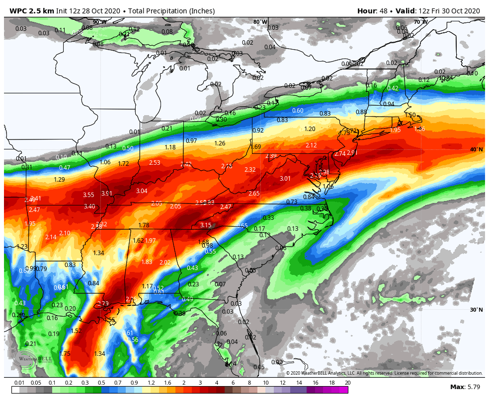
Hurricane Zeta will bring a storm surge and strong winds to southeastern Louisiana by midday today. Hurricane force winds are expected between Morgan City Louisiana and the Mississippi/Alabama border. Rainfall up to 4-6 inches is possible.
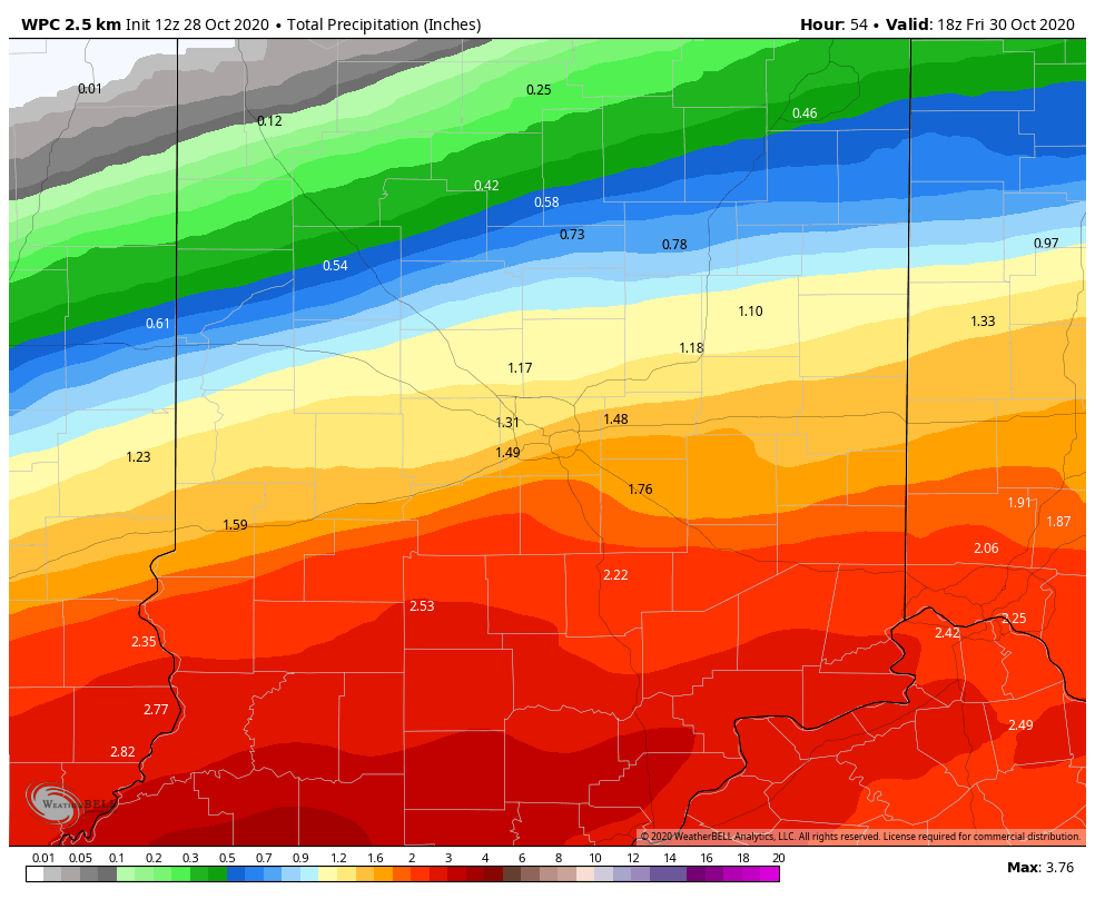
Central Indiana should see at least an inch of rainfall Thursday, with the highest amounts south of I-70. Amounts will be lower around the Lafayette area. Circulation from Zeta will merge with a big piece of energy in the upper atmosphere out to the West.

Here’s what’s making the rain so widespread: circulation from Zeta will merge with a big piece of energy in the upper atmosphere out to the West.
Never miss me! Subscribe for free. My Huge Radar has real-time weather tracking, current temperatures, and severe weather watches and warnings. Get detailed Indiana conditions by clicking here. Click here to see my central Indiana 7-Day Forecast. Follow these links to get my forecasts for Lafayette, Muncie, Hendricks County, and Hamilton County. Need a second opinion? Click here for central Indiana National Weather Service forecasts. (Some charts via WeatherBELL.)
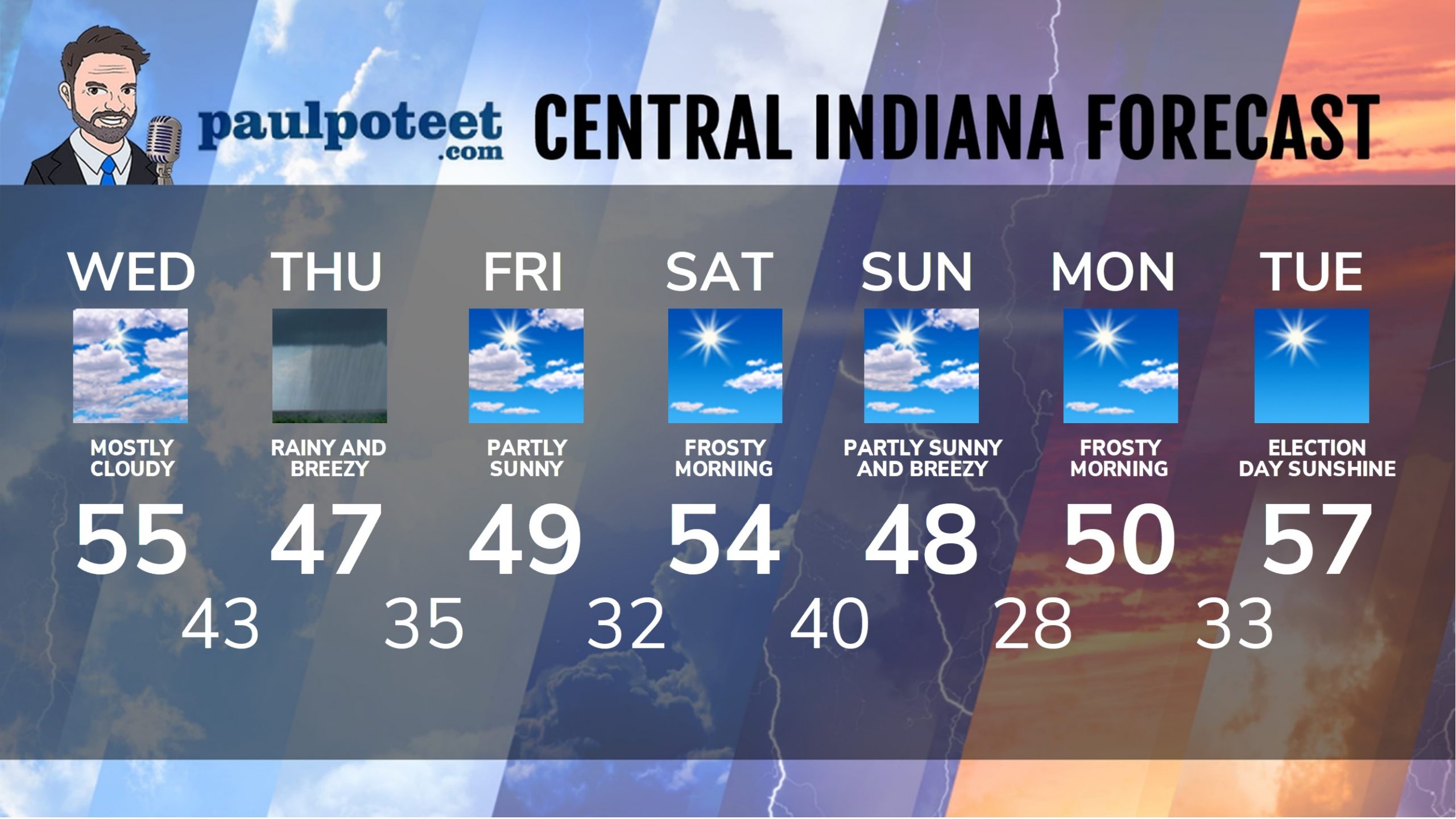
INDY SEVEN DAY FORECAST
Today: Morning fog, then mostly cloudy. High 55.
Tonight: Cloudy. Shower chance in the evening, with rain after midnight. Low 43.
Thursday: Rain, heavy at times. Breezy. High 47.
Thursday Night: Scattered showers. Low 35.
Friday: Partly to mostly sunny. High 49.
Friday Night: Mostly clear. Low 32.
Saturday: Frosty morning. Mostly sunny. High 54.
Saturday Night: Mostly clear. Low 40.
Sunday: Partly sunny. Wind gusting to 30 mph. High 48.
Sunday Night: Partly sunny. Low 28.
Monday: Frosty morning. Mostly sunny. High 50.
Monday Night: Clear. Low 33.
Tuesday: Sunny. High 57.
Never miss me! Subscribe for free. My Huge Radar has real-time weather tracking, current temperatures, and severe weather watches and warnings. Get detailed Indiana conditions by clicking here. Click here to see my central Indiana 7-Day Forecast. Follow these links to get my forecasts for Lafayette, Muncie, Hendricks County, and Hamilton County. Need a second opinion? Click here for central Indiana National Weather Service forecasts. (Some charts via WeatherBELL.)


Indiana’s Weather For Wednesday: Hurricane Zeta will bring a storm surge and strong winds to southeastern Louisiana… https://t.co/lW4gLox5WD
RT @PaulPoteet: Indiana’s Weather For Wednesday: Hurricane Zeta will bring a storm surge and strong winds to southeastern Louisiana by midd…