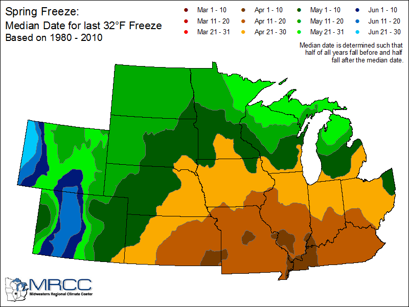
Lots of questions the last few days about the last freeze on average. This chart shows the last average 32 degree day. Generally, from Indy southward that date is April 11-20, and for the northern half of the state the date is between April 21-30.
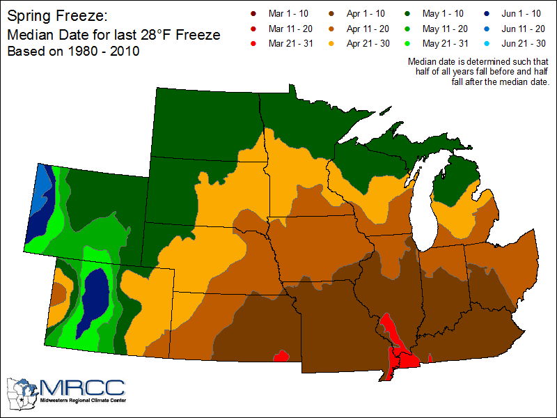
All of central Indiana has already passed the average date for a “hard freeze” of 28 degrees or colder. That’s between April 1-10.
That being said…might want to protect those plants at least one more time tonight!
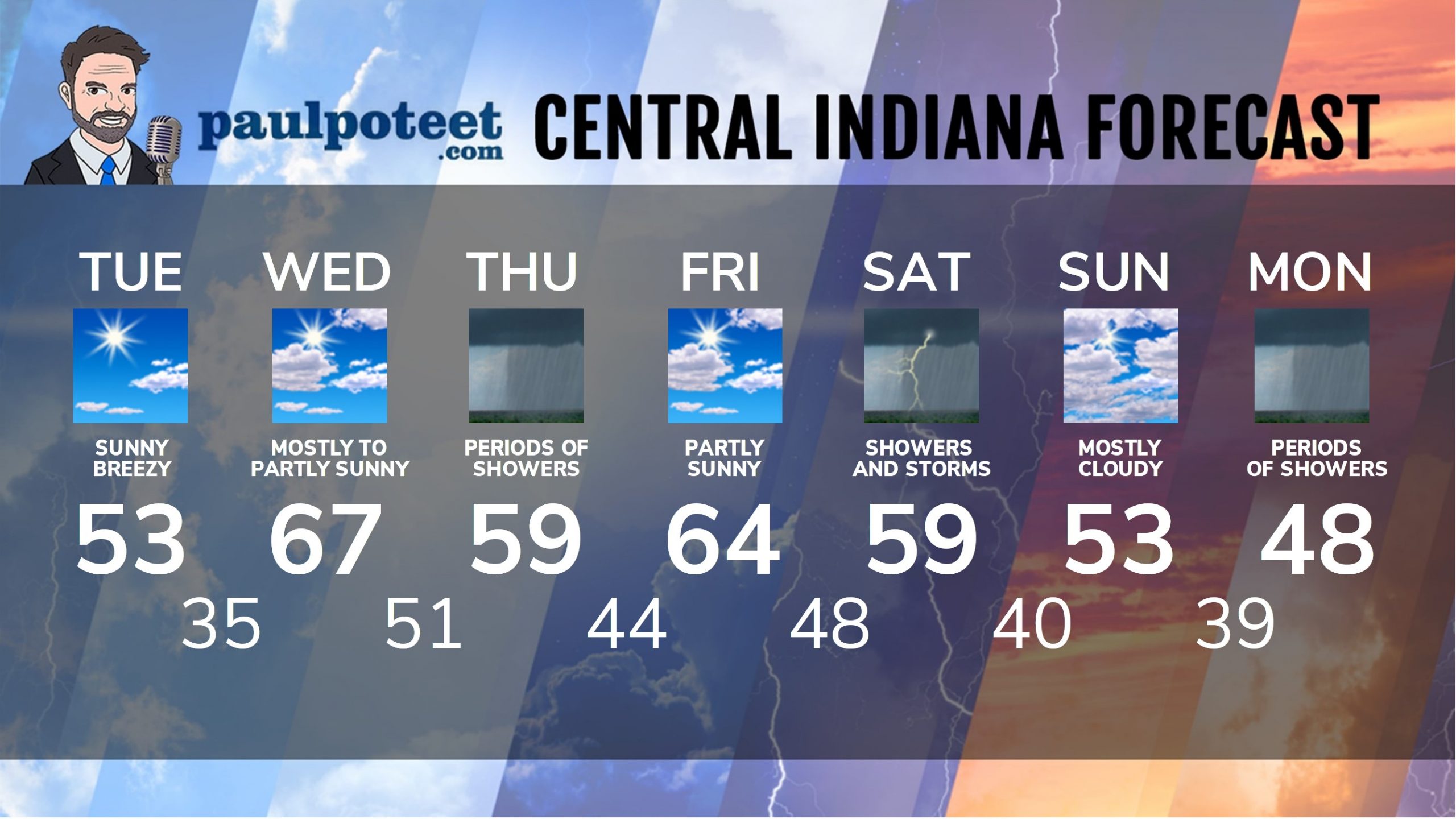
INDY SEVEN DAY FORECAST
Today: Mostly sunny and cooler. Wind gusting to 30 mph. High 53.
Tonight: Mostly clear, with patchy frost. Low 35.
Wednesday: Mostly to partly sunny. High 67.
Wednesday Night: Clouding up, with shower chances after midnight. Low 51.
Thursday: Periods of showers. High 59.
Thursday Night: Scattered showers. Low 44.
Friday: Partly sunny. High 64.
Friday Night: Mostly cloudy. Scattered showers and storms after midnight. Low 48.
Saturday: Periods of showers. Thunderstorms are also possible. High 59.
Saturday Night: Scattered showers. Low 40.
Sunday: Mostly cloudy. High 53.
Sunday Night: Partly cloudy. Low 39.
Monday: Scattered showers return. High 48.
Never miss me! Subscribe for free. My Huge Radar has real-time weather tracking, current temperatures, and severe weather watches and warnings. Get detailed Indiana conditions by clicking here. Click here to see my central Indiana 7-Day Forecast. Follow these links to get my forecasts for Lafayette, Muncie, Hendricks County, and Hamilton County. Need a second opinion? Click here for central Indiana National Weather Service forecasts. (Some charts via WeatherBELL.)


RT @PaulPoteet: Indiana’s Weather For Tuesday: Lots of questions the last few days about the last freeze on average… https://t.co/xwQrqKx1at