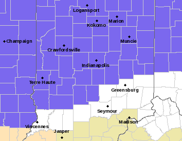
Why couldn’t National Weatherperson’s Day been Monday, when the Indy high was 67? Instead, winter is back with a Winter Weather Advisory from 4pm Wednesday until 10am Thursday.
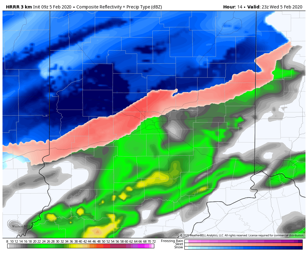
Expect freezing rain, sleet, and snow. This particular computer modeling (via WeatherBELL is for 6pm.)
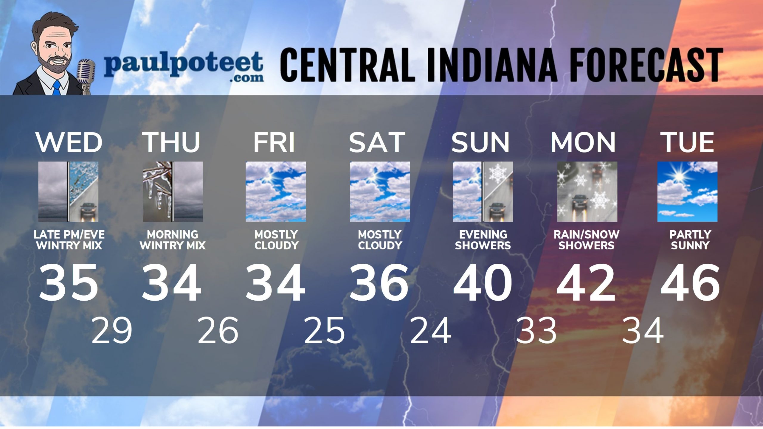
INDY SEVEN DAY FORECAST
Today: Later afternoon rain, freezing rain, and sleet. High 35.
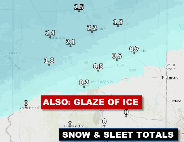
Tonight: Wintry mix of sleet and freezing rain. Less than an in inch of snow and sleet, but a glaze of ice. Low 29.
Thursday: Wintry mix of snow, sleet, and freezing rain, mainly in the morning. High 34.
Thursday Night: Snow showers. Low 26.
Friday: Mostly cloudy. A few flurries. High 34.
Friday Night: Mostly cloudy. Low 25.
Saturday: Cloudy. A few flurries. High 36.
Saturday Night: Partly cloudy. Low 24.
Sunday: Mostly cloudy. High 40.
Sunday Night: Rain and snow showers. Low 33.
Monday: Snow and rain showers, mainly in the morning. High 42.
Monday Night: Cloudy. Low 34.
Tuesday: Partly cloudy. High 46.
Never miss me! Subscribe for free. My Huge Radar has real-time weather tracking, current temperatures, and severe weather watches and warnings. Get detailed Indiana conditions by clicking here. Click here to see my central Indiana 7-Day Forecast. Follow these links to get my forecasts for Lafayette, Muncie, Hendricks County, and Hamilton County. Need a second opinion? Click here for central Indiana National Weather Service forecasts. (Some charts via WeatherBELL.)


Get the story on tonight’s weather at https://t.co/zSQ9Ft9ECY. Temps and rain/snow/ice info always on… https://t.co/2L0o63hPZT
RT @PaulPoteet: Get the story on tonight’s weather at https://t.co/zSQ9Ft9ECY. Temps and rain/snow/ice info always on https://t.co/jIbOYm3K…
RT @PaulPoteet: Get the story on tonight’s weather at https://t.co/zSQ9Ft9ECY. Temps and rain/snow/ice info always on https://t.co/jIbOYm3K…