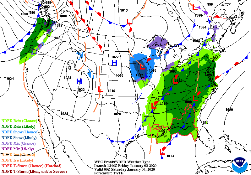
Look at these lows! All stacked up on the map from the East Coast back to the northern Plains.
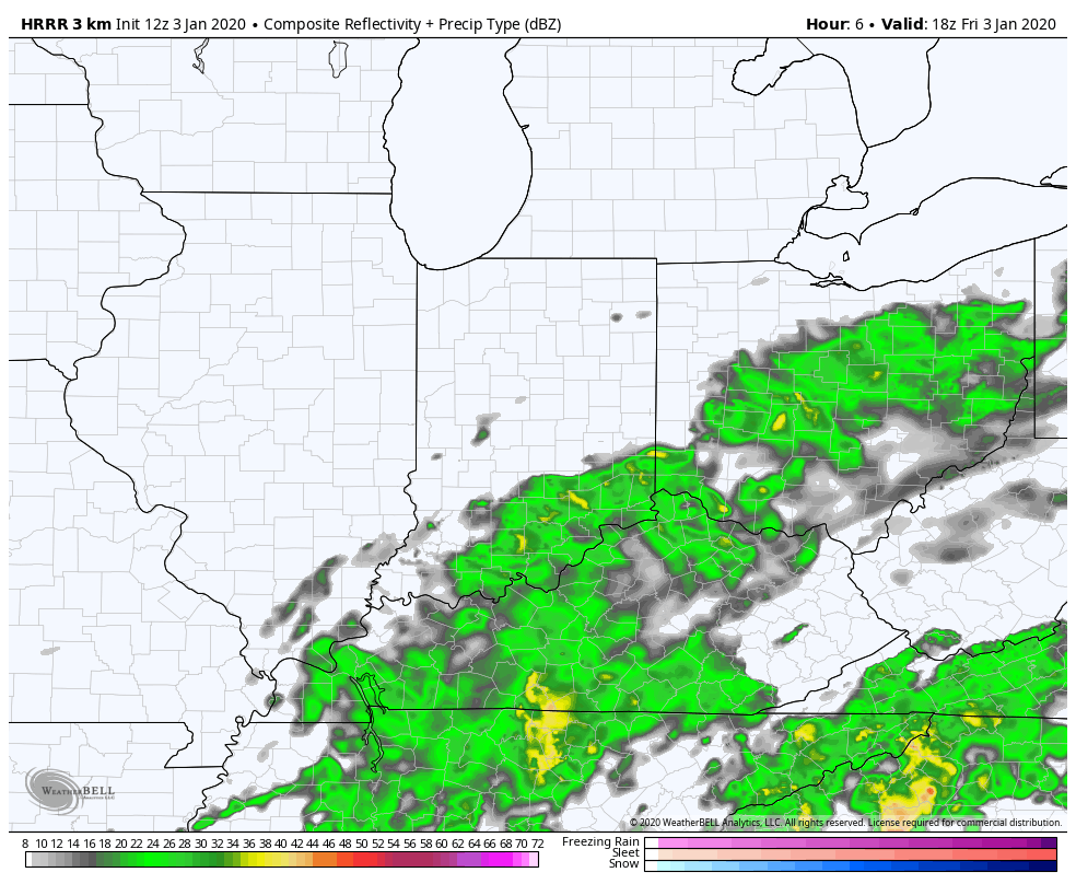
As of Friday midday rainfall totals from central Indiana generally run from about a tenth of an inch to about a half-inch. The best chances for additional showers is south and southeast of Indy. Another round of scattered showers will develop this evening. Precipitation will be lighter tomorrow, and will be mixed with snow. No significant accumulation is expected. (Chart via WeatherBELL.)
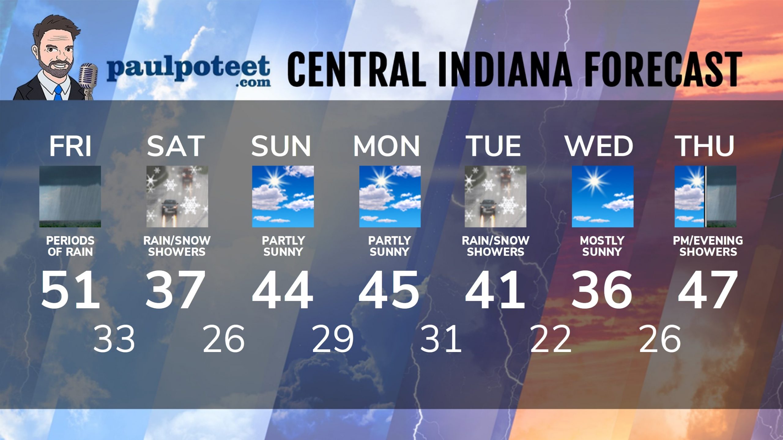
INDY SEVEN DAY FORECAST
Friday: Foggy and rainy. High 51.
Friday Night: Rain, possibly mixed with snow after midnight. Low 33.
Saturday: Mostly cloudy, with snow and rain showers. High 37.
Saturday Night: Partly cloudy. Low 26.
Sunday: Partly sunny. High 44.
Sunday Night: Partly cloudy. Low 29.
Monday: Partly sunny. High 45.
Monday Night: Partly cloudy. Low 31.
Tuesday: Mostly cloudy, with rain and snow showers possible. High 41.
Tuesday Night: Mostly cloudy. Low 22.
Wednesday: Mostly sunny. High 36.
Wednesday Night: Mostly clear. Low 26.
Thursday: Partly to mostly cloudy, with scattered showers. High 47.
Never miss me! Subscribe for free. My Huge Radar has real-time weather tracking, current temperatures, and severe weather watches and warnings. Get detailed Indiana conditions by clicking here. Click here to see my central Indiana 7-Day Forecast. Follow these links to get my forecasts for Lafayette, Muncie, Hendricks County, and Hamilton County. Need a second opinion? Click here for central Indiana National Weather Service forecasts. (Some charts via WeatherBELL.)


Indiana’s Weather For The Weekend
Look at these lows! All stacked up on the map from the East Coast back to the n… https://t.co/ifOa1h4Bgz