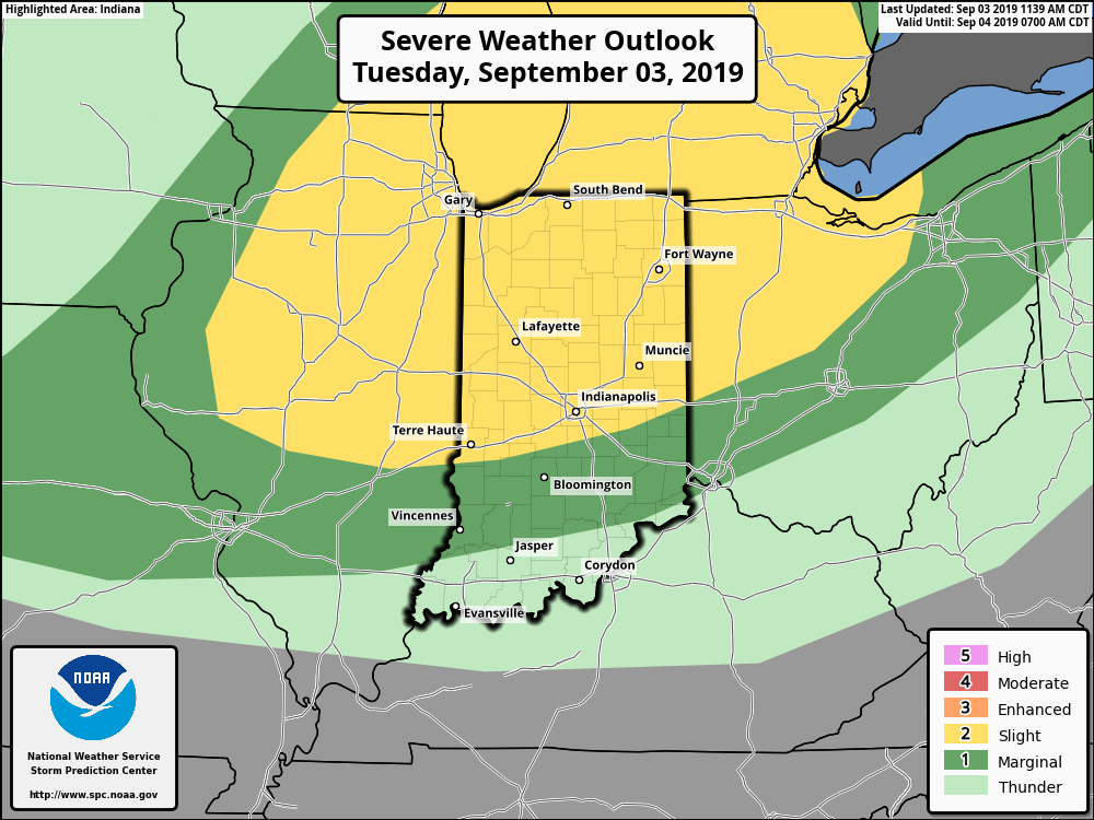
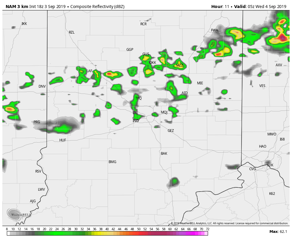
There is a slight risk that showers and storms this afternoon and evening could be severe. Double check the Doppler and get warnings instantly when you use My Huge Radar.
The cold front that divides the muggy, unstable air from nicer weather will roll through around 1am tonight.
That should let in nicer weather through the rest of the week!
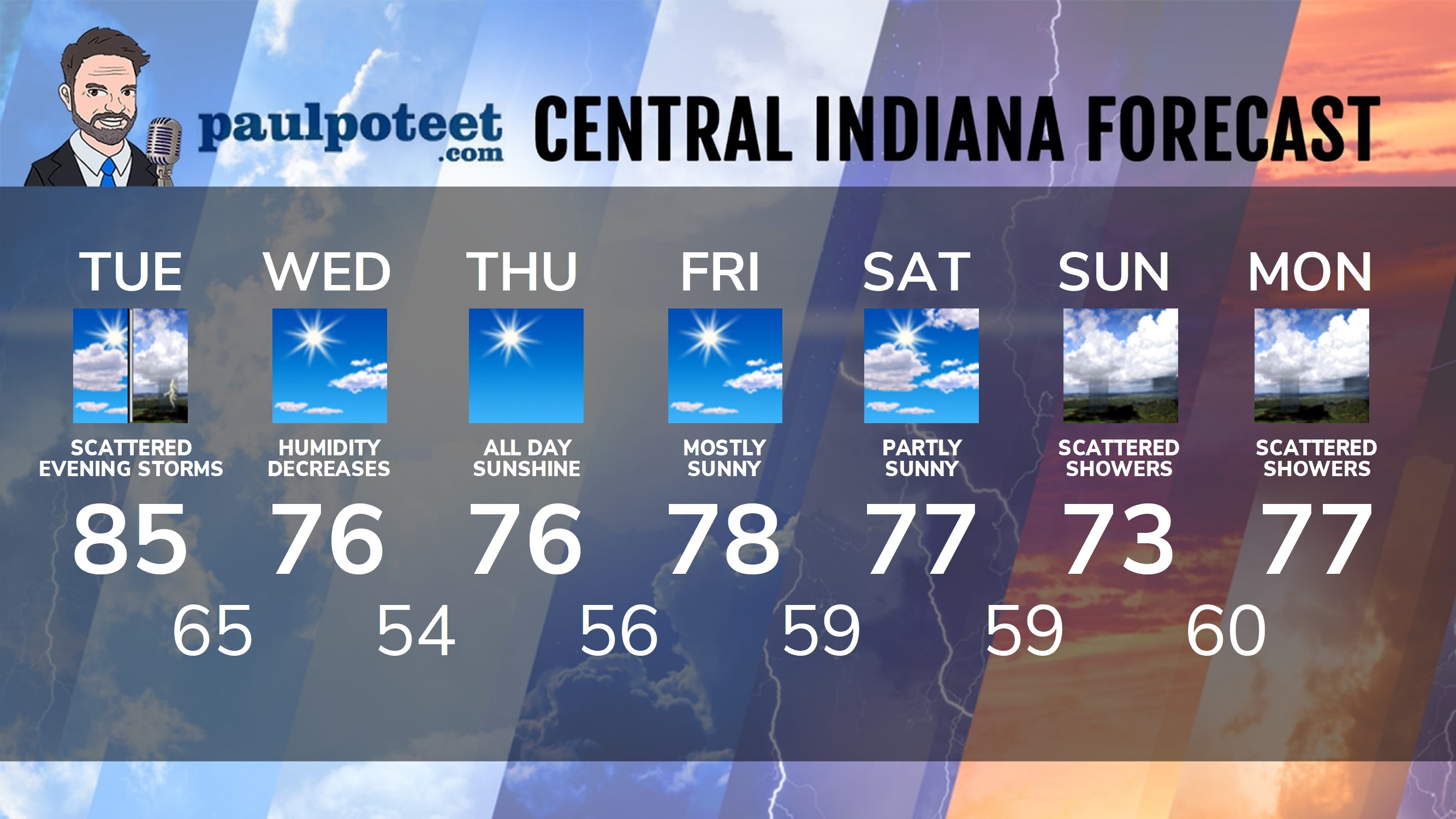
INDY SEVEN DAY FORECAST
Tonight: Scattered showers and storms. Low 64.
Today: Partly to mostly sunny, with lower humidity. High 79.
Tonight: Mostly clear. Low 55.
Thursday: Sunny. High 76.
Thursday Night: Clear. Low 56.
Friday: Mostly sunny. High 78.
Friday Night: Partly cloudy. Low 59.
Saturday: Partly sunny. High 78.
Saturday Night: Partly cloudy. Low 58.
Sunday: Partly to mostly cloudy with spotty showers. High 75.
Sunday Night: Spotty showers. Low 60.
Monday: Mostly cloudy with spotty showers, mainly in the morning. High 81.
Monday Night: Spotty showers. Low 62.
Tuesday: Partly cloudy. High 86.
Never miss me! Subscribe for free. My Huge Radar has real-time weather tracking, current temperatures, and severe weather watches and warnings. Get detailed Indiana conditions by clicking here. Click here to see my central Indiana 7-Day Forecast. Follow these links to get my forecasts for Lafayette, Muncie, Hendricks County, and Hamilton County. Need a second opinion? Click here for central Indiana National Weather Service forecasts. (Some charts via WeatherBELL.)


Indiana’s Weather For Tuesday
There is a slight risk that showers and storms this afternoon and evening could be… https://t.co/vR7XAyfjeA