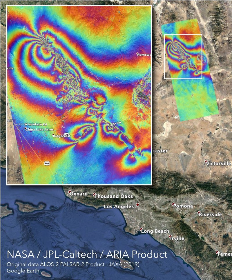
 The Advanced Rapid Imaging and Analysis team at NASA made this map highlighting the faults of the 2 recent big quakes in CA. Each stripe indicates the ground has been displaced there by some 4.8″. The closer together the stripes, the more the ground was displaced. Psychedelic!
How was the map made? Click here.
Never miss me! Subscribe for free. My Huge Radar has real-time weather tracking, current temperatures, and severe weather watches and warnings. Get detailed Indiana conditions by clicking here. Click here to see my central Indiana 7-Day Forecast. Follow these links to get my forecasts for Lafayette, Muncie, Hendricks County, and Hamilton County. Need a second opinion? Click here for central Indiana National Weather Service forecasts. (Some charts via WeatherBELL.)


The Psychedelic Fault Map
The Advanced Rapid Imaging and Analysis team at NASA made this map highlighting the fa… https://t.co/oLIex4p7ZU