It’s the first weekend of Spring, and the season roared in through the Midwest and Ohio River valleys Thursday night and early Friday morning, with reports of wind damage and high wind gusts in downstate Illinois.
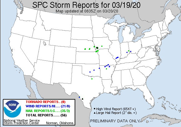
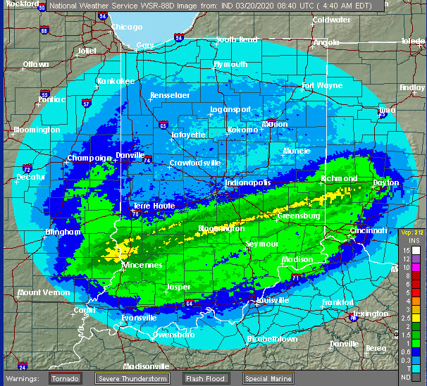
There were also a few wind reports noted by the Storm Prediction Center in southeast Indiana, along with large hail. A more widespread problem was flooding rainfall south of Indianapolis. A strip of 2-3 inches is shown from around Vincennes over to Dayton Ohio.
There’s a Friday free-fall behind a cold front. with a 20-degree drop likely in an hour or two in the middle of the day.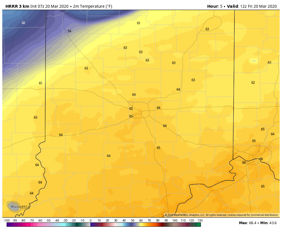
(Chart via WeatherBELL.)
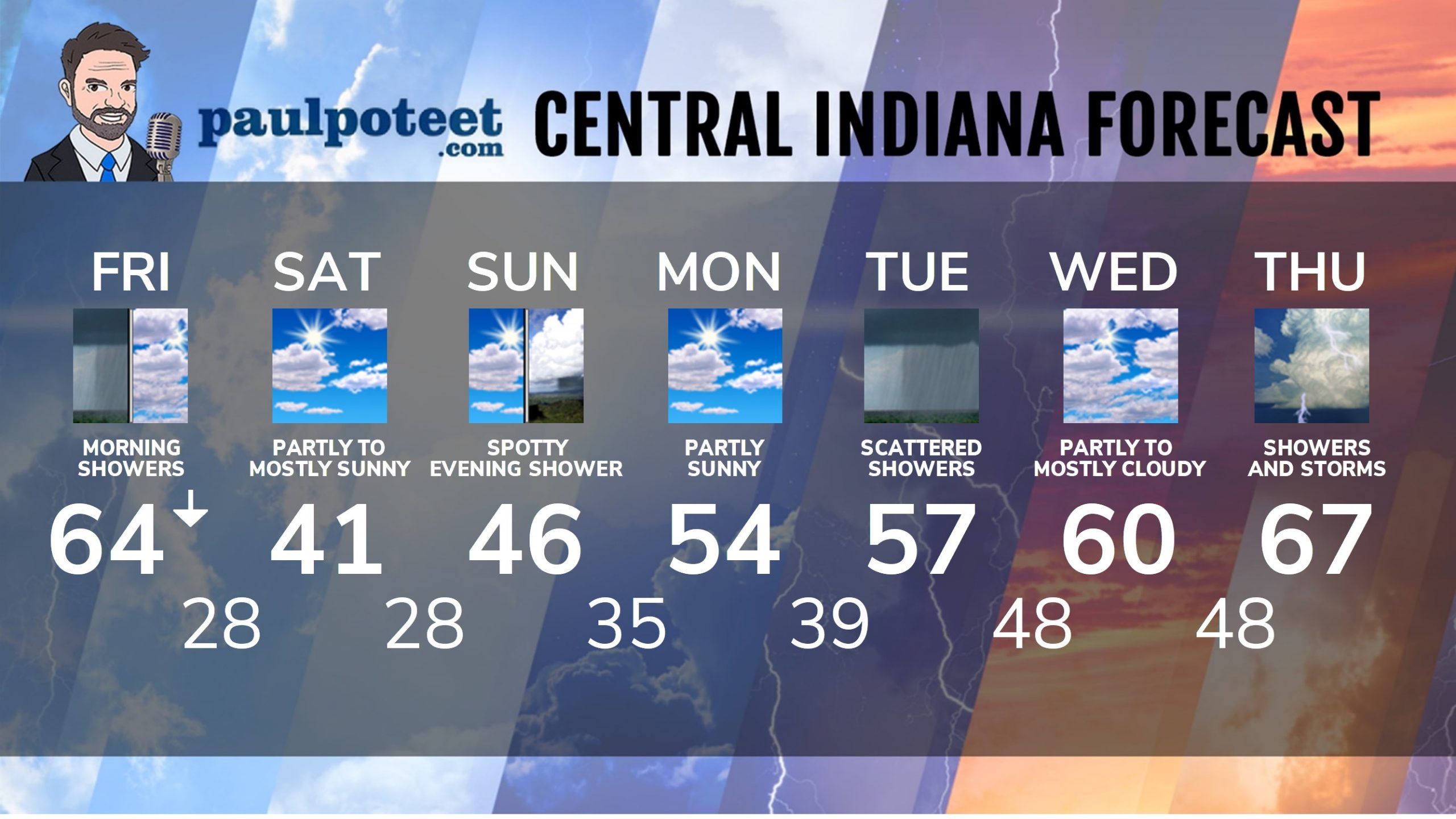
INDY SEVEN DAY FORECAST
Friday: Morning showers. Mostly cloudy. Temps fall to the 40s by afternoon. Wind gusting to 30 mph.
Friday Night: Partly cloudy and colder. Low 28.
Saturday: Mostly to partly sunny. High 41.
Saturday Night: Partly cloudy. Low 28.
Sunday: Partly to mostly cloudy. High 46.
Sunday Night: Spotty showers. Low 35.
Monday: Early morning spotty shower chance. Otherwise, partly sunny. High 54.
Monday Night: Mostly cloudy. Spotty showers. Low 39.
Tuesday: Mostly cloudy, with scattered showers. High 57.
Tuesday Night: Rainy. Low 48.
Wednesday: Partly to mostly cloudy. High 60.
Wednesday Night: Mostly cloudy. Shower and storm chances late. Low 48.
Thursday: Scattered showers and storms. High 67.
Never miss me! Subscribe for free. My Huge Radar has real-time weather tracking, current temperatures, and severe weather watches and warnings. Get detailed Indiana conditions by clicking here. Click here to see my central Indiana 7-Day Forecast. Follow these links to get my forecasts for Lafayette, Muncie, Hendricks County, and Hamilton County. Need a second opinion? Click here for central Indiana National Weather Service forecasts. (Some charts via WeatherBELL.)


