Dusted and gusted…Indiana weather can’t be trusted. Another year of it comes to a close with a big wind chill and small snowfall.
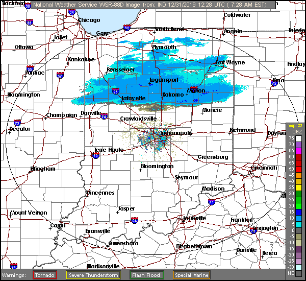
Here are the snow showers on Tuesday morning radar. (Check My Huge Radar for the latest.)
Chills will be in the 20s Tuesday, and in the teens New Years Eve. The year will begin with dry weather and a cloudy sky. The sun comes out the first day of 2020!
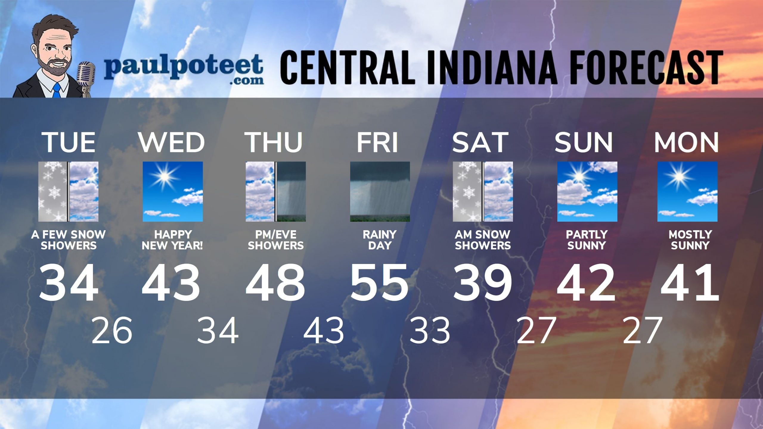
INDY SEVEN DAY FORECAST
Tuesday: Cloudy with a few snow showers in the morning. Wind gusting to 35 mph again. High 34.
New Years Eve: Clouds decrease slowly. Wind gusts to 25 mph. Low 26.
New Years Day: Becoming mostly sunny. High 43.
Wednesday Night: Mostly clear. Low 34.
Thursday: Clouds return, with afternoon showers. High 48.
Thursday Night: Rainy. Low 43.
Friday: Rainy. High 55.
Friday Night: Rain, possibly mixed with snow. Low 33.
Saturday: Mostly cloudy, with rain and snow showers possible. High 39.
Saturday Night: Mostly to partly cloudy. Low 27.
Sunday: Partly sunny. High 42.
Sunday Night: Partly cloudy. Low 27.
Sunday: Partly sunny. High 41.
Never miss me! Subscribe for free. My Huge Radar has real-time weather tracking, current temperatures, and severe weather watches and warnings. Get detailed Indiana conditions by clicking here. Click here to see my central Indiana 7-Day Forecast. Follow these links to get my forecasts for Lafayette, Muncie, Hendricks County, and Hamilton County. Need a second opinion? Click here for central Indiana National Weather Service forecasts. (Some charts via WeatherBELL.)


Indiana’s Weather For The New Year
Dusted and gusted…Indiana weather can’t be trusted. Another year of it comes t… https://t.co/wBFqywtXqB