The typical Christmas high in central Indiana is in the mid 30s. We’ll beat it by about 20 degrees this year. If you use the definition of a White Christmas as “an inch or more of snow on the ground,” we may still qualify, given the three inches still officially reported early Monday morning at the Indy Airport.
Nine inches of snow was on the ground on Christmas Day 2004 in Indianapolis. It was a good decade for that. There was seven inches of snow on the ground on Christmas Day 2002, and 2.6 inches fell in 2005.
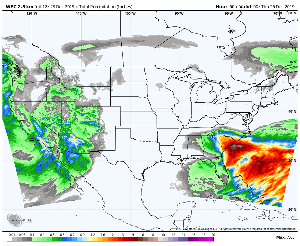
No chance of any *new* snow this season, or any precipitation at all through Christmas. Roughest sledding (if you will) is the rain in the Southeast.
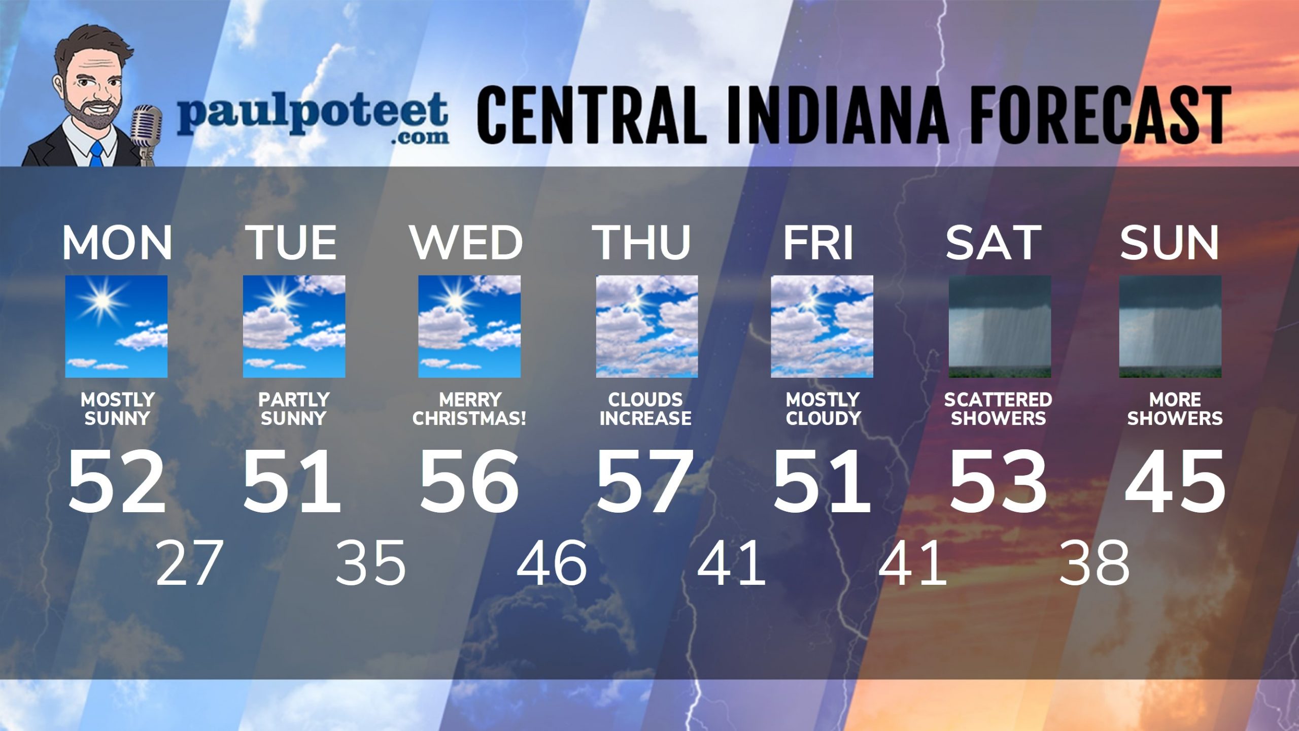
INDY SEVEN DAY FORECAST
Monday: Mostly sunny. High 52.
Monday Night: Partly cloudy. Low 27.
Tuesday: Partly sunny. High 51.
Christmas Eve: Partly cloudy. Low 35.
Christmas Day: Partly sunny. High 56.
Wednesday Night: Clouds increase. Low 46.
Thursday: Mostly cloudy. High 57.
Thursday Night: Mostly cloudy. Low 41.
Friday: Mostly cloudy. High 51.
Friday Night: Scattered showers late. Low 41.
Saturday: Scattered showers. High 53.
Saturday Night: Scattered showers. Low 38.
Sunday: Scattered showers. High 45.
Never miss me! Subscribe for free. My Huge Radar has real-time weather tracking, current temperatures, and severe weather watches and warnings. Get detailed Indiana conditions by clicking here. Click here to see my central Indiana 7-Day Forecast. Follow these links to get my forecasts for Lafayette, Muncie, Hendricks County, and Hamilton County. Need a second opinion? Click here for central Indiana National Weather Service forecasts. (Some charts via WeatherBELL.)


Indiana’s Weather For Christmas Week
The typical Christmas high in central Indiana is in the mid 30s. We’ll beat… https://t.co/5Ic2wcIARS
RT @PaulPoteet: Indiana’s Weather For Christmas Week
The typical Christmas high in central Indiana is in the mid 30s. We’ll beat it by ab…