The weather map shows high pressure muscling in for two spectacular Summer days for Indiana.
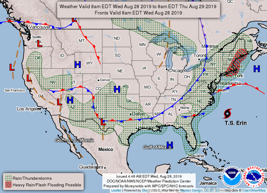
The map also shows Tropical Storm Erin, who should stay out at sea. Tropical Storm Dorian may become a hurricane after it blows through Puerto Rico and the U.S. Virgin Islands Wednesday and makes its way toward Florida.
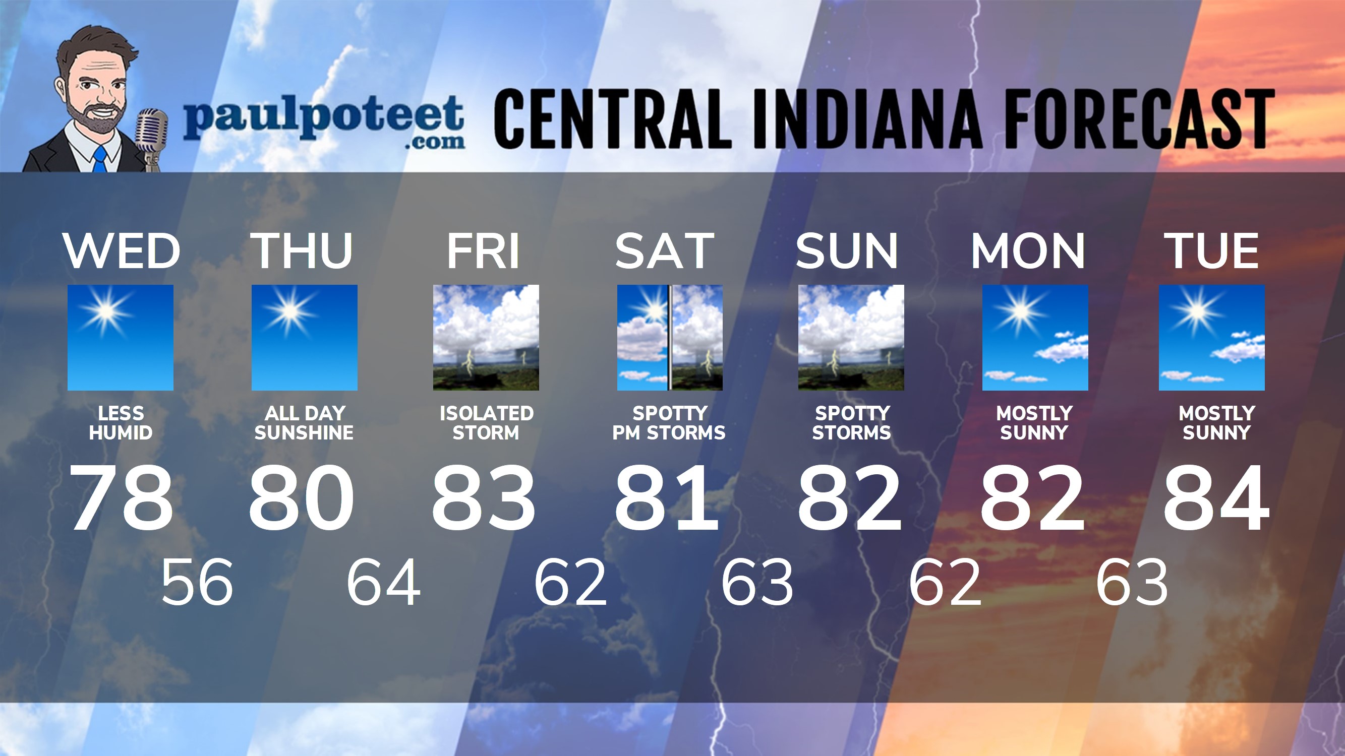
INDY SEVEN DAY FORECAST
Today: Sunny and less humid. High 78.
Tonight: Clear and cool. Low 56.
Thursday: Sunny. High 80.
Thursday Night: Mostly clear. Humidity increases again. Low 64.
Friday: Partly sunny and more muggy. Isolated shower or storm. High 83.
Friday Night: Partly cloudy. Low 62.
Saturday: Partly sunny. High 81.
Saturday Night: Partly cloudy. Scattered showers or storms possible. Low 63.
Sunday: Partly sunny. Stray showers and storms. High 82.
Sunday Night: Partly cloudy. Stray showers and storms. Low 62.
Labor Day: Mostly sunny. High 82.
Monday Night: Mostly clear. Low 63.
Tuesday: Mostly sunny. High 84.
Never miss me! Subscribe for free. My Huge Radar has real-time weather tracking, current temperatures, and severe weather watches and warnings. Get detailed Indiana conditions by clicking here. Click here to see my central Indiana 7-Day Forecast. Follow these links to get my forecasts for Lafayette, Muncie, Hendricks County, and Hamilton County. Need a second opinion? Click here for central Indiana National Weather Service forecasts. (Some charts via WeatherBELL.)


RT @PaulPoteet: Indiana’s Weather For Wednesday
The weather map shows high pressure muscling in for two spectacular Summer days for India…