We may do something we haven’t done since the first half of June…have four consecutive days with highs in the 70s. Enjoy the break from the heat. The break from humidity doesn’t really kick in until later tonight and Friday. That drier air will combine with a clear sky to bring low down to around 60 for some by Friday morning!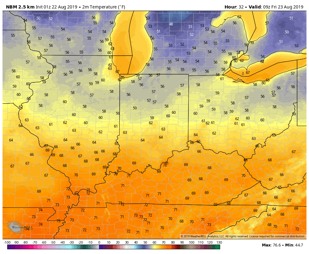
Showers and storms will still be around today. The biggest chances–especially by this evening–will be near and south of Interstate 70. 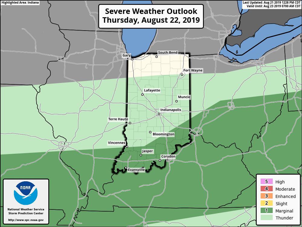
For the latest Storm Prediction Center outlook, and any current warnings, visit My Huge Radar.
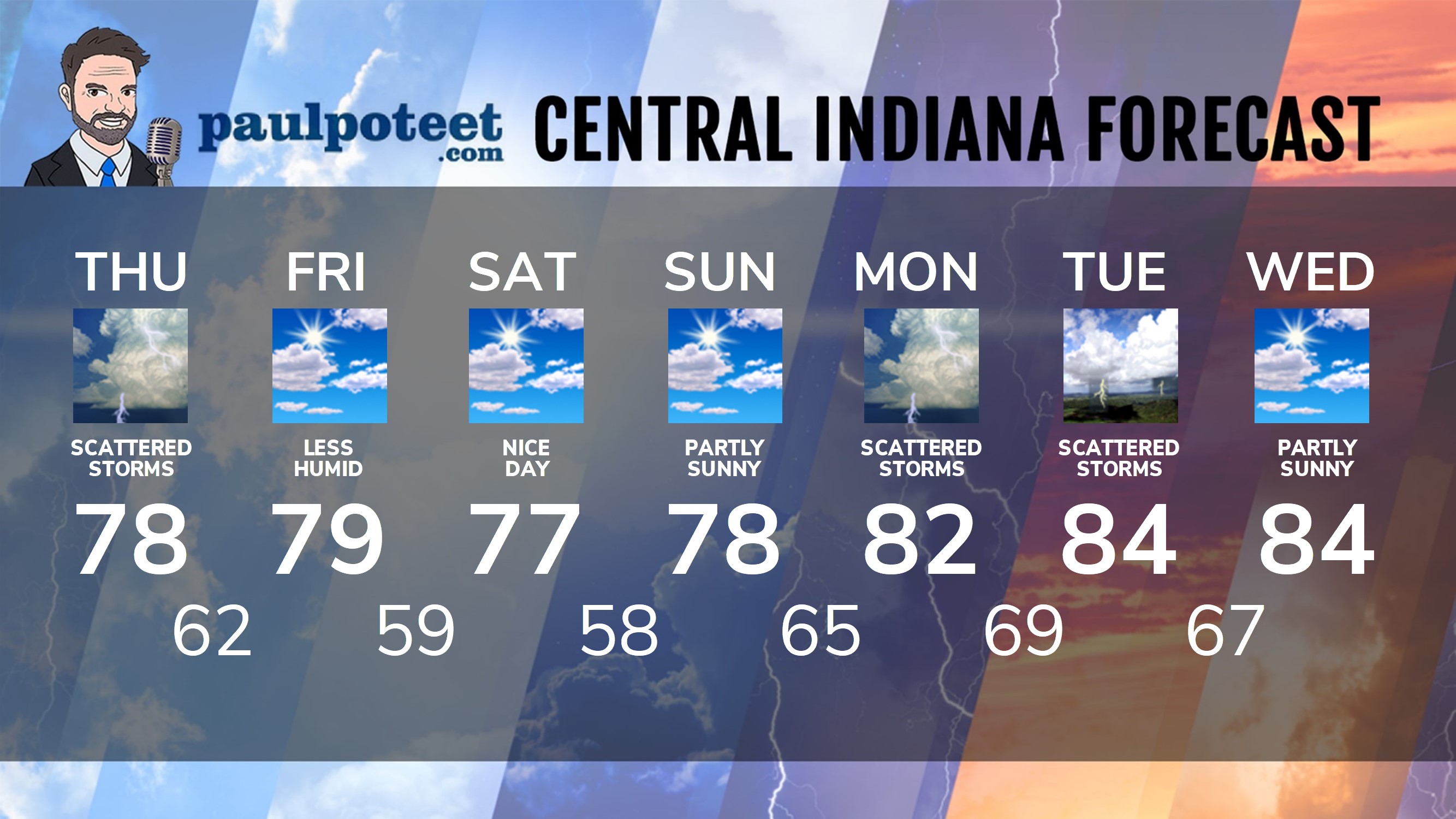
INDY SEVEN DAY FORECAST
Today: Mostly cloudy, with scattered showers. Storms possible. High 78.
Tonight: Scattered showers. Low 62.
Friday: Partly sunny. Not as humid. High 79.
Friday Night: Mostly clear. Low 59.
Saturday: Partly sunny. Nice! High 77.
Saturday Night: Partly cloudy. Low 58.
Sunday: Partly sunny. High 78.
Sunday Night: Partly cloudy. Low 65.
Monday: Partly to mostly cloudy, with scattered showers and storms. High 82.
Monday Night: Scattered showers and storms. Low 69.
Tuesday: Partly sunny, with scattered showers and storms. High 84.
Tuesday Night: Partly cloudy. Low 67.
Wednesday: Partly sunny. High 84.
Never miss me! Subscribe for free. My Huge Radar has real-time weather tracking, current temperatures, and severe weather watches and warnings. Get detailed Indiana conditions by clicking here. Click here to see my central Indiana 7-Day Forecast. Follow these links to get my forecasts for Lafayette, Muncie, Hendricks County, and Hamilton County. Need a second opinion? Click here for central Indiana National Weather Service forecasts. (Some charts via WeatherBELL.)


Indiana’s Weather For Thursday
We may do something we haven’t done since the first half of June…have four consecu… https://t.co/UQI12fEV1s
RT @PaulPoteet: Indiana’s Weather For Thursday
We may do something we haven’t done since the first half of June…have four consecutive day…