…An active weather pattern for much of the Plains into the Mid to Upper
Mississippi Valley regions…
…Thunderstorms to bring heavy rain, localized Flash Flooding and Severe
Weather to portions of the Plains…
…An elevated to Critical Fire Weather threat across the Southern High
Plains…
..Cooler than average temperatures expected from the Rockies to the West
Coast and from the Mid-Atlantic to the Northeast, while much above average
temperatures spread from the Southern Plains to the Great Lakes…
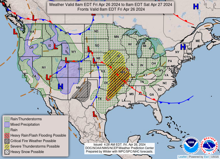
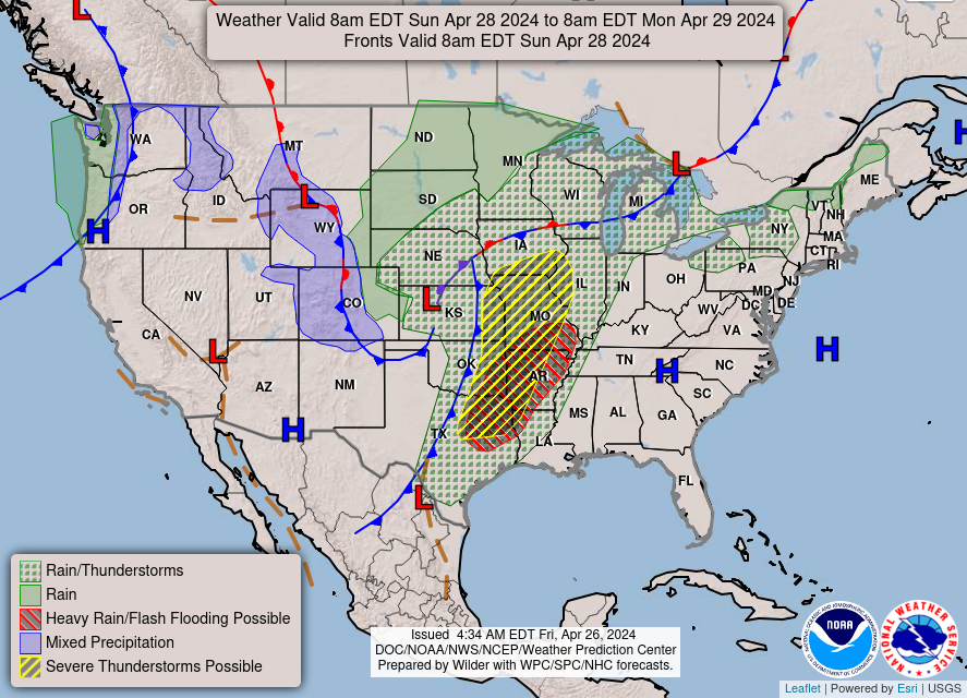
A dynamic weather system is poised to bring significant weather impacts
across the Plains extending into the Mid-to-Upper Mississippi Valley
regions this weekend. This system will usher in a variety of weather
phenomena including thunderstorms, heavy rainfall, and even severe weather
conditions. Thunderstorm activity is forecasted to intensify across
portions of the Plains, particularly in areas extending from the Southern
Plains to the Great Lakes. These storms are likely to bring heavy
rainfall, increasing the risk of localized flash flooding in low-lying and
urban areas. There’s a Slight Risk (at least 15%) of Excessive Rainfall
leading to Flash Flooding over portions of eastern Oklahoma and
northeastern Texas into western Arkansas and southern Missouri today.
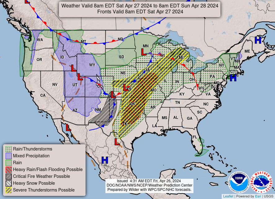
Another system emerging from the Rockies will bring the focus for heavy
rainfall and severe storms back over the Southern Plains on Saturday.
There’s a Moderate Risk (at least 40%) of Excessive Rainfall over central
to northeastern Oklahoma on Saturday. Furthermore, some of these storms
may turn severe, with the potential for damaging winds, large hail, and
isolated tornadoes. To that end, the Storm Prediction Center issued an
Enhanced Risk (level 3/5) of Severe Thunderstorms over portions of eastern
Nebraska, northeastern Kansas, northwestern Missouri and southwestern Iowa
today Another Enhanced Risk area was issued across parts of southern Iowa,
eastern/central Kansas, southeastern Nebraska, northwestern Missouri,
central Oklahoma and north-central Texas for Saturday as another system
spawns another round of storms for the Central U.S..
While thunderstorms pose a threat to some areas, the Southern High Plains
face an Elevated to Critical Fire Weather threat through this weekend. Dry
and gusty conditions, coupled with low relative humidity levels, will
create favorable conditions for the rapid spread of wildfires. Outdoor
burning is strongly discouraged, and residents should exercise extreme
caution to prevent the ignition of fires. A cooler air mass will settle
over regions stretching from the Rockies to the West Coast and from the
Mid-Atlantic to the Northeast. Temperatures are forecasted to remain below
average for this time of year. Conversely, a swath of much above average
temperatures is expected to encompass areas from the Southern Plains to
the Great Lakes. Daytime highs will soar, potentially reaching
unseasonably warm levels. Meanwhile, unsettled weather, including
rain/snow showers and scattered to isolated thunderstorms are expected to
spread across much of the West through Saturday.
Kebede
Graphics available at
https://www.wpc.ncep.noaa.gov/basicwx/basicwx_ndfd.php


Leave a Reply