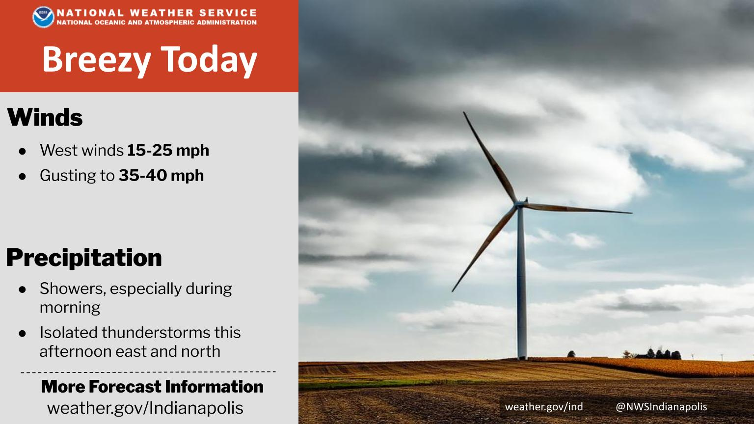
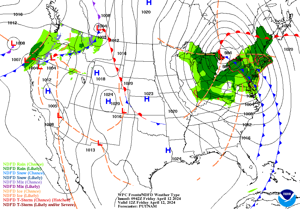
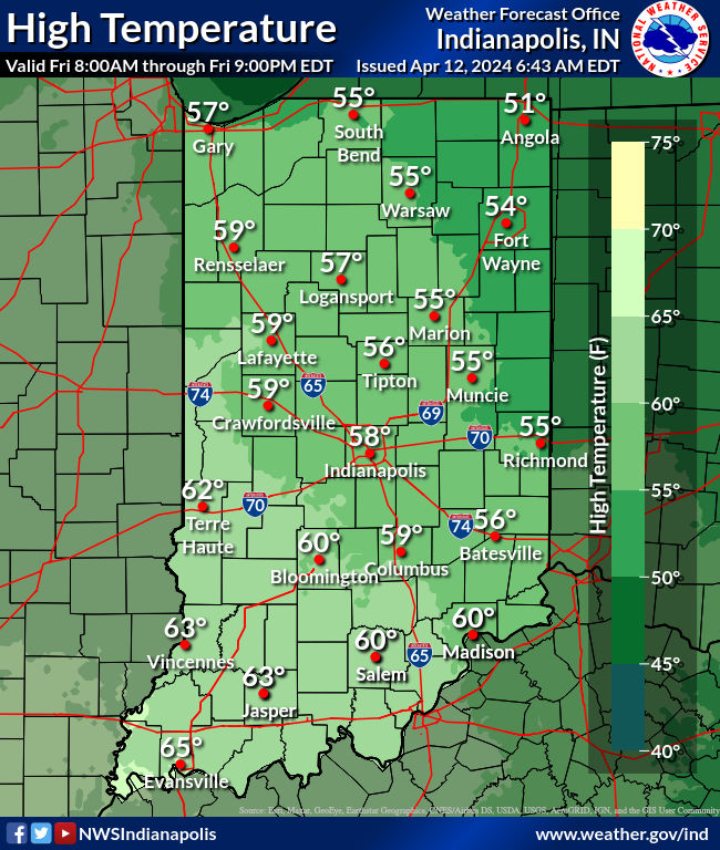
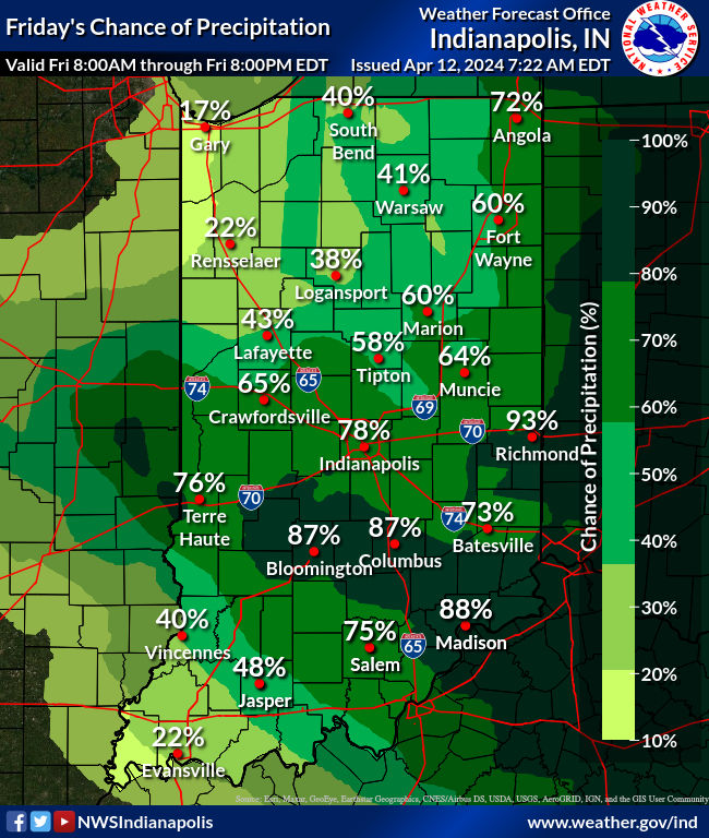
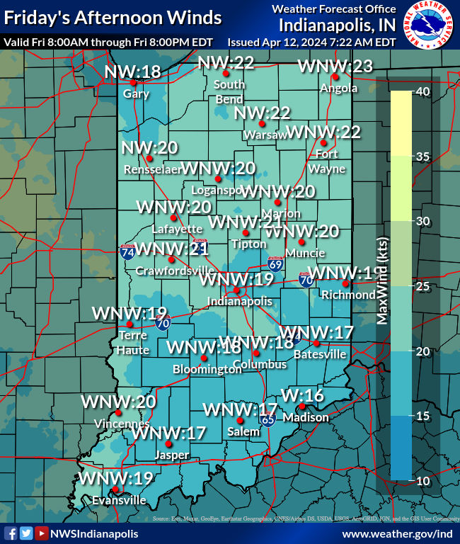
We’ve had just under SIX inches of rain so far this month, which is easily the wettest start to April on record in Indianapolis, Rain has returned today, but additional amounts will be less than an a quarter of an inch. Rivers are high, and minor flooding continues. Look for breezy conditions today, with gusts up to 40 mph at times. Scattered showers and isolated thunderstorms will be across mainly northeastern and eastern Indiana this afternoon. Dry tonight!
That sprawling area of low pressure finally pulls away for a nicer weekend.
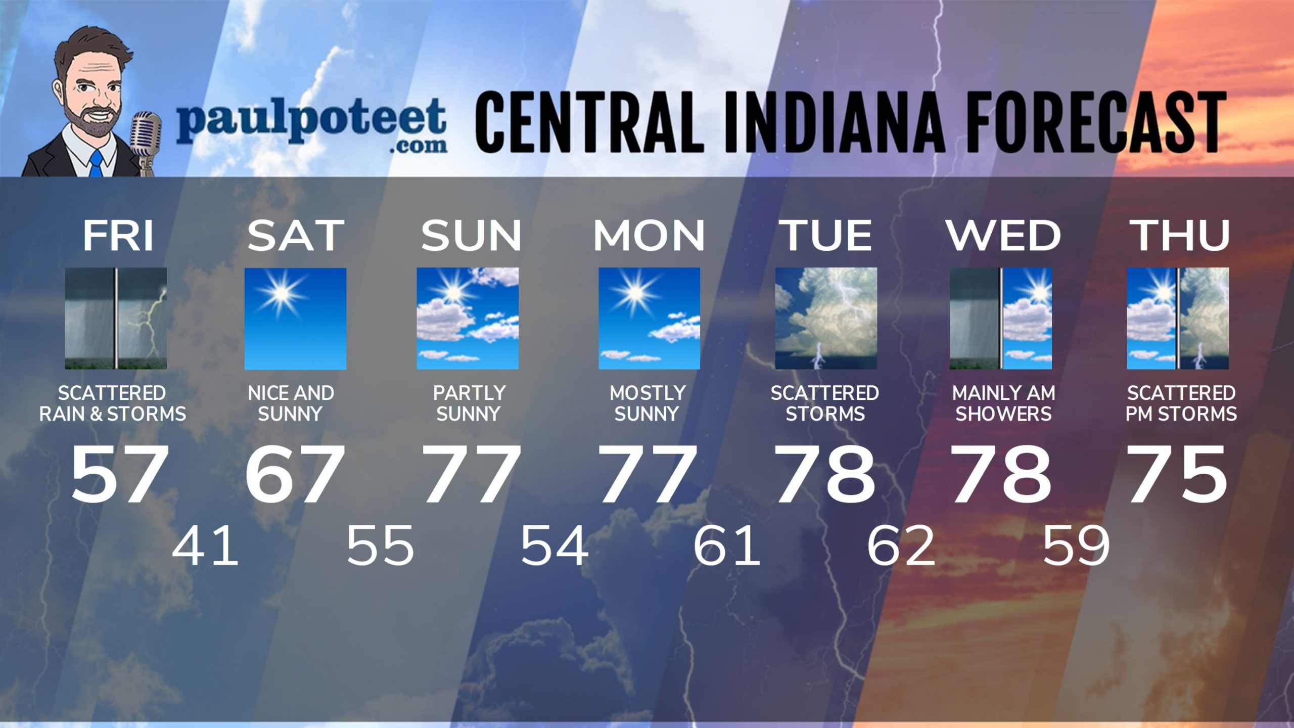
INDY SEVEN DAY FORECAST
Today: Morning rain. Scattered showers and storms in the afternoon. Wind gusts to 40 mph. High 57.
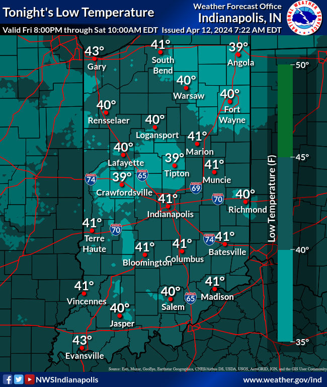
Tonight: Clearing. Low 41.
Saturday: Sunny. High 67.
Saturday Night: Mostly clear. Low 55.
Sunday: Partly sunny, breezy and warmer. High 77.
Sunday Night: Partly cloudy. Low 54.
Monday: Partly sunny. High 77.
Monday Night: Clouds increase. Spotty shower or storm after midnight. Low 61.
Tuesday: Mostly cloudy, with scattered showers and storms. High 78.
Tuesday Night: Showers and storms, with a few possibly severe. Low 62.
Wednesday: Mainly morning showers, then partly sunny. High 78.
Wednesday Night: Partly cloudy. Low 59.
Thursday: Partly sunny. Scattered afternoon showers and storms. High 75.
Never miss me! Subscribe for free. My Huge Radar has real-time weather tracking, current temperatures, and severe weather watches and warnings. Get detailed Indiana conditions by clicking here. Click here to see my central Indiana 7-Day Forecast. Follow these links to get my forecasts for Lafayette, Muncie, Hendricks County, and Hamilton County. Need a second opinion? Click here for central Indiana National Weather Service forecasts. (Some charts via WeatherBELL.)


