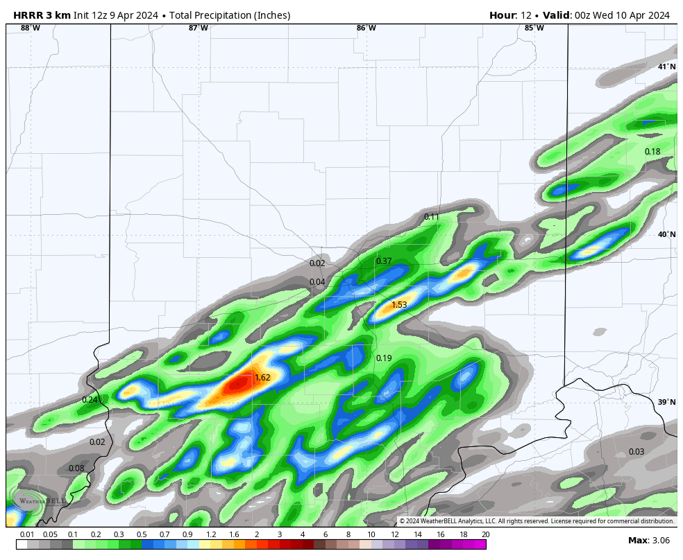
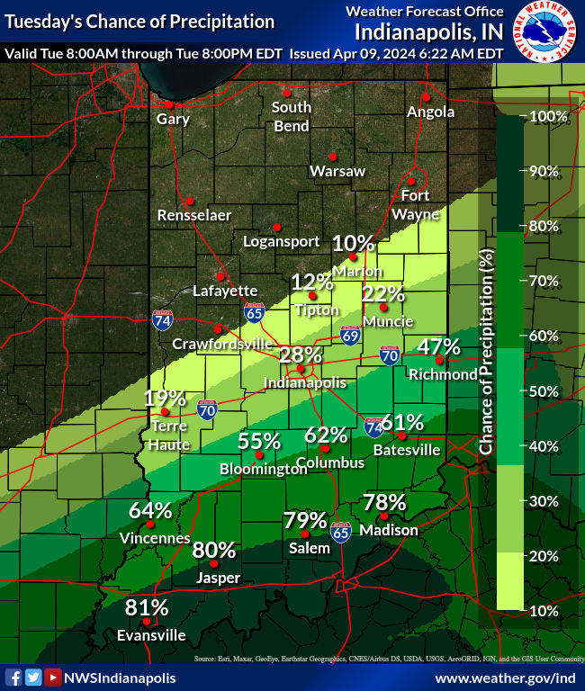
Does anybody even care about the weather today? I feel a letdown. Nevertheless, rain chances return today, particularly in the south and southeast, and mainly in the afternoon and evening. A cold front will move into the area today and gradually stall. Some storms are also possible, but nothing severe. Here’s where today’s best chances for rain will be.
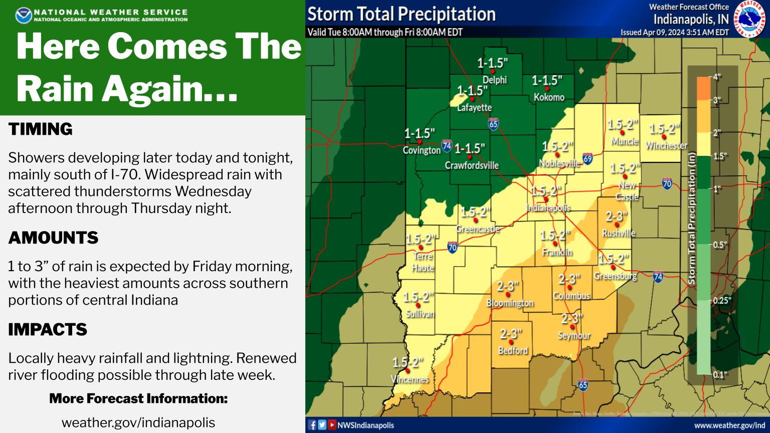
Rain through this stretch could total one to three inches!
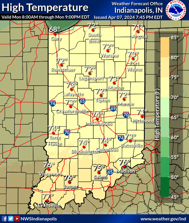
Temperatures will be above normal again today, likely warmer in the north despite being north of the boundary, with less (thinner) cloud cover and significantly less precipitation threat. An active weather pattern will continue through much of the rest of the work week as that aforementioned cold front (by then a stationary front) stalls in through Thursday. Storms could even be severe in the southeastern part of the state Thursday.
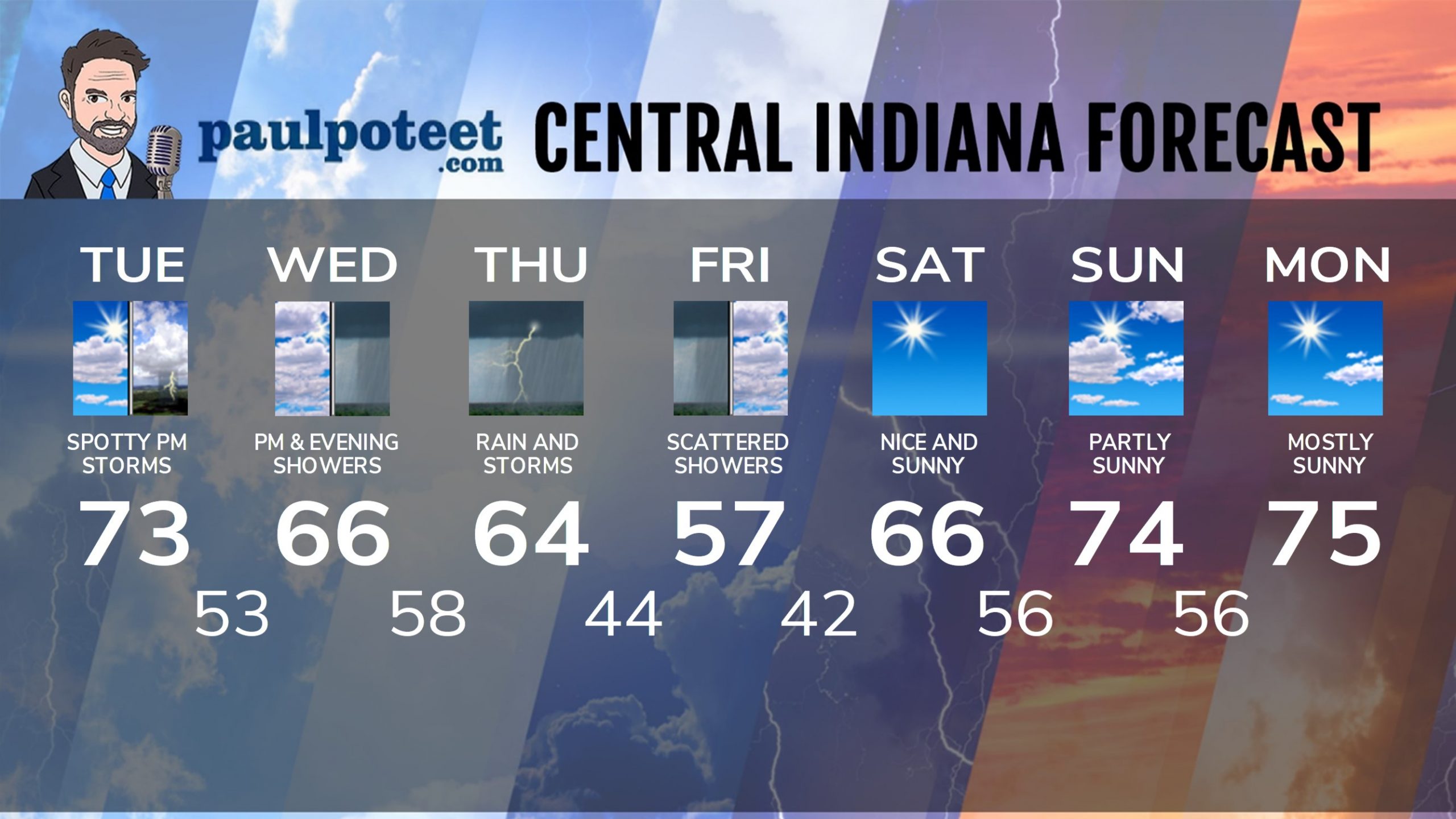
INDY SEVEN DAY FORECAST
Today: Partly to mostly cloudy, with a spotty shower or storm possible in the afternoon. High 73.
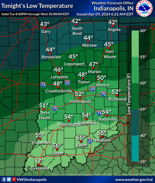
Tonight: Mostly cloudy, with a spotty shower or storm. Low 53.
Wednesday: Periods of rain, mainly in the afternoon. High 66.
Wednesday Night: Showers. Low 58.
Thursday: Showers, storms, breezy. High 64.
Thursday Night: Showers continue. Breezy. Low 44.
Friday: Still some showers. Partly sunny otherwise. High 57.
Friday Night: Mostly clear. Low 42.
Saturday: Sunny. High 66.
Saturday Night: Partly cloudy. Low 56.
Sunday: Partly sunny. High 74.
Sunday Night: Partly cloudy. Low 56.
Monday: Mostly sunny. High 75.
Never miss me! Subscribe for free. My Huge Radar has real-time weather tracking, current temperatures, and severe weather watches and warnings. Get detailed Indiana conditions by clicking here. Click here to see my central Indiana 7-Day Forecast. Follow these links to get my forecasts for Lafayette, Muncie, Hendricks County, and Hamilton County. Need a second opinion? Click here for central Indiana National Weather Service forecasts. (Some charts via WeatherBELL.)


