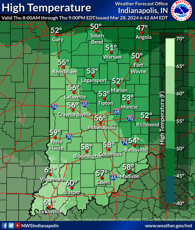
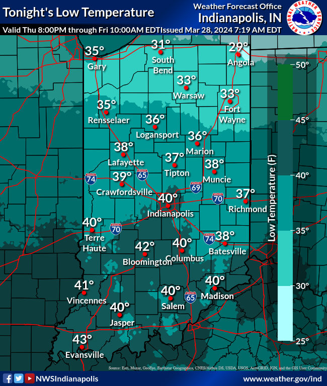
Back to nearly normal temperatures today, after a frosty start. Here are the morning lows:
24 Lafayette
25 Anderson
26 Kokomo, Bloomington
27 Muncie
28 Indy, Terre Haute
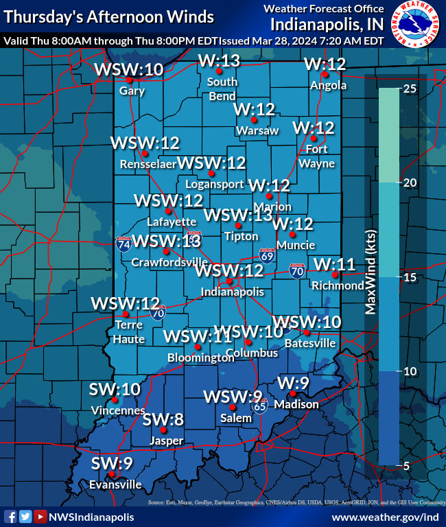
Mostly clear and mostly calm in the morning, with surface high pressure nearby.
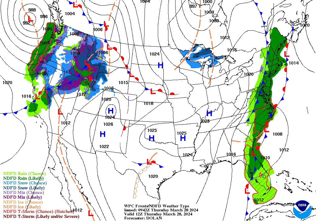
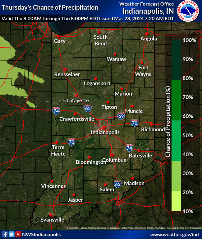
That nearly-calm wind gives way to gusts up to around 20 mph in the afternoon. It won’t be as cold tonight or tomorrow. As the warmer air pushes in there may be a few sprinkles overnight, especially in the northern half of the state. Good Friday’s overall weather looks good, with clouds gradually thickening. Should be a nice spring day.
A weekend weathermaker starts bringing back rain chances after sunset Friday night, and is with us Saturday, especially in the morning. There could be some thunder.
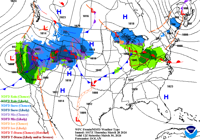
Showers and storms will be with us on and off from Sunday afternoon through Tuesday. Look at these potential rain totals!
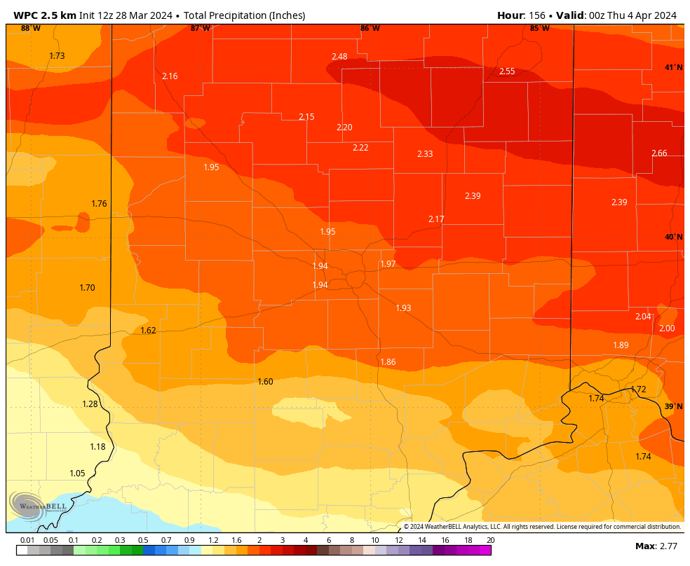
The heaviest rain and strongest storms will pop Monday night into Tuesday morning.
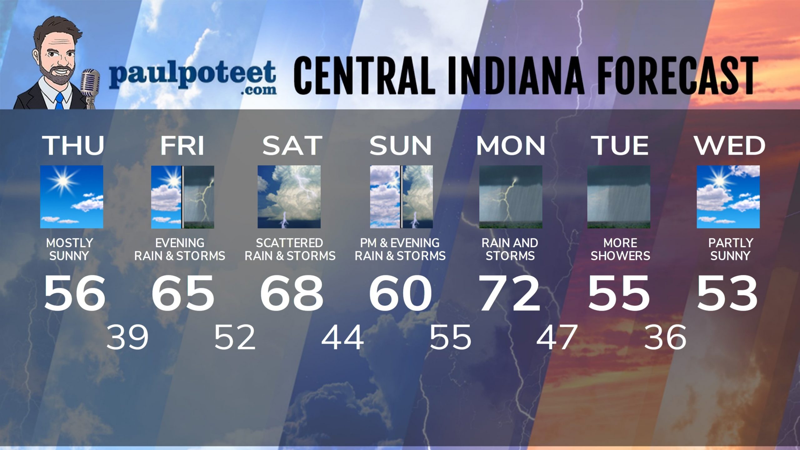
INDY SEVEN DAY FORECAST
Today: Mostly sunny. High 56.
Tonight: Partly cloudy. Low 39.
Friday: Partly sunny. High 65.
Friday Night: Mostly cloudy. Scattered showers and storms, especially after
midnight. Low 52.
Saturday: Partly to mostly cloudy. Scattered showers and storms. High 68.
Saturday Night: Scattered evening storms. Partly to mostly cloudy
overnight. Low 44.
Sunday: Partly to mostly cloudy. Scattered afternoon showers and storms.
High 60.
Sunday Night:Scattered showers and storms. Low 55.
Monday: Showers and storms. Heavy rain and strong storms possible. High 72.
Monday Night; Showers and storms. Low 47.
Tuesday: More showers. High 55.
Tuesday Night: Partly cloudy and cooler. Low 36.
Wednesday: Partly sunny. High 53.