It was 68 at Midnight in Indy, but fallling fast now with the passage of the cold front, which is also shutting down the threat of severe weather.
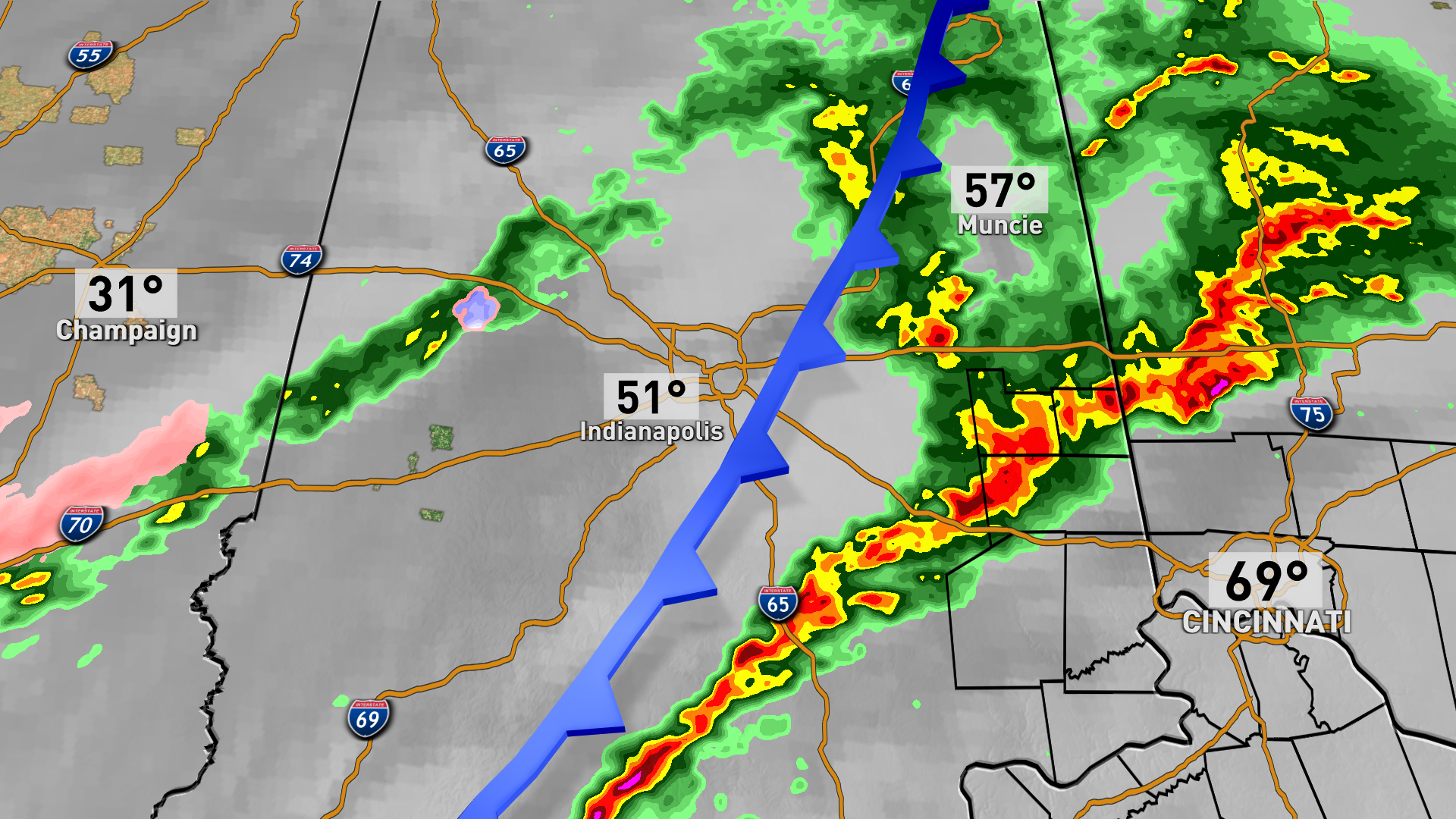
Several severe thunderstorm warnings overnight, with reports of high wind and wind damge. First Number is speed in MPH.
60	3 E Avon	Hendricks	IN	3977	8634	(IND)
59	Indianapolis Int'l Airp	Marion	IN	3972	8630	(IND)
60	Broad Ripple	Marion	IN	3987	8613	A couple gusts estimated at or above 60 mph. (IND)
UNK	3 NNW Homecroft	Marion	IN	3970	8615	Report from mPING ... 3-inch tree limbs broken. (IND)
UNK	Greenfield	Hancock	IN	3979	8577	2-inch diameter tree limbs down. (IND)
59	3 ESE Fairland	Shelby	IN	3958	8580	(IND)
Never miss me! Subscribe for free. My Huge Radar has real-time weather tracking, current temperatures, and severe weather watches and warnings. Get detailed Indiana conditions by clicking here. Click here to see my central Indiana 7-Day Forecast. Follow these links to get my forecasts for Lafayette, Muncie, Hendricks County, and Hamilton County. Need a second opinion? Click here for central Indiana National Weather Service forecasts. (Some charts via WeatherBELL.)


