(Via @NWSIndianapolis.) 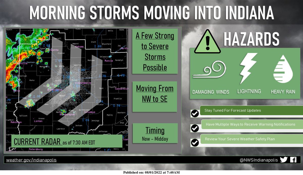 A lingering line of strong thunderstorms is moving into Indiana this morning. Frequent lightning and heavy rain are expected, but the strongest cells may produce damaging winds. A few isolated showers ahead of this main line may make for a wet morning commute. #INwx #NWSIND https://t.co/C60YUaRaLV
My Huge Radar has real-time weather tracking, current temperatures, and severe weather watches and warnings. Get detailed Indiana conditions by clicking here. Follow these links to get my forecasts for Lafayette, Muncie, Hendricks County, and Hamilton County. Need a second opinion? Click here for central Indiana National Weather Service forecasts.
Never miss me! Subscribe for free. My Huge Radar has real-time weather tracking, current temperatures, and severe weather watches and warnings. Get detailed Indiana conditions by clicking here. Click here to see my central Indiana 7-Day Forecast. Follow these links to get my forecasts for Lafayette, Muncie, Hendricks County, and Hamilton County. Need a second opinion? Click here for central Indiana National Weather Service forecasts. (Some charts via WeatherBELL.)


