All of the state is under either a level two or three (out of five) risk for severe weather by this evening.

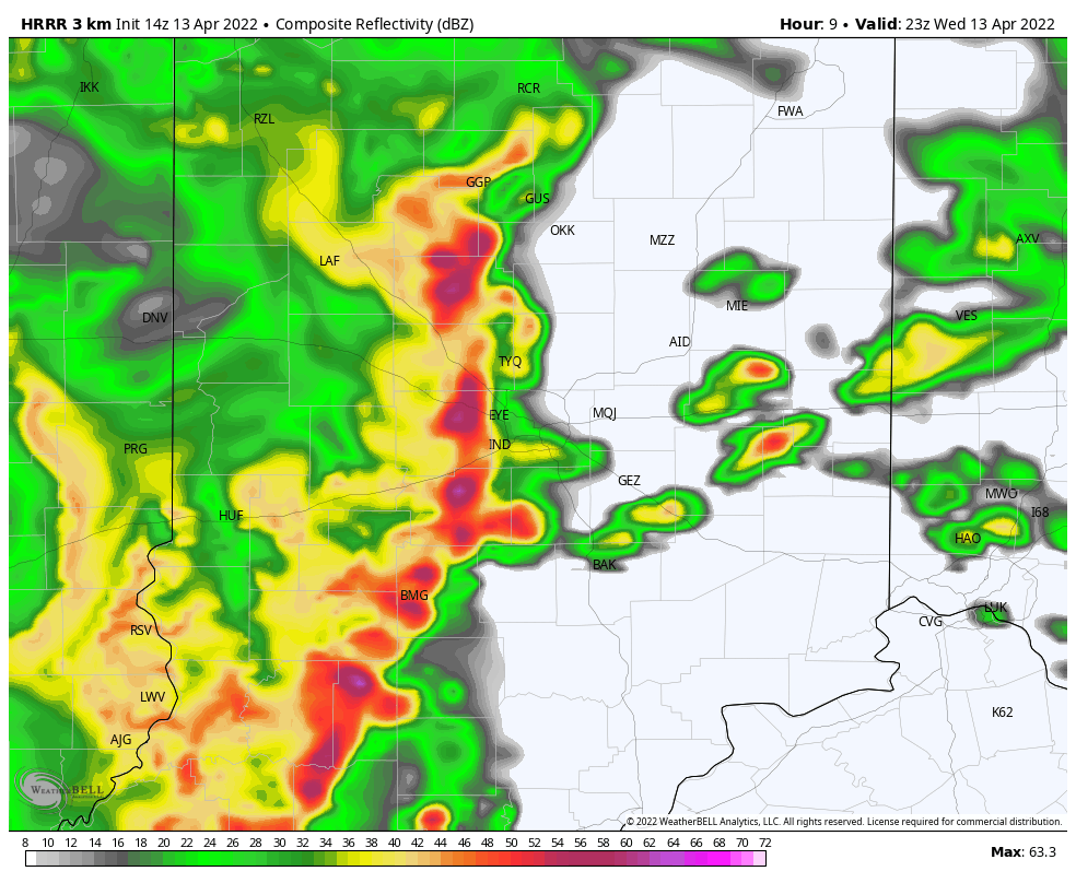
Just rain so far this morning, but storms will strengthen later this afternoon. Here’s a computer-modeled look at how a squall line could be positioned by 7pm.
INDY SEVEN DAY FORECAST
Today: Showers and storms. Some storms could be severe. Wind gusts outside of storms could also gust to 35 mph. High 69.
Tonight: Showers and storms in the evening that could be severe. Clearing toward daybreak. Low 40.
Thursday: Sunny. Wind gusting to 35 mph. High 59.
Thursday Night: Mostly clear. Low 41.
Friday: Partly sunny. High 65.
Friday Night: Partly cloudy. Isolated shower possible late. Low 41.
Saturday: Partly sunny. High 56.
Saturday Night: Partly cloudy. Low 33.
Easter Sunday: Partly to mostly cloudy. High 53.
Sunday Night: Scattered showers after midnight. Low 39.
Monday: Mostly to partly cloudy, with a few spotty showers. High 55.
Tuesday Night: Partly cloudy. Low 36.
Tuesday: Partly sunny. High 52.
:end
Never miss me! Subscribe for free. My Huge Radar has real-time weather tracking, current temperatures, and severe weather watches and warnings. Get detailed Indiana conditions by clicking here. Click here to see my central Indiana 7-Day Forecast. Follow these links to get my forecasts for Lafayette, Muncie, Hendricks County, and Hamilton County. Need a second opinion? Click here for central Indiana National Weather Service forecasts. (Some charts via WeatherBELL.)


