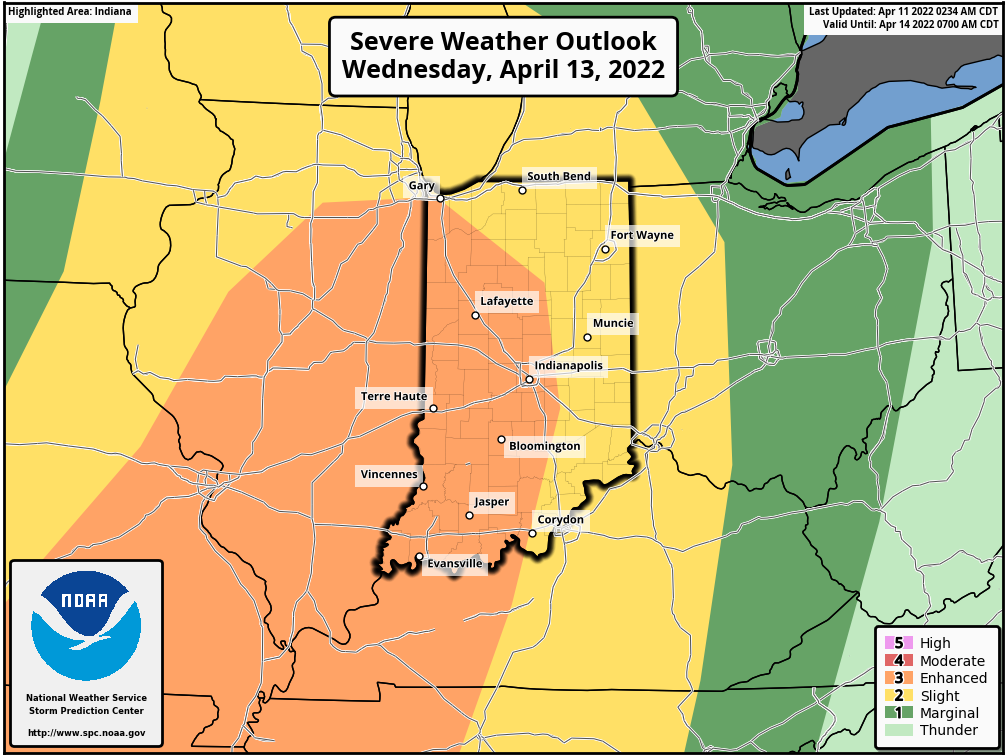
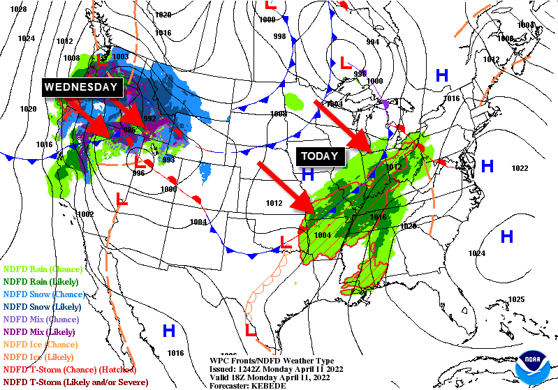
Another day in the 60s, but this time with rain and some thunder. Storms are Wednesday could be severe. Much of Indiana is up to a level 3 (out of 5) risk.
That’ll be from a system still coming together in the West. In between today and tomorrow: a quiet Tuesday.
Never miss me! Subscribe for free. My Huge Radar has real-time weather tracking, current temperatures, and severe weather watches and warnings. Get detailed Indiana conditions by clicking here. Click here to see my central Indiana 7-Day Forecast. Follow these links to get my forecasts for Lafayette, Muncie, Hendricks County, and Hamilton County. Need a second opinion? Click here for central Indiana National Weather Service forecasts. (Some charts via WeatherBELL.)
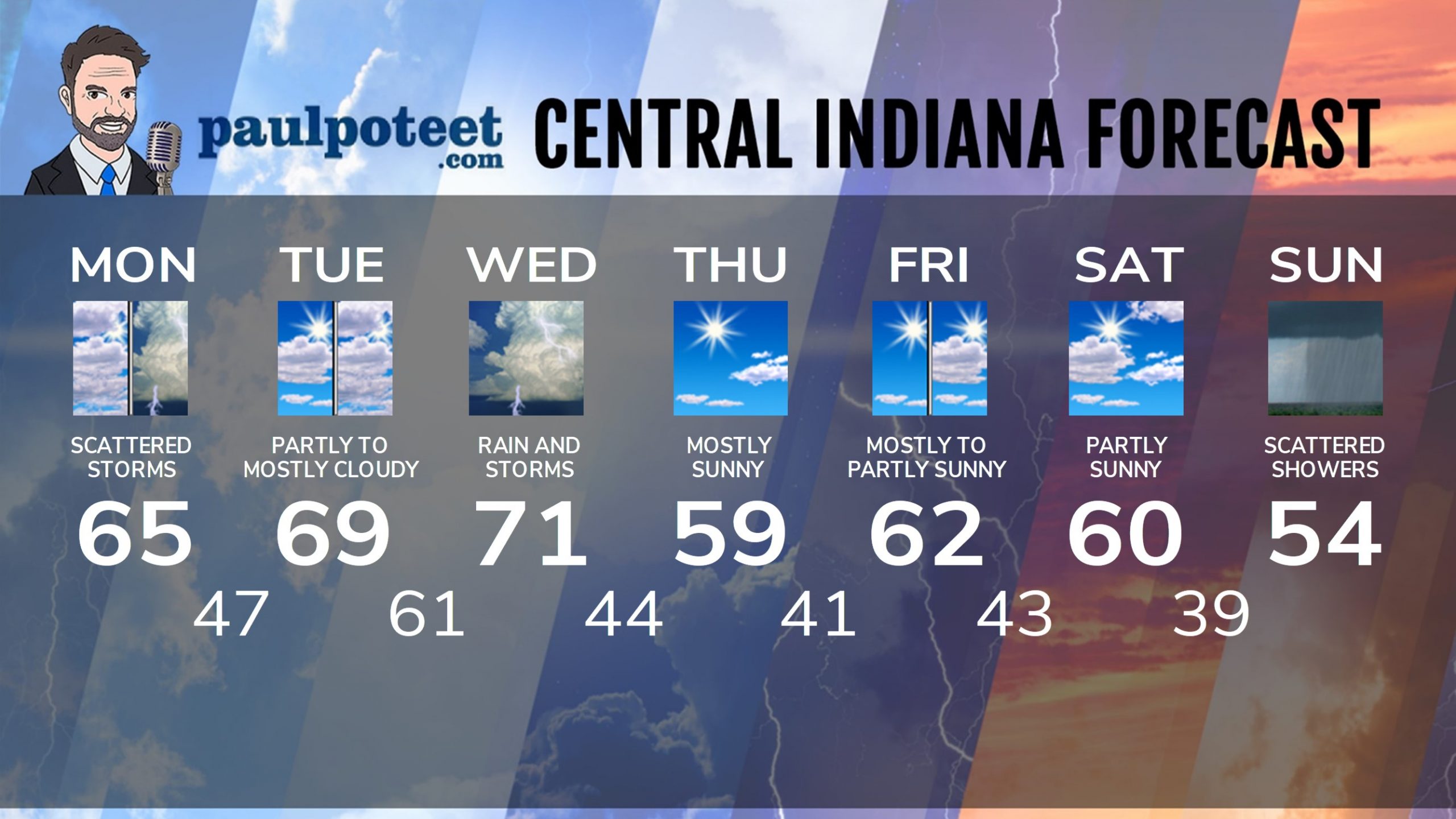
INDY SEVEN DAY FORECAST
Today: Mostly cloudy, with scattered showers and storms, mainly in the afternoon. High 65.
Tonight: Scattered evening showers and storms. Partly cloudy late. Low 47.
Tuesday: Partly to mostly cloudy. Isolated shower possible. High 69.
Tuesday Night: Scattered showers and storms, mainly after midnight. Low 61.
Wednesday: Showers and storms. Some storms could be severe in the afternoon. High 71.
Wednesday Night: Showers and storms. Some storms could be severe. Low 44.
Thursday: Mostly sunny. High 59.
Thursday Night: Mostly clear. Low 41.
Friday: Mostly to partly sunny. High 62.
Friday Night: Partly cloudy. Low 43.
Saturday: Partly sunny. High 60.
Saturday Night: Scattered showers late. Low 39.
Easter Sunday: Partly sunny. Scattered showers. High 54.
Never miss me! Subscribe for free. My Huge Radar has real-time weather tracking, current temperatures, and severe weather watches and warnings. Get detailed Indiana conditions by clicking here. Click here to see my central Indiana 7-Day Forecast. Follow these links to get my forecasts for Lafayette, Muncie, Hendricks County, and Hamilton County. Need a second opinion? Click here for central Indiana National Weather Service forecasts. (Some charts via WeatherBELL.)


