Sloppy travel later this afternoon through tonight, with the arrival of a storm system centered down South. Up here there will be a mixed bag of precip as a result.

A Winter Weather Advisory is in place for much of the state starting in the afternoon.

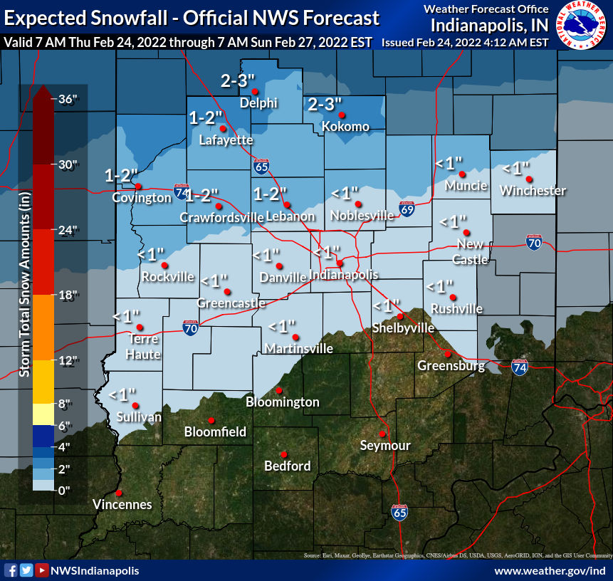
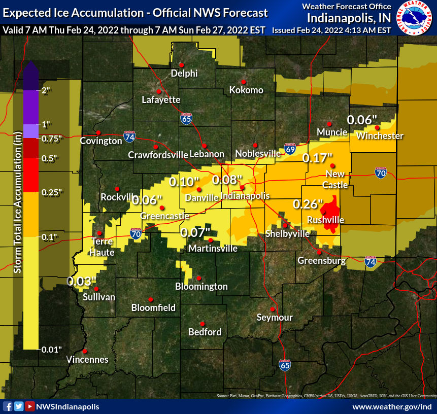
The precipitation will fall mainly as snow the farther north you are, and as a wintry mix closer to I-70.
Never miss me! Subscribe for free. My Huge Radar has real-time weather tracking, current temperatures, and severe weather watches and warnings. Get detailed Indiana conditions by clicking here. Click here to see my central Indiana 7-Day Forecast. Follow these links to get my forecasts for Lafayette, Muncie, Hendricks County, and Hamilton County. Need a second opinion? Click here for central Indiana National Weather Service forecasts. (Some charts via WeatherBELL.)
INDY SEVEN DAY FORECAST
Today: Early morning light snow showers, with freezing drizzle also possible. Later afternoon snow. Snow will mix with sleet and freezing rain. High 35.
Tonight: Wintry mix of freezing rain, sleet and snow. Snow/sleet totals around an inch in Marion County. Up to two inches north, and less than an inch south/southeast. Low 26.
Friday: Mostly cloudy. High 32.
Friday Night: Mostly cloudy. Low 19.
Saturday: Partly sunny. High 36.
Saturday Night: Mostly clear. Low 24.
Sunday: Mostly sunny. High 43.
Sunday Night: Mostly clear. Low 23.
Monday: Mostly sunny. High 46.
Monday Night: Partly cloudy. Low 28.
Tuesday: Partly sunny. High 48.
Monday Night: Partly cloudy. Low 31.
Wednesday: Partly sunny. High 54.

Never miss me! Subscribe for free. My Huge Radar has real-time weather tracking, current temperatures, and severe weather watches and warnings. Get detailed Indiana conditions by clicking here. Click here to see my central Indiana 7-Day Forecast. Follow these links to get my forecasts for Lafayette, Muncie, Hendricks County, and Hamilton County. Need a second opinion? Click here for central Indiana National Weather Service forecasts. (Some charts via WeatherBELL.)


