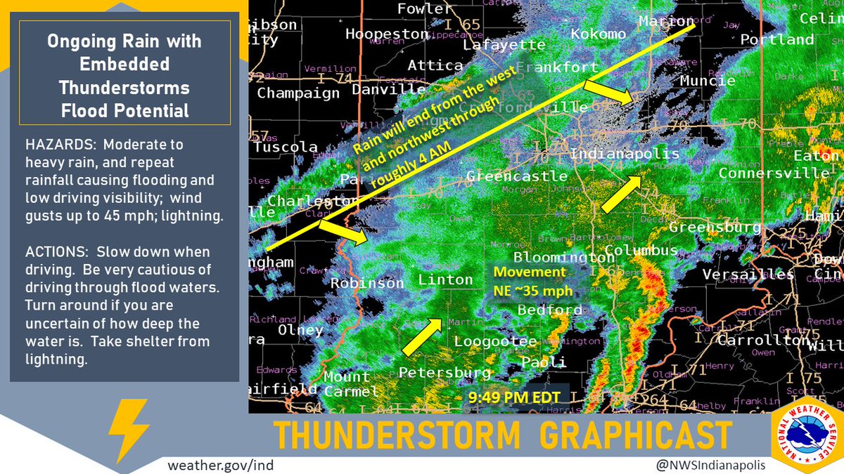
(Via @NWSIndianapolis.) At 9:49 PM EDT a large area of rain, with embedded t-storms in SE IN, continues to move NE ~35 mph across much of IN. The back edge of this area is mainly along the W IN border. Rain chances will greatly diminish WNW to ESE thru 4 AM. Chief threat is flooding. #INwx #nwsind https://t.co/iedRoaTb1u
My Huge Radar has real-time weather tracking, current temperatures, and severe weather watches and warnings. Get detailed Indiana conditions by clicking here. Follow these links to get my forecasts for Lafayette, Muncie, Hendricks County, and Hamilton County. Need a second opinion? Click here for central Indiana National Weather Service forecasts.
Never miss me! Subscribe for free. My Huge Radar has real-time weather tracking, current temperatures, and severe weather watches and warnings. Get detailed Indiana conditions by clicking here. Click here to see my central Indiana 7-Day Forecast. Follow these links to get my forecasts for Lafayette, Muncie, Hendricks County, and Hamilton County. Need a second opinion? Click here for central Indiana National Weather Service forecasts. (Some charts via WeatherBELL.)


