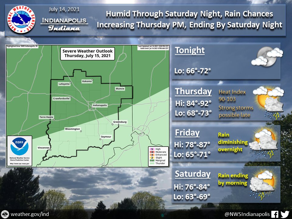
(Via @NWSIndianapolis.) Continued humid w/ rain chances increasing latter 1/2 of Thu into Fri. Slight risk of excessive rain. Strong storms possible late Thu/Thu night. Heat indices Thu 90-103°. Rain chances ending late Sat/Sat night. Thru Sat night high temps 76-92°, lows 63-73. #INwx #nwsind https://t.co/Wv2W3qpJhf
My Huge Radar has real-time weather tracking, current temperatures, and severe weather watches and warnings. Get detailed Indiana conditions by clicking here. Follow these links to get my forecasts for Lafayette, Muncie, Hendricks County, and Hamilton County. Need a second opinion? Click here for central Indiana National Weather Service forecasts.
Never miss me! Subscribe for free. My Huge Radar has real-time weather tracking, current temperatures, and severe weather watches and warnings. Get detailed Indiana conditions by clicking here. Click here to see my central Indiana 7-Day Forecast. Follow these links to get my forecasts for Lafayette, Muncie, Hendricks County, and Hamilton County. Need a second opinion? Click here for central Indiana National Weather Service forecasts. (Some charts via WeatherBELL.)


