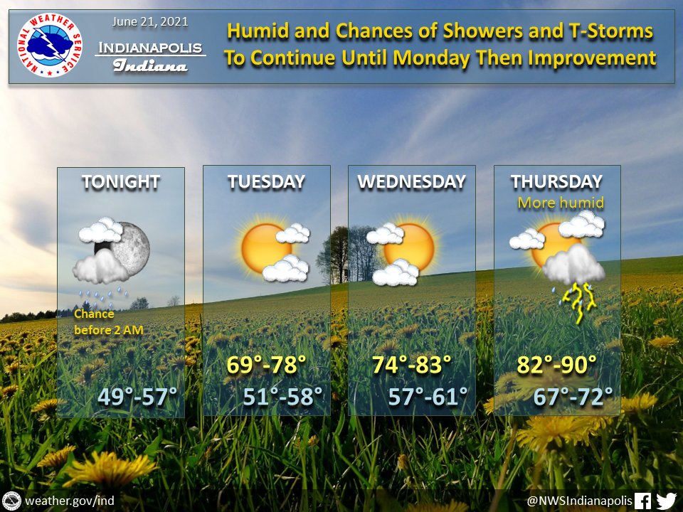
(Via @NWSIndianapolis.) Lingering showers/t-storms ending NW to SE by 2 AM tonight. Drier air thru Wed. More humid Thu w/ chances of showers/t-storms Thu PM. Temps rebounding, starting off with lows tonight in the upper 40s to mid 50s, peaking Thu in the low 80s to about 90°. #INwx #nwsind https://t.co/6JpTiuLpce
My Huge Radar has real-time weather tracking, current temperatures, and severe weather watches and warnings. Get detailed Indiana conditions by clicking here. Follow these links to get my forecasts for Lafayette, Muncie, Hendricks County, and Hamilton County. Need a second opinion? Click here for central Indiana National Weather Service forecasts.
Never miss me! Subscribe for free. My Huge Radar has real-time weather tracking, current temperatures, and severe weather watches and warnings. Get detailed Indiana conditions by clicking here. Click here to see my central Indiana 7-Day Forecast. Follow these links to get my forecasts for Lafayette, Muncie, Hendricks County, and Hamilton County. Need a second opinion? Click here for central Indiana National Weather Service forecasts. (Some charts via WeatherBELL.)


