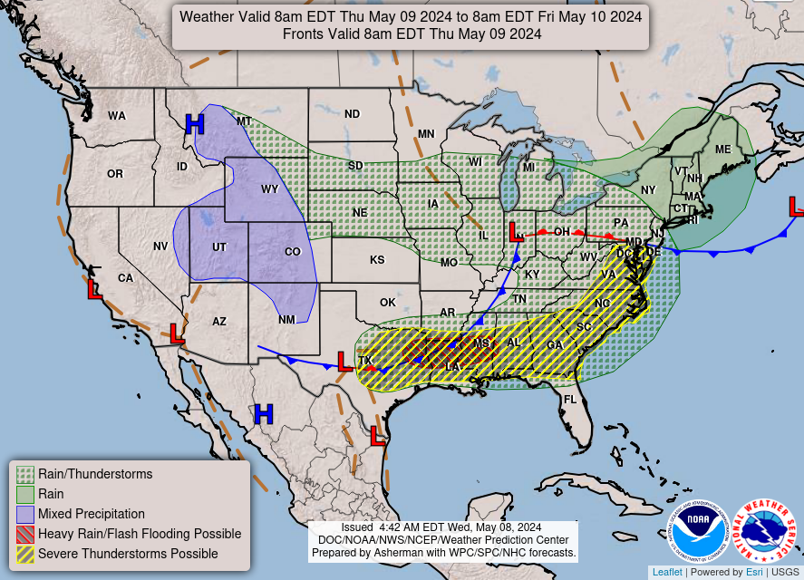
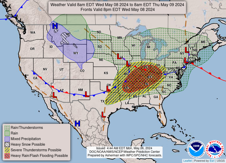
….There is an Enhanced Risk of severe thunderstorms over parts of the
Central High Plains on Saturday…
…There is a Moderate Risk of excessive rainfall over parts of the Middle
Mississippi Valley on Saturday and the Central/Southern High Plains on
Sunday…
…There are Heat Advisories over parts of western Texas…
A front over the Central Plains into the Central Rockies will move
eastward to off most of the Eastern Seaboard by Monday. The boundary will
aid in triggering showers and severe thunderstorms over parts of the
Central High Plains. Therefore, the SPC has issued an Enhanced Risk (level
3/5) of severe thunderstorms over parts of the Central High Plains through
Sunday morning. The hazards associated with these thunderstorms are
frequent lightning, severe thunderstorm wind gusts, hail, and a few
tornadoes. In addition, there is an added threat of severe thunderstorm
wind gusts of 65 knots or greater over parts of eastern Colorado and
western Kansas. Furthermore, there is also an added threat of hail, two
inches or greater, over parts of eastern Colorado.
Moreover, the showers and thunderstorms will create heavy rain over parts
of southern Missouri and the Central High Plain. Therefore, the WPC has
issued a Slight Risk (level 2/4) of excessive rainfall over parts of the
Middle Mississippi Valley through Sunday morning. The associated heavy
areas, roads, small streams, and low-lying areas the most vulnerable. rain
will create mainly localized areas of flash flooding, with urban areas,
roads, small streams, and low-lying areas the most vulnerable.
On Sunday, upper-level energy moving from the Southwest to the Southern
High Plains will create showers and strong to severe thunderstorms will
develop over parts of the Central/Southern High Plains. Therefore, the SPC
has issued a Marginal Risk (level 1/5) of severe thunderstorms over parts
of the Central/Southern High Plains from Sunday through Monday morning.
The hazards associated with these thunderstorms are frequent lightning,
severe thunderstorm wind gusts, hail, and a minimal threat of tornadoes.
The showers and thunderstorms will also cause heavy rain to develop over
parts of the Central/Southern High Plains. Therefore, the WPC has issued a
Slight Risk (level 2/4) of excessive rainfall over parts of the
Central/Southern High Plains from Sunday through Monday morning. The
associated heavy rain will create mainly localized areas of flash
flooding, with urban areas, roads, small streams, and low-lying areas the
most vulnerable.
Furthermore, an upper-level low over the Great Lakes/Northeast will help
produce rain over parts of the Great Lakes and the Northeast through
Monday. Another area of upper-level energy and a weakening front will help
create showers and thunderstorms over parts of Florida through Monday.
Furthermore, upper-level ridging over Texas helps spawn Heat Advisories
over parts of western Texas.
Ziegenfelder
Graphics available at
https://www.wpc.ncep.noaa.gov/basicwx/basicwx_ndfd.php


