A weakening line of storms will enter Indiana around 10am. Storms will probably pause in the early afternoon, only to return with a severe threat between about 3 and 9pm. This afternoon’s severe weather threats include large hail greater than 2″, damaging winds, and even a few strong tornadoes. Best threat for strong tornadoes is over North and Eastern Indiana.


INDY SEVEN DAY FORECAST
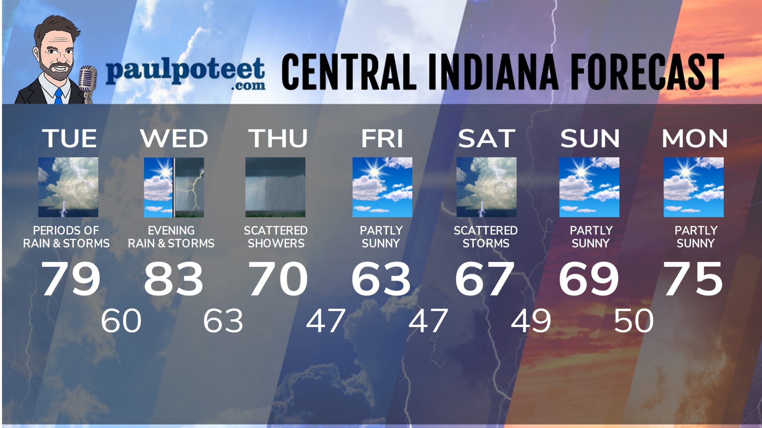
Today: Periods of showers and storms. Storms could be severe in the mid to late afternoon. High 79.
Tonight: Evening showers and storms could be severe. Clearing after midnight. Low 60.
Wednesday: Mostly sunny to partly sunny. High 83.
Wednesday Night: Showers and storms, possibly severe. Low 63.
Thursday: Partly to mostly cloudy, with scattered showers. High 70.
Thursday Night: Partly cloudy. Low 47.
Friday: Partly sunny. High 63.
Friday Night: Partly cloudy. Low 47.
Saturday: Mostly cloudy with scattered showers and storms. High 67.
Saturday Night: Partly cloudy. Low 49.
Sunday: Partly sunny. High 69.
Sunday Night: Partly cloudy. Low 50.
Monday: Partly cloudy. High 75.


Never miss me! Subscribe for free. My Huge Radar has real-time weather tracking, current temperatures, and severe weather watches and warnings. Get detailed Indiana conditions by clicking here. Click here to see my central Indiana 7-Day Forecast. Follow these links to get my forecasts for Lafayette, Muncie, Hendricks County, and Hamilton County. Need a second opinion? Click here for central Indiana National Weather Service forecasts. (Some charts via WeatherBELL.)


