…Unsettled weather and severe thunderstorm chances ramp up across parts
of the central and southern Plains this week…
…Above average temperatures throughout the western and central United
States, with cooler weather in the Great Lakes and much of the East…
The mostly quiet weather pattern experienced the last few days over the
Lower 48 is expected to gradually retreat as an upper trough develops over
the western U.S. midweek and sparks increasing thunderstorm chances
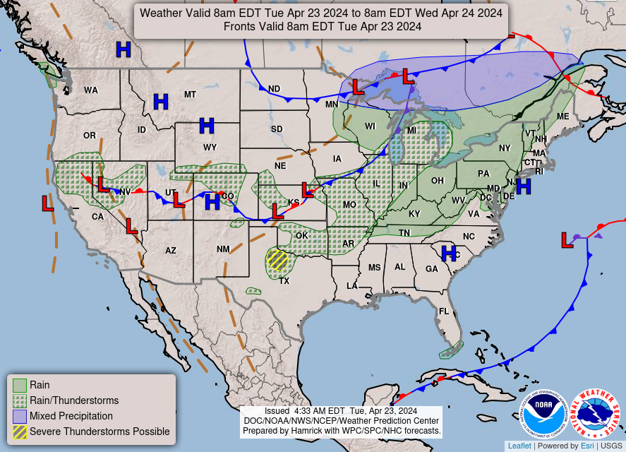
throughout the Great Plains and parts of the Midwest. First, a pair of
cold fronts crossing the Great Lakes and Ohio Valley today will spread
showers and isolated thunderstorms over the region before reaching the
Northeast on Wednesday. Temperatures may drop rapidly enough for
precipitation to end as snow across northern New England. Meanwhile, a
trailing cold front entering the southern Plains will be the focus for
thunderstorms over the next few days from northern and West Texas to
central Oklahoma. A few storms could be capable of producing large hail
and damaging wind gusts across northwest Texas today, which has prompted
the Storm Prediction Center to issue a Slight Risk (level 2/5) of severe
weather. A few isolated severe thunderstorms may also develop off a
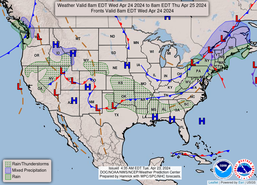
southern High Plains dryline on Wednesday ahead of the approaching western
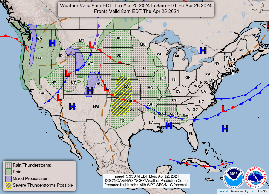
upper trough. This upper level system will aid in more widespread shower
and thunderstorm activity throughout the central and southern Plains on
Thursday. Scattered severe thunderstorms are possible as low pressure
develops over the central High Plains and a strengthening dryline pushes
eastward, with most of the severe potential located between south-central
Nebraska and northern Texas. Along with the severe thunderstorm threat,
heavy rain could lead to isolated instances of flash flooding.
Elsewhere, unsettled weather is also in the forecast throughout parts of
the Great Basin and eventually the Pacific Northwest by Thursday as
initial upper ridging and well above average temperatures gradually erode.
Much of the rainfall is expected to be mostly beneficial outside of any
lightning potential with thunderstorms over the central Great Basin. Highs
throughout the southwest are anticipated to reach the 80s and 90s through
Wednesday, with 60s and 70s for much of the Intermountain West.
Cooler weather is in store for the Great Lakes and much of the eastern
U.S. beginning with the potential for frost this morning from the southern
Appalachians to southern New England. Lows dipping into the 30s here may
damage sensitive plants and vegetation if left unprotected. Temperatures
are forecast to rebound this afternoon as highs reach into the 60s and 70s
ahead of the next spring cold front entering from the Great Lakes tonight.
This will allow for midweek temperatures to drop to around 10 to 20
degrees below average for the Great Lakes and Northeast, equating to high
temperatures ranging from the 40s in northern locations to 60s along the
northern Mid-Atlantic coastline.
Snell
Graphics available at
https://www.wpc.ncep.noaa.gov/basicwx/basicwx_ndfd.php


Leave a Reply