One thing to note, Indianapolis is already in the top 13 for wettest April`s on record. Numerous chances for rainfall Tuesday, and then
again the weekend of April 27-28th will likely push Indianapolis at least into the top 10 for wettest April`s on record.
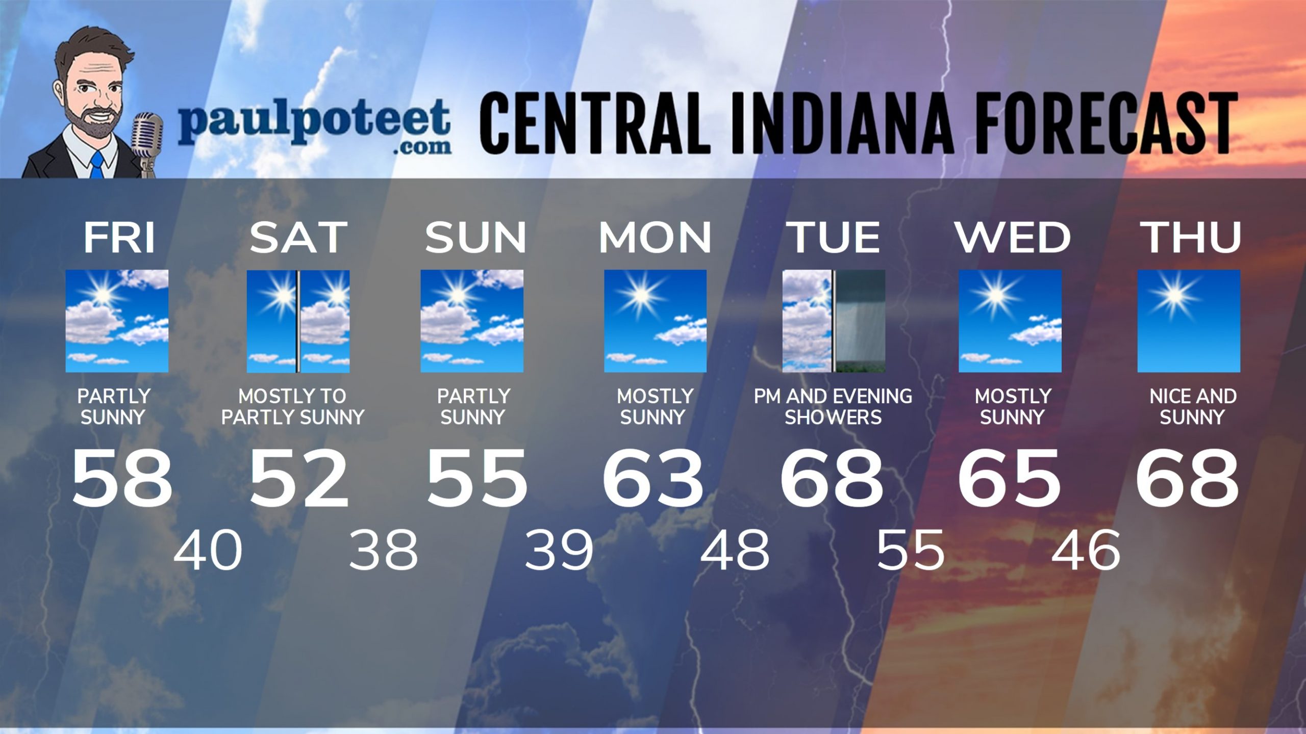
As expected the five day streak of 70s and 80s has ended behind a cold front. Even the 60s won’t be back until Monday and the 70s won’t return for a week. The peak heat in Indy was 82 degrees on Monday. Lafayette also peaked at 82, and Muncie’s hottest high was 83.
Thursday Night Rain Totals:
.68″ Lafayette
.48″ Terre Haute
.44″ Kokomo
.40″ Shelbyville
.26″ Muncie
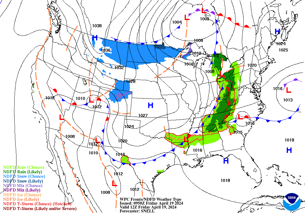
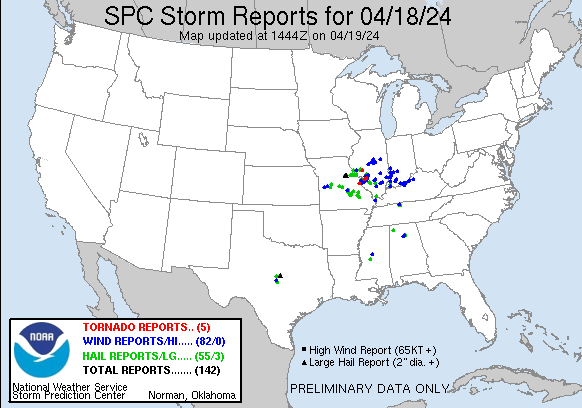
Severe weather was confined to some damaging wind gusts in the southwestern quarter of the state.
INDY SEVEN DAY FORECAST
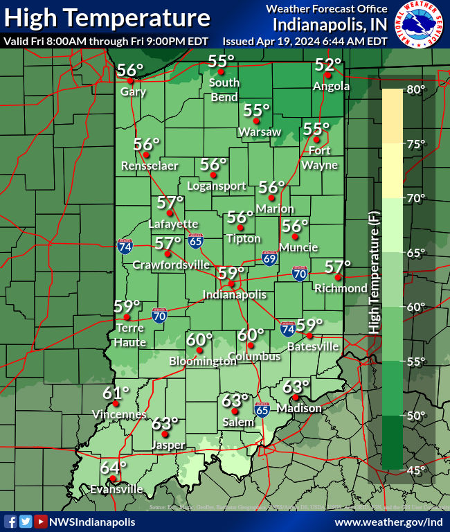
Today: Becoming partly sunny. High 58.
Tonight: Mostly cloudy evening. Clearing overnight. Low 40.
Saturday: Mostly sunny morning. Partly sunny afternoon. High 52.
Saturday Night: Partly cloudy. Low 38.
Sunday: Partly sunny. High 55.
Sunday Night: Mostly clear. Low 39.
Monday: Mostly sunny. High 63.
Monday Night: Partly cloudy. Clouds increase late. Low 48.
Tuesday: Partly to mostly cloudy, with scattered showers. High 68.
Tuesday Night: Scattered showers. Low 55.
Wednesday: Sunny morning. Mostly sunny afternoon. High 65.
Wednesday Night: Mostly clear. Low 46.
Thursday: Sunny. High 68.
Never miss me! Subscribe for free. My Huge Radar has real-time weather tracking, current temperatures, and severe weather watches and warnings. Get detailed Indiana conditions by clicking here. Click here to see my central Indiana 7-Day Forecast. Follow these links to get my forecasts for Lafayette, Muncie, Hendricks County, and Hamilton County. Need a second opinion? Click here for central Indiana National Weather Service forecasts. (Some charts via WeatherBELL.)


