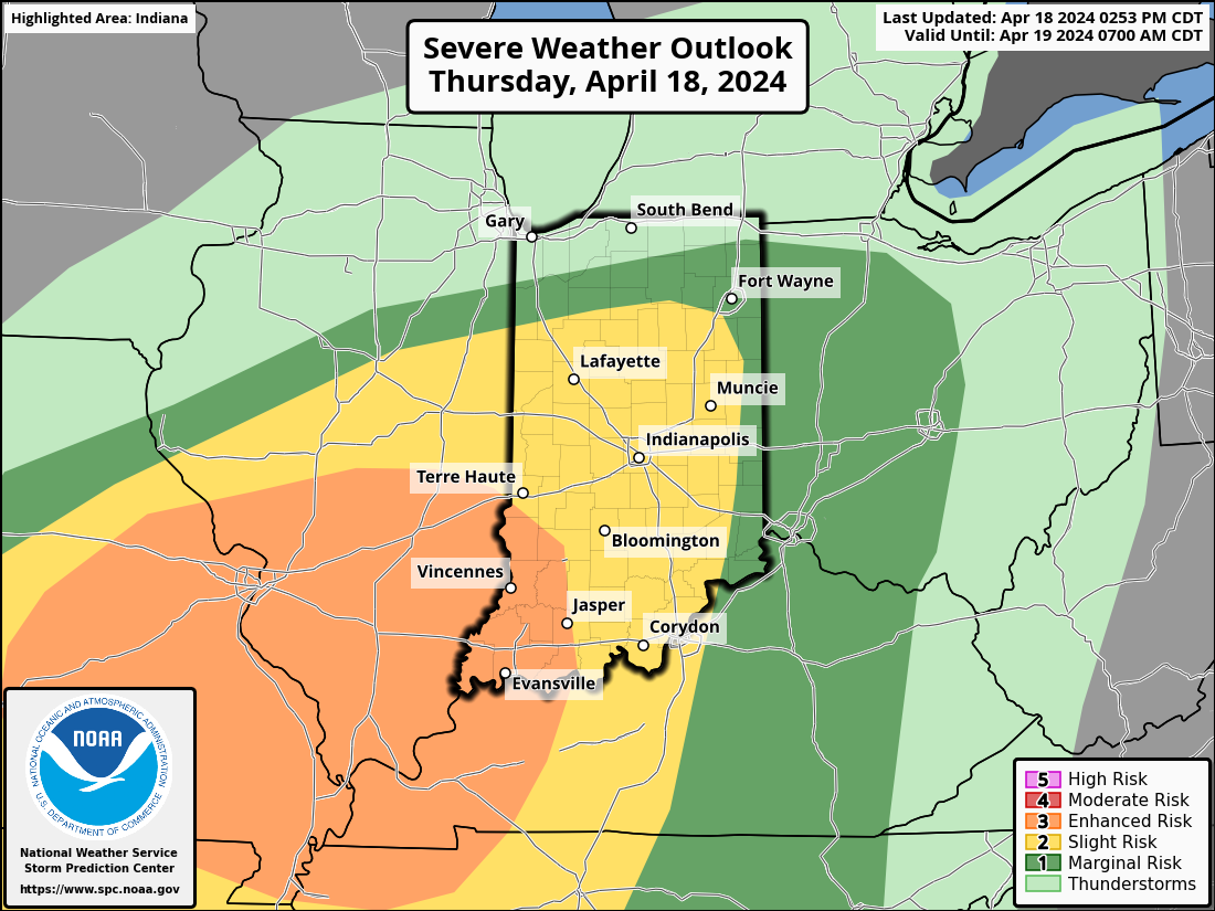
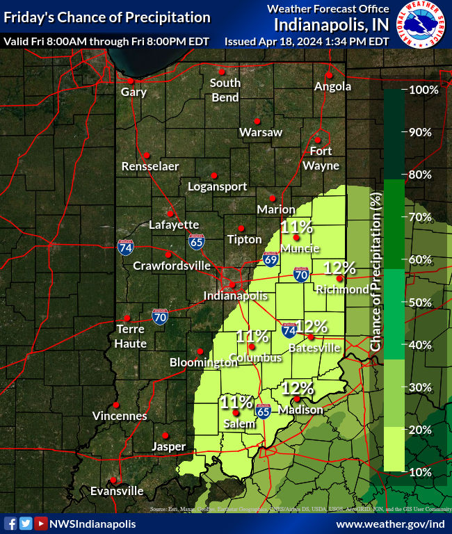
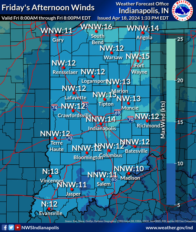
The Storm Prediction Center expanded the slight risk area to include most of Central Indiana. A line of strong to potentially severe thunderstorms should move through central Indiana this evening through the overnight hours. Damaging winds will be the primary threat, but large hail and tornadoes cannot be ruled out, especially in the south-western quarter of the state. Locally heavy rainfall is also possible. Timing of the severe threat is after sunset until about 3am.
Never miss me! Subscribe for free. My Huge Radar has real-time weather tracking, current temperatures, and severe weather watches and warnings. Get detailed Indiana conditions by clicking here. Click here to see my central Indiana 7-Day Forecast. Follow these links to get my forecasts for Lafayette, Muncie, Hendricks County, and Hamilton County. Need a second opinion? Click here for central Indiana National Weather Service forecasts. (Some charts via WeatherBELL.)


