MONDAY MORNING HEADLINES
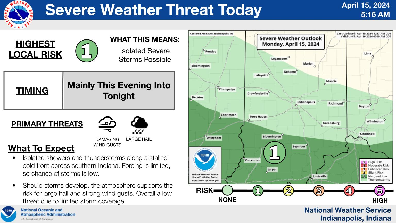
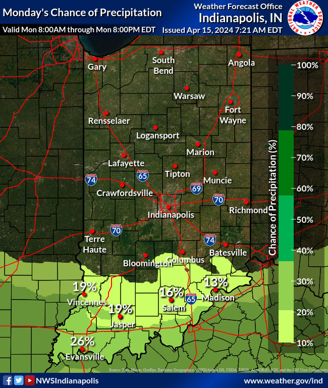
– Isolated thunderstorms possible late today in the far southwest, with additional storms developing tonight. Some hail is possible with these storms.
– Ongoing River Flooding.
– Multiple rounds of showers and storms this week, severe weather possible late Tuesday into Wednesday.
– Cooling trend late next week.
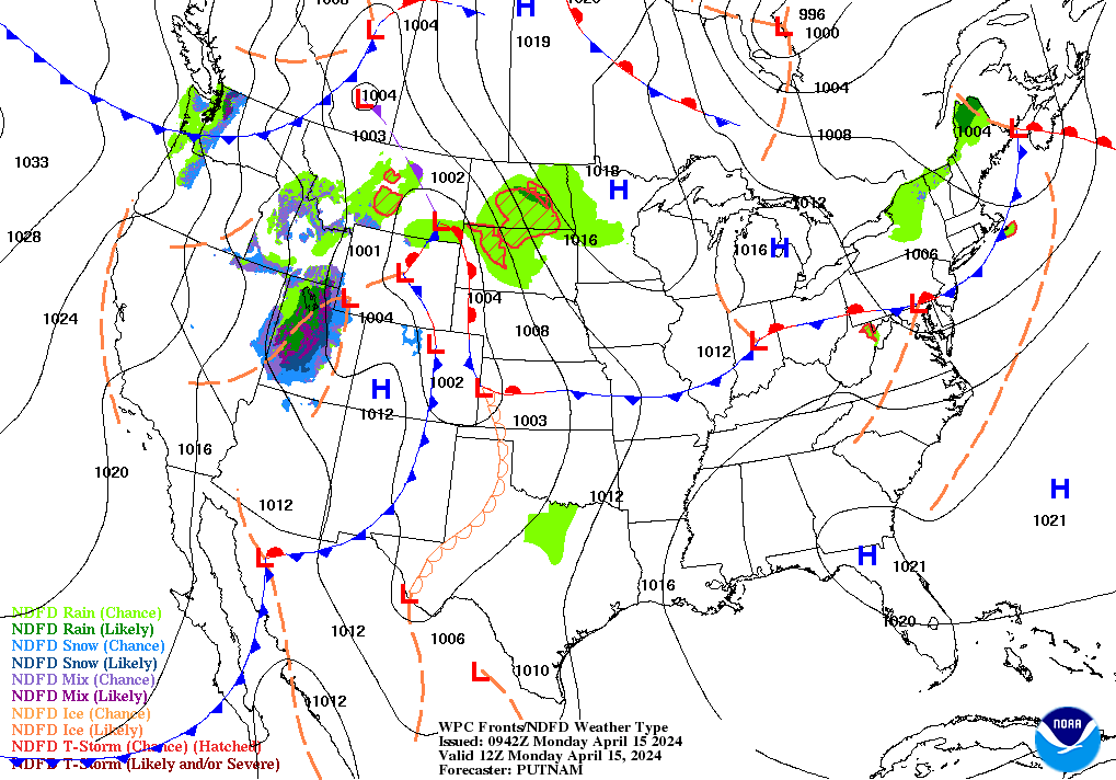
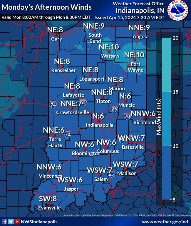
Here’s the front across central Indiana this morning heading southward. The wind will shift to the north behind it, keeping highs “only” in the 70s north of I-70.
A semi-cut off mid to upper-level low pressure system currently resides over the western US. This feature is expected to eject eastward into the Plains today, triggering the development of a surface low over the central Plains. That low heads northeastward towards Indiana on Tuesday/Wednesday. Storms arrive in two rounds, with one late Tuesday night and the second on Wednesday. Round one looks to develop over Missouri and Illinois Tuesday afternoon and progress eastward. Those storms may “out-run” the instability and then weaken.
On Wednesday, the first round of storms should be out of the region with the system`s cold front/dry line approaching from the west. At this point we will be well within the warm sector, though the parent system is expected to be weakening. As the system weakens, upper- level flow becomes more westerly which may twist the winds above us. As such, all hazards are possible on Wednesday…hail, wind, and tornadoes.
INDY SEVEN DAY FORECAST
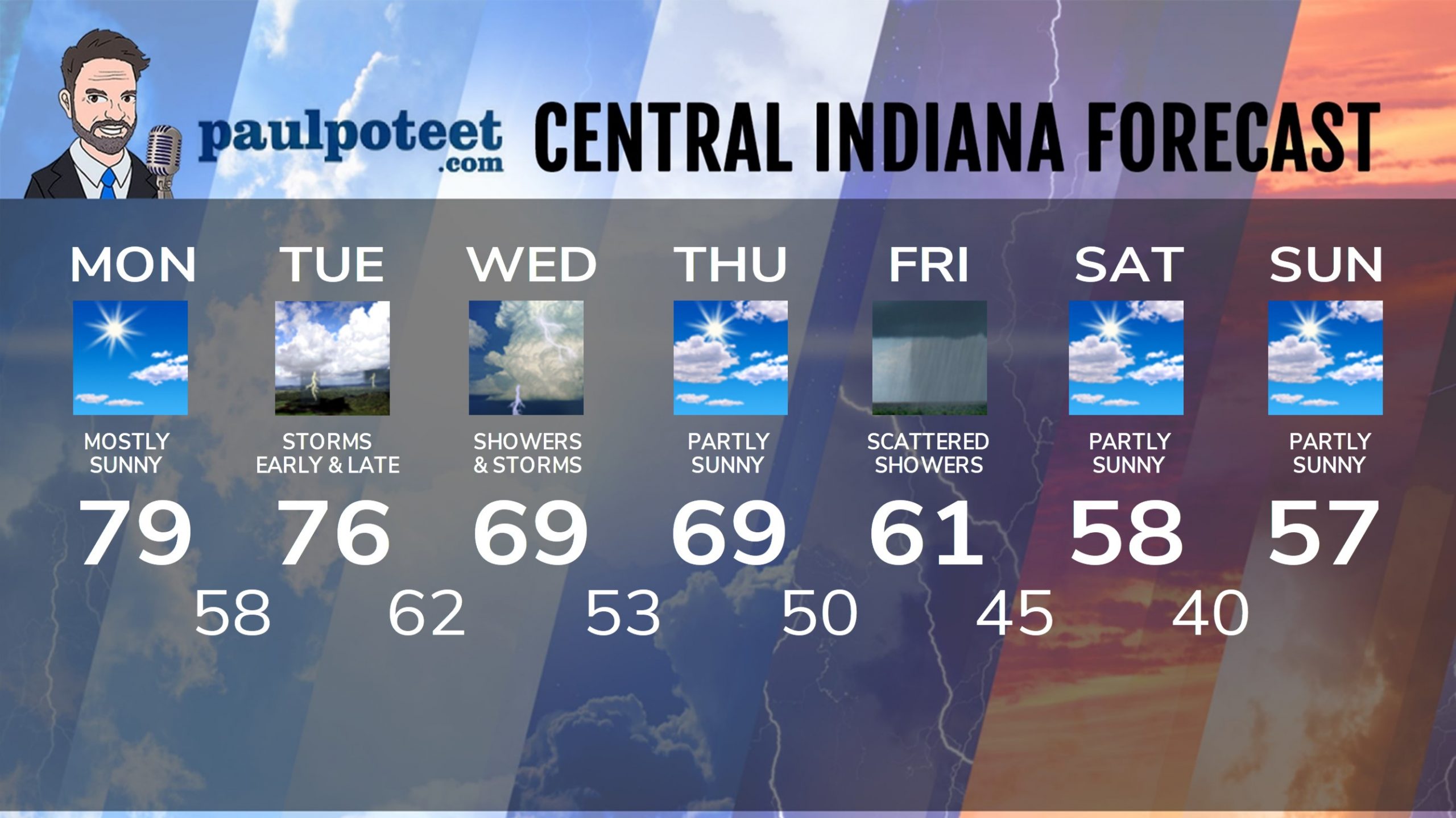
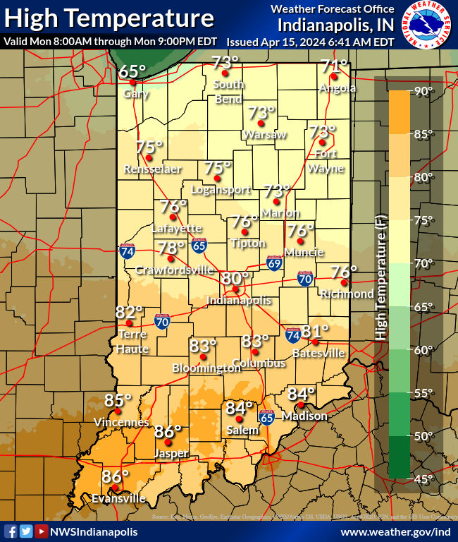
Today: Mostly sunny and warm again! High 79.
Tonight: Clouds increase. Spotty shower or storm after midnight. Low 58.
Tuesday: Mostly cloudy, with scattered showers and storms, mainly in the morning. High 76.
Tuesday Night: Showers and storms, with a few possibly severe. Low 62.
Wednesday: Periods of showers and storms, possibly severe. High 69.
Wednesday Night: Partly cloudy. Low 53.
Thursday: Partly sunny. High 69.
Thursday Night: Partly cloudy. Low 50.
Friday: Mostly cloudy and cooler, with scattered showers. High 61.
Friday Night: Partly cloudy. Low 45.
Saturday: Partly sunny. High 58.
Saturday Night: Partly cloudy. Low 40.
Sunday: Partly sunny. High 57.
Never miss me! Subscribe for free. My Huge Radar has real-time weather tracking, current temperatures, and severe weather watches and warnings. Get detailed Indiana conditions by clicking here. Click here to see my central Indiana 7-Day Forecast. Follow these links to get my forecasts for Lafayette, Muncie, Hendricks County, and Hamilton County. Need a second opinion? Click here for central Indiana National Weather Service forecasts. (Some charts via WeatherBELL.)


