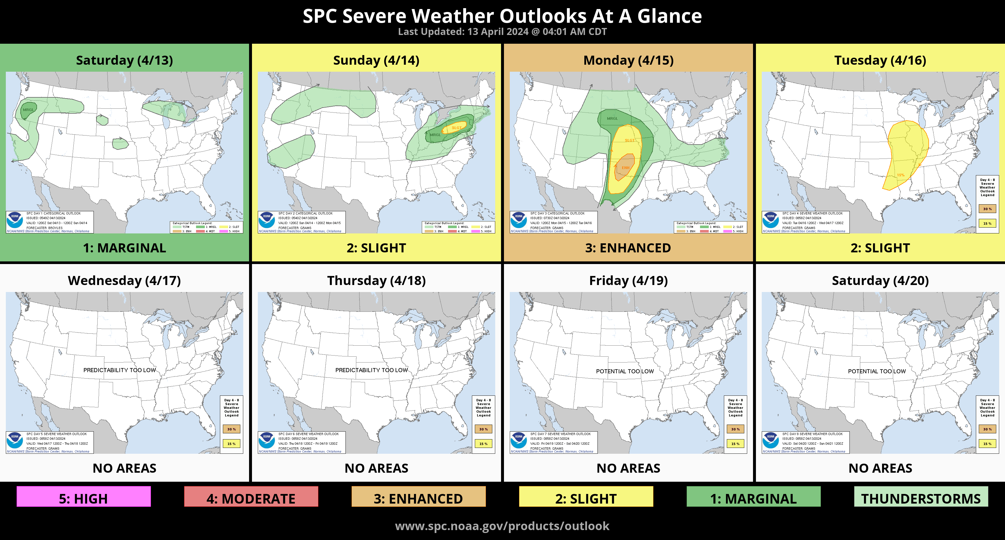
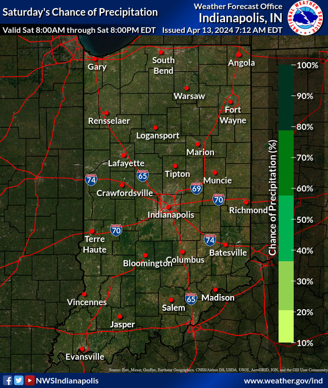
It’s our nicest day since Eclipse Monday, but you just need your plain ol’ sunglasses today, as a ridge of surface high pressure moves eastward across the area. Some high clouds may make an appearance later in the day ahead of a warm front. You will feel the effects of that warm front Sunday.
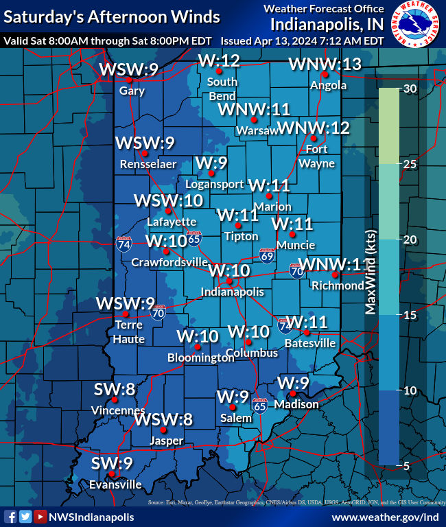
A weak upper-level wave will help stir wind gusts up to 30 mph Sunday morning and midday. As that departs it will drag a weak cold front through the state. This front should settle somewhere in central Indiana and lose its forward momentum. There`s a very low chance that a few showers and thunderstorms develop on this boundary Sunday evening. The best chance of any showers and storms or potentially severe weather would be further northeast.
Our next weathermaker is sitting off the California coast. After spending a few days traversing the intermountain west, this feature should eject into the Great Plains on Monday, Indiana Tuesday and Wednesday. There could be strong to severe storms Tuesday afternoon and evening.
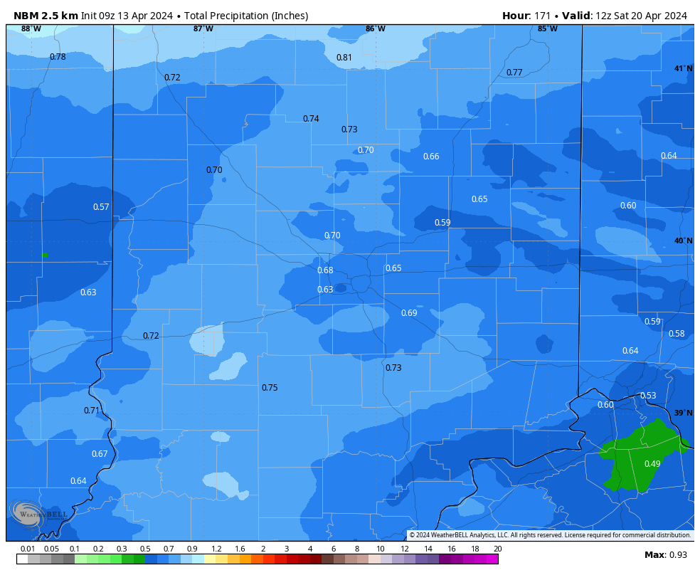
Rain over the next seven days (thankfully) should not be *too* heavy, with amounts staying three-quarters of an inch or lower.
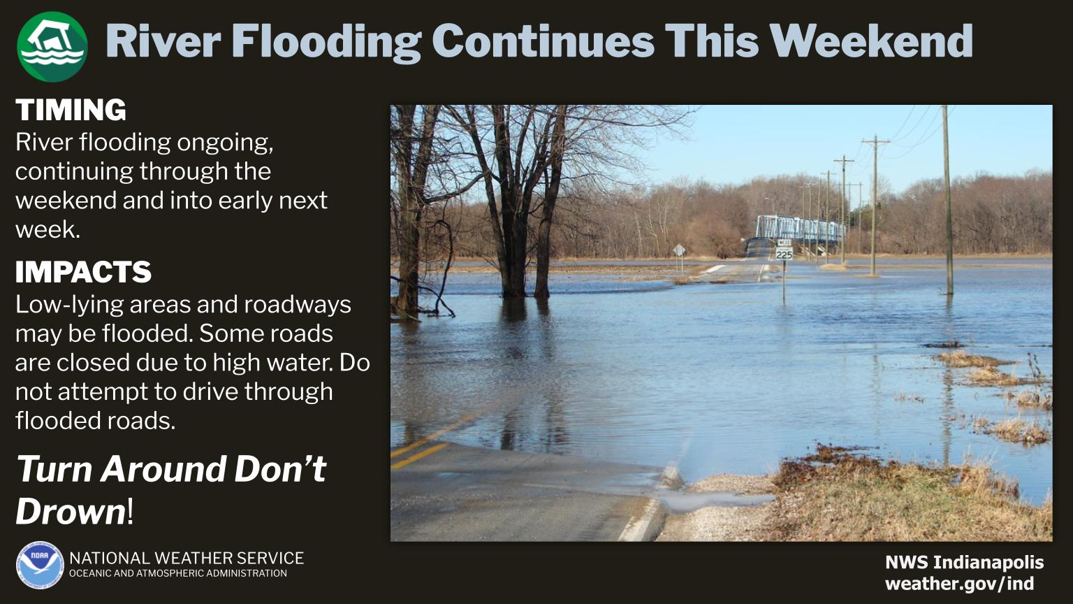
Rivers are already swollen.
Never miss me! Subscribe for free. My Huge Radar has real-time weather tracking, current temperatures, and severe weather watches and warnings. Get detailed Indiana conditions by clicking here. Click here to see my central Indiana 7-Day Forecast. Follow these links to get my forecasts for Lafayette, Muncie, Hendricks County, and Hamilton County. Need a second opinion? Click here for central Indiana National Weather Service forecasts. (Some charts via WeatherBELL.)


