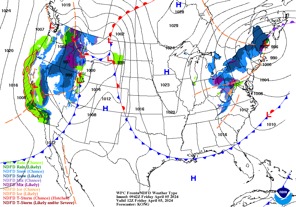
Talk about luck! The best looking day of the 7 Day Forecast is the one with a major outdoor event. I should be this lucky on Race Day. But, first Friday things first. Low pressure at the surface…and a trough above us…will finally pull away this evening.
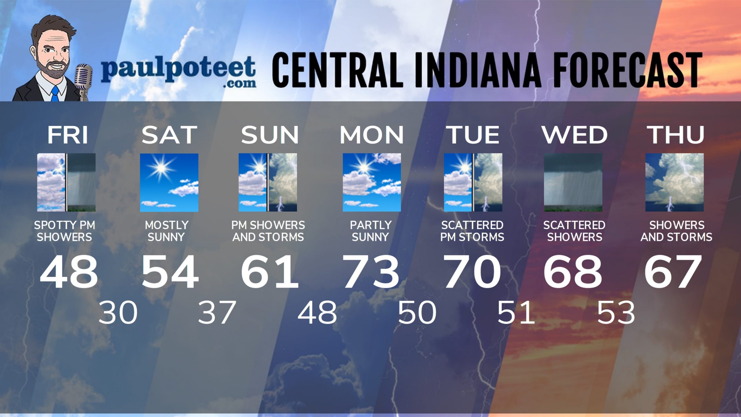
INDY SEVEN DAY FORECAST
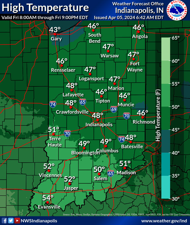
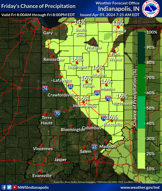
Today: Mostly cloudy. Spotty showers in the afternoon. High 48.
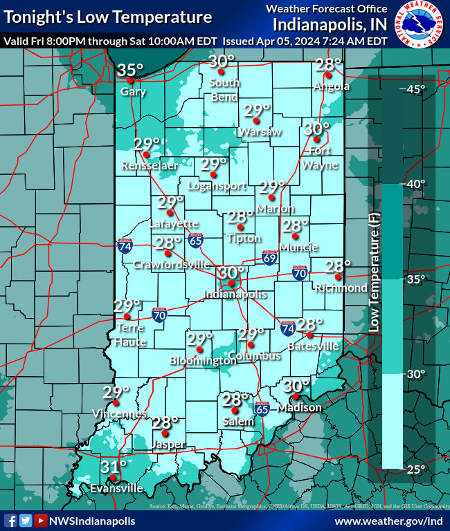
Tonight: Spotty shower possible until sunset, then clearing with a Freeze Warning. Low 30.
Saturday: Sunny morning. Mostly sunny afternoon. High 54.
Saturday Night: Mostly clear. Low 37.
Sunday: Showers and storms, mainly in the afternoon. Some storms could produce large hail and damaging wind gusts. High 61.
Sunday Night: Scattered showers and storms, especially in the evening. Low 48.
Eclipse Day: Early morning low clouds give way to a sunny midday. High, thin clouds in the afternoon. High 73.
Monday Night: Partly cloudy. Low 50.
Tuesday: Partly to mostly cloudy, with scattered afternoon showers and storms. High 70.
Tuesday Night: Scattered showers and storms. Low 51.
Wednesday: Scattered showers and storms. High 68.
Wednesday Night: Showers and storms. Low 53.
Thursday: Showers and storms likely. High 67.
Never miss me! Subscribe for free. My Huge Radar has real-time weather tracking, current temperatures, and severe weather watches and warnings. Get detailed Indiana conditions by clicking here. Click here to see my central Indiana 7-Day Forecast. Follow these links to get my forecasts for Lafayette, Muncie, Hendricks County, and Hamilton County. Need a second opinion? Click here for central Indiana National Weather Service forecasts. (Some charts via WeatherBELL.)


