An overnight complex of showers and storms is pulling away from Indiana in the mid-morning. Satellites show rapid clearing just behind it. This region of clearing is just ahead of a deepening surface low located over Missouri.
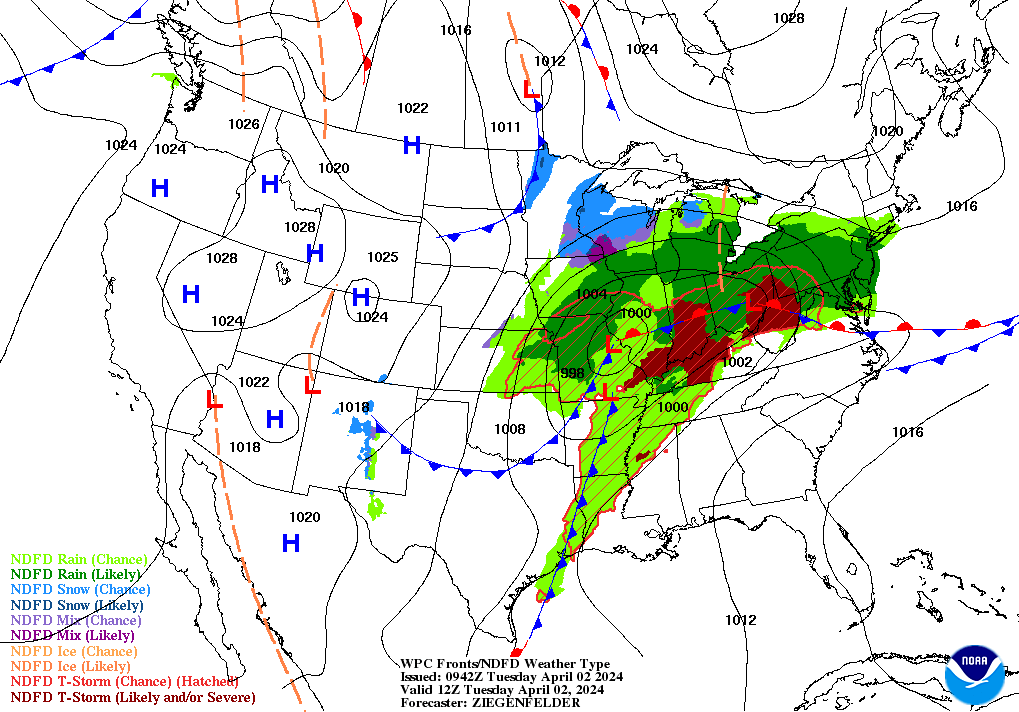
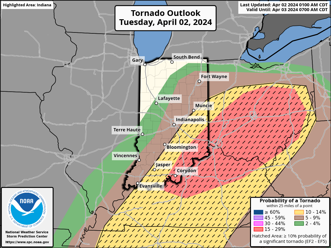
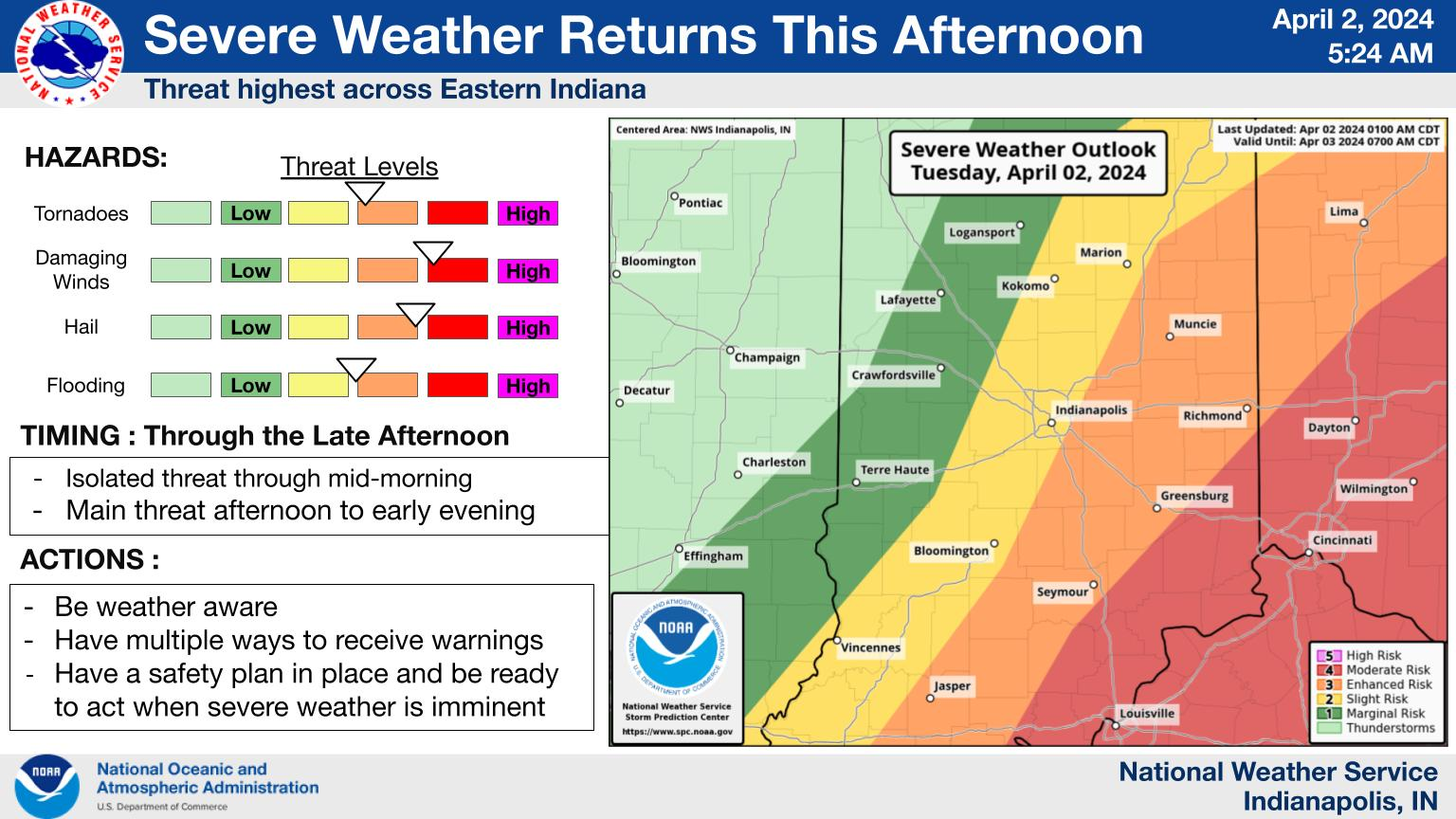
As such, expect a clearing trend not long after this morning`s rain comes to an end. The clearing, plus a developing low-level jet, will contribute building instability. That means a return to severe potential later this afternoon, until around sunset. Large hail, damaging winds, and tornadoes are all possible. There is a possibility of EF2 or higher tornadoes that could do significant damage.
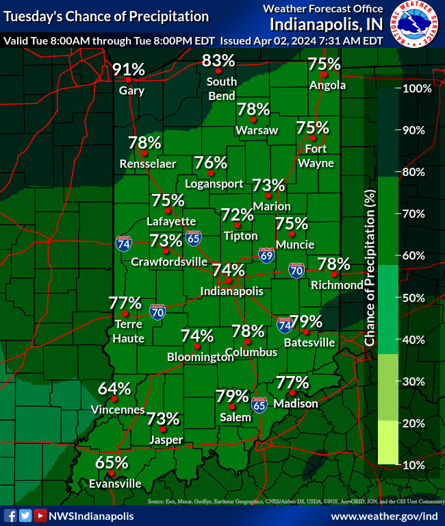
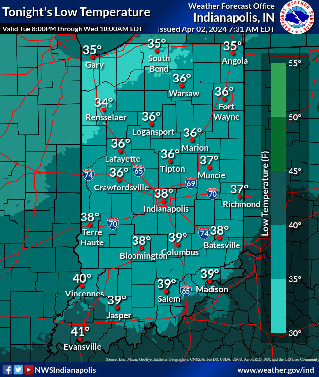
There is also a Flood Watch in place, thanks to over an inch of rain already, and another inch or two possible today. Temps tumble overnight, and we will be in the 30s and 40s the rest of the week!
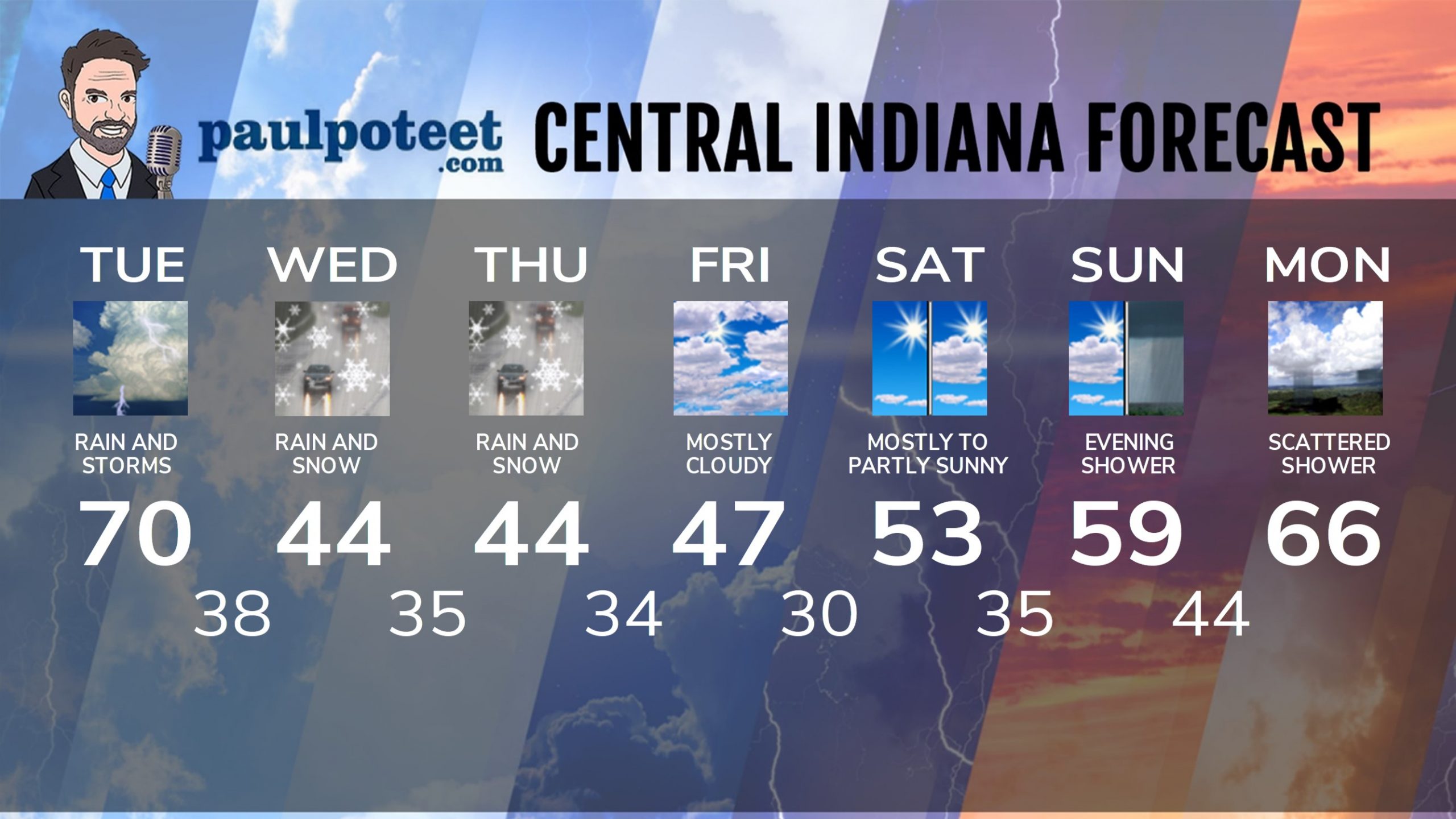
INDY SEVEN DAY FORECAST
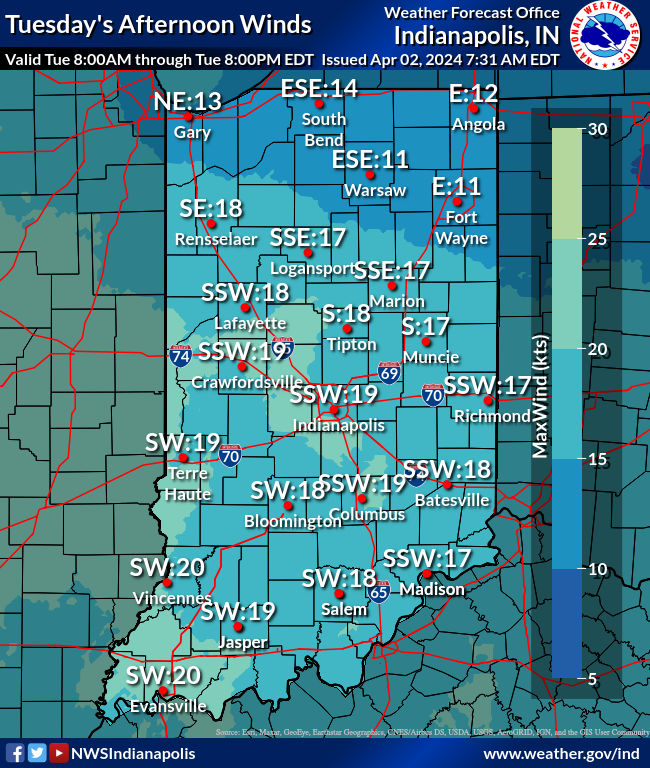
Today: Showers and storms, especially in the afternoon, when heavy rain and severe storms are possible. Wind gusting to 35 mph. High 70.
Tonight: Spotty evening shower, otherwise mostly cloudy. Low 38.
Wednesday: Rain and snow showers. High 44.
Wednesday Night: Rain and snow showers. Wind gusting to 30 mph. Chills in the 20s. Low 35.
Thursday: Rain and snow showers. High 44.
Thursday Night: Mostly cloudy, with spotty showers. Low 34.
Friday: Mostly cloudy. High 47.
Friday Night: Clearing and colder. Low 30.
Saturday: Mostly sunny morning. Partly sunny afternoon. High 53.
Saturday Night: Partly cloudy. Low 35.
Sunday: Partly sunny. High 59.
Sunday Night: Scattered showers. Low 44.
Eclipse Day: Partly sunny. Scattered showers possible. High 66.