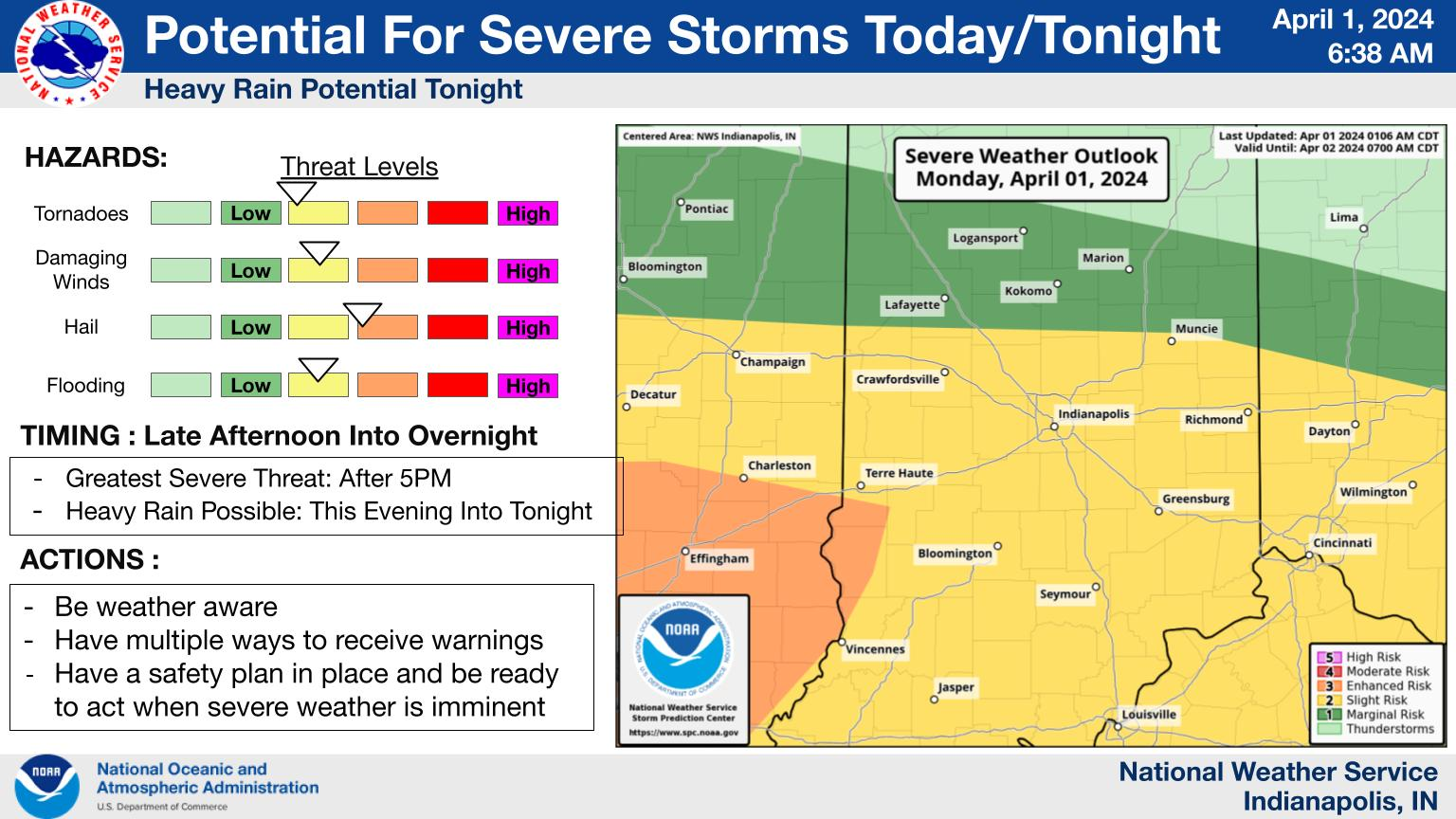
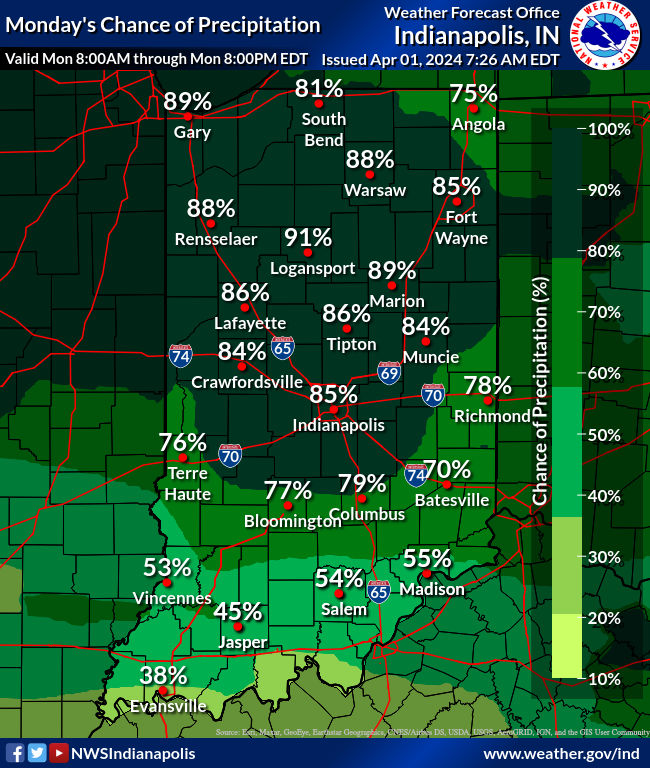
The biggest chance for heavy rain and severe weather in central Indiana come tonight, and again Tuesday afternoon. That’s followed by tumbling temperatures behind a cold front that will finally sweep up the mess. Until then a stationery front is locked in place across the state.
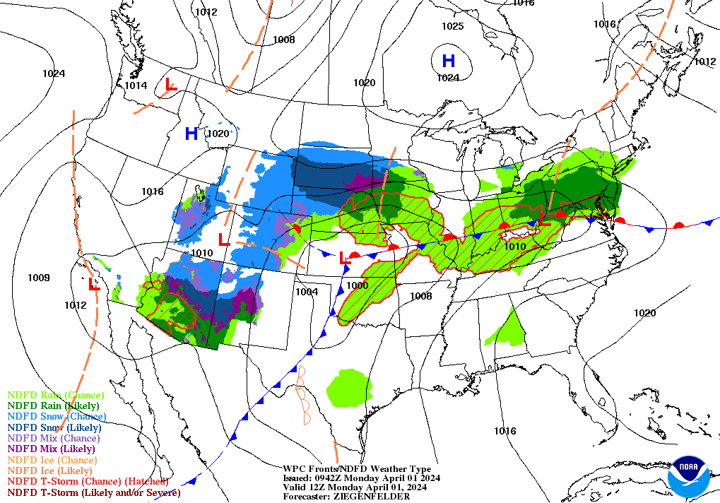
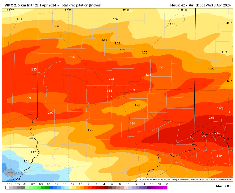
The atmosphere will recharge by later this afternoon and evening, as the upper atmosphere delivers a fresh round of energy. In addition to severe weather there is also the threat of heavy rain, with over two inches possible.
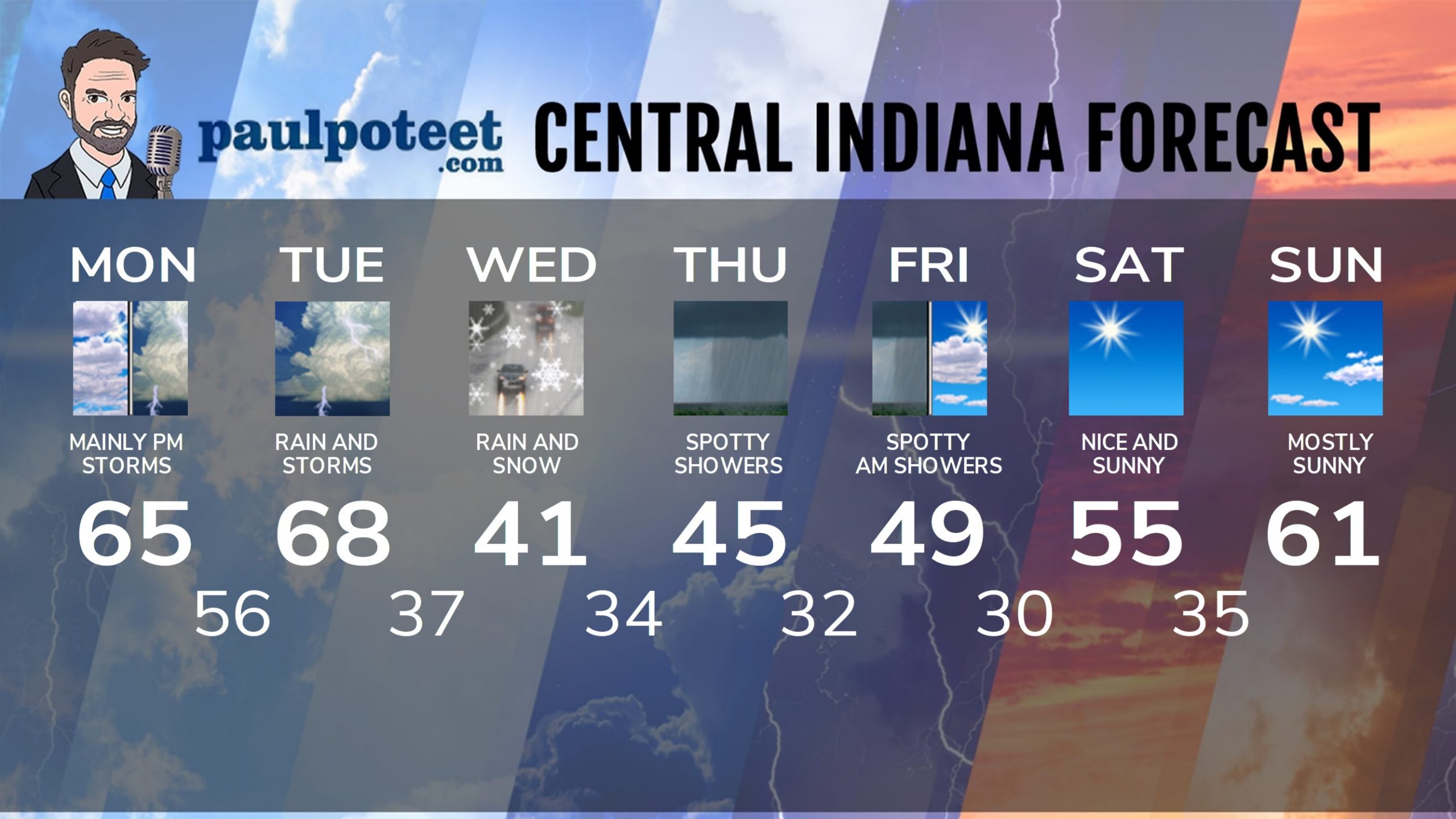
INDY SEVEN DAY FORECAST
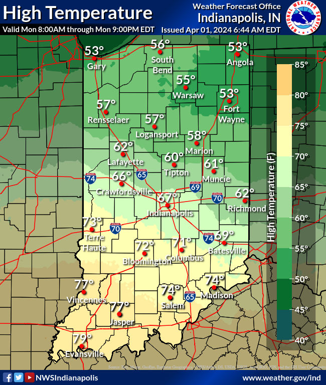
Today: Scattered showers and storms, mainly in the afternoon. High 65.
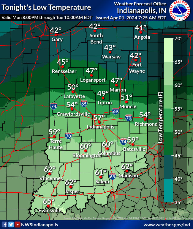
Tonight: Showers and storms. Heavy rain is possible, and evening storms could be severe. Low 56.
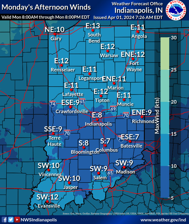
Tuesday: Showers and storms, especially in the afternoon, when heavy rain and strong storms are possible. Wind gusting to 30 mph. High 68.
Tuesday Night: Spotty evening showers. Cloudy overnight. Low 37.
Wednesday: Rain and snow showers, with wind gusting to 35 mph. High 41.
Wednesday Night: Rain and snow showers. Still breezy. Low 34.
Thursday: Cloudy, with spotty showers. High 45.
Thursday Night: Mostly cloudy, with spotty showers. Low 32.
Friday: Mostly cloudy with spotty morning showers. Partly sunny later. High 49.
Friday Night: Clearing and colder. Low 30.
Saturday: Sunny. High 55.
Saturday Night: Clear. Low 35.
Sunday: Mostly sunny. High 61.
Never miss me! Subscribe for free. My Huge Radar has real-time weather tracking, current temperatures, and severe weather watches and warnings. Get detailed Indiana conditions by clicking here. Click here to see my central Indiana 7-Day Forecast. Follow these links to get my forecasts for Lafayette, Muncie, Hendricks County, and Hamilton County. Need a second opinion? Click here for central Indiana National Weather Service forecasts. (Some charts via WeatherBELL.)


