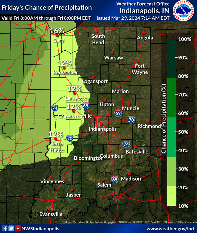
Make the most of today – it’s the best weather day for a week. Showers and storms will develop late this evening and overnight, happening first in the northern half of the state. Rain and rumbles through Saturday morning, then a precipitation pause while the front sags south into southern Indiana.
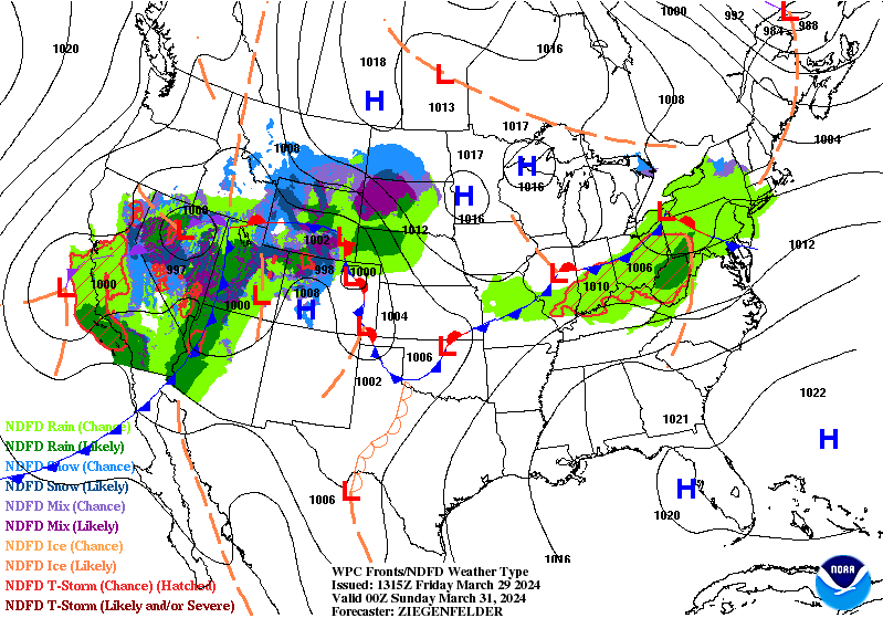
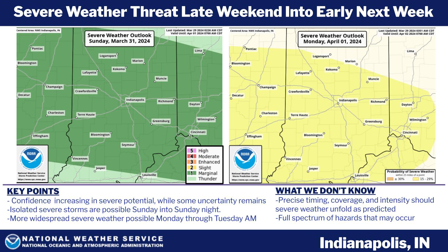
No severe weather Saturday, but there could be storms with large hail as the front returns to the north Easter Sunday afternoon and evening. Another round of severe weather is possible Monday. Heavy rain is also a threat.
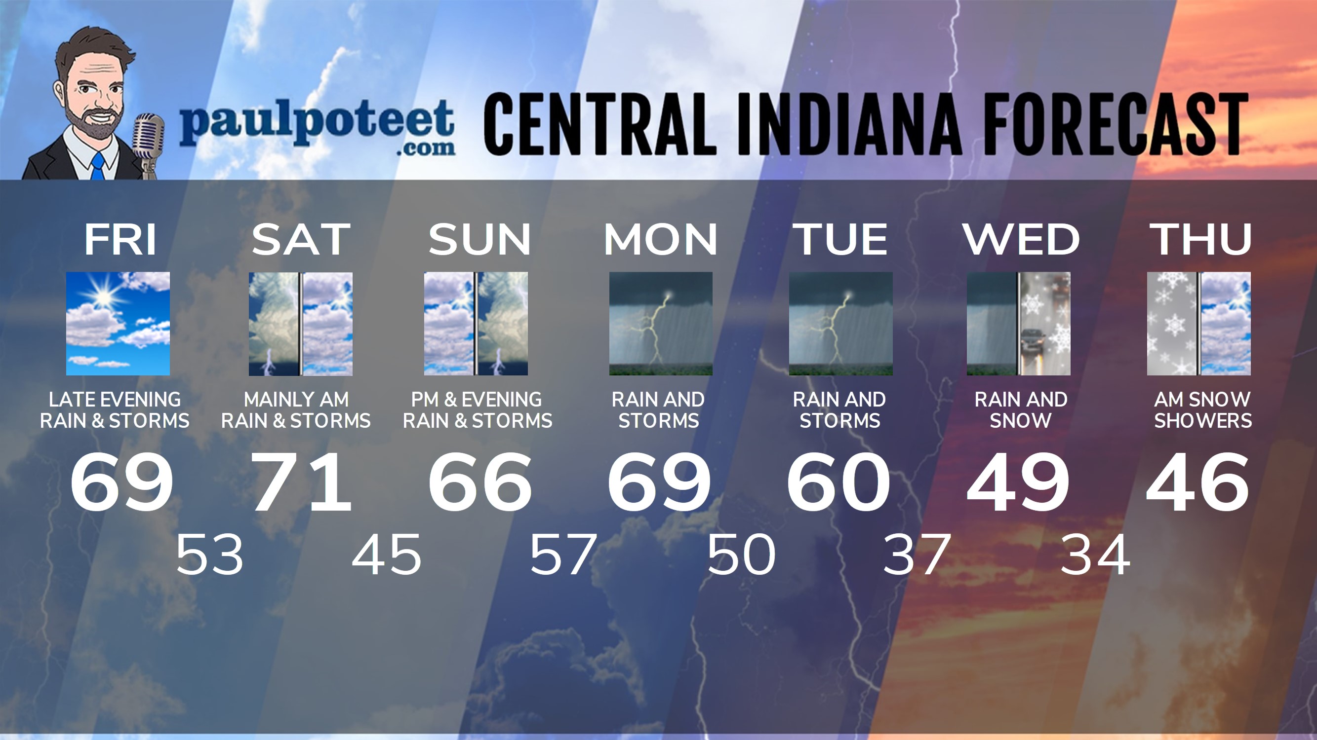
INDY SEVEN DAY FORECAST
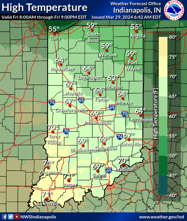
Today Partly sunny. High 69.
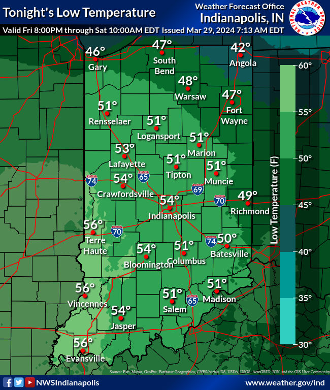
Tonight: Mostly cloudy. Scattered showers and storms, especially after midnight. Low 53.
Saturday: Partly to mostly cloudy. Scattered showers and storms in the morning. A few spotty storms possible in the afternoon. High 71.
Saturday Night: Partly cloudy. Low 45.
Sunday: Partly to mostly cloudy. Scattered showers and storms, mainly in the afternoon. Some could produce large hail. High 66.
Sunday Night:Showers and storms. Low 57.
Monday: Showers and storms. Heavy rain and strong storms possible. High 69.
Monday Night; Showers and storms. Heavy rain and strong storms possible. Low 50.
Tuesday: Showers and storms. Heavy rain and strong storms possible. High 60.
Tuesday Night: Scattered showers. Low 37.
Wednesday: Mostly cloudy and cooler,with scattered showers. High 49.
Wednesday Night: Scattered rain and snow showers. Low 34.
Thursday: Morning snow showers. Mostly to partly cloudy. High 46.
Never miss me! Subscribe for free. My Huge Radar has real-time weather tracking, current temperatures, and severe weather watches and warnings. Get detailed Indiana conditions by clicking here. Click here to see my central Indiana 7-Day Forecast. Follow these links to get my forecasts for Lafayette, Muncie, Hendricks County, and Hamilton County. Need a second opinion? Click here for central Indiana National Weather Service forecasts. (Some charts via WeatherBELL.)


