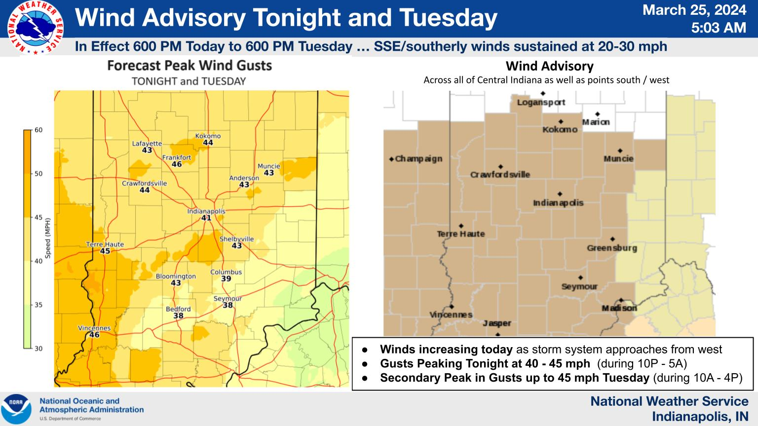
Amid a gusty to windy backdrop, steady rain will arrive from west to east this evening, bringing light/moderate rainfall by dawn Tuesday. A line of showers and t-storms will cross the region Tuesday, with embedded marginal severe weather possible; damaging winds are the greatest threat. #INwx #nwsind


Never miss me! Subscribe for free. My Huge Radar has real-time weather tracking, current temperatures, and severe weather watches and warnings. Get detailed Indiana conditions by clicking here. Click here to see my central Indiana 7-Day Forecast. Follow these links to get my forecasts for Lafayette, Muncie, Hendricks County, and Hamilton County. Need a second opinion? Click here for central Indiana National Weather Service forecasts. (Some charts via WeatherBELL.)


