The breeze will be back again today, but the passage of a cold front has shifted the wind direction from southwest to west and northwest, contributing to highs in the 40s instead of the 50s. Some Spring!
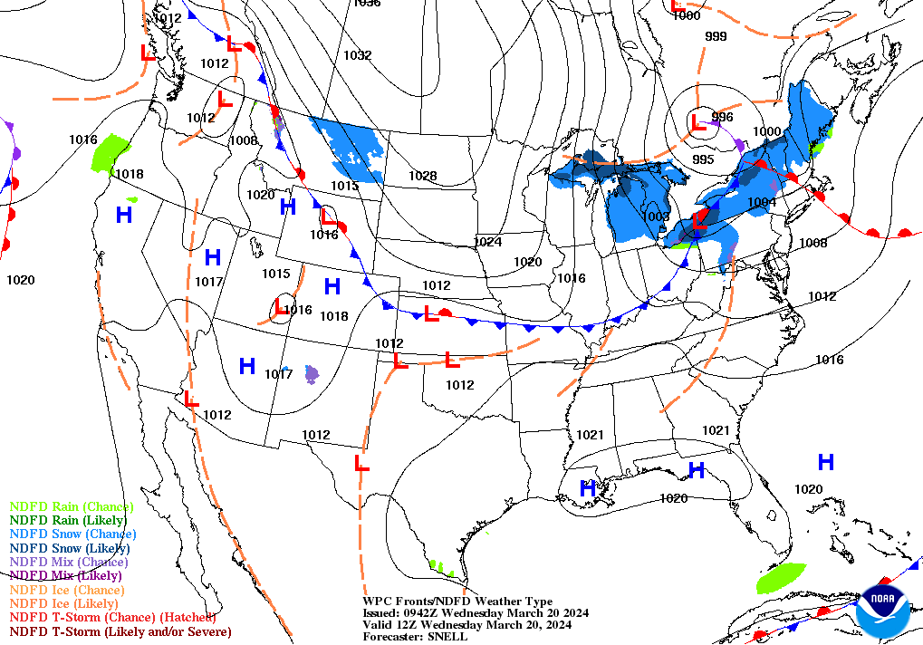
Afternoon gusts could hit 30 mph, and with very dry air in place you are advised to avoid any open burning outdoors. The wind will relax overnight, but chills will still be in the upper teens and 20s Thursday morning.
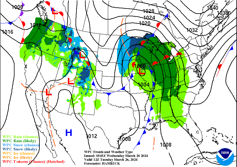
Our next weathermaker just brings scattered showers Friday, mainly in the afternoon and evening. A bigger system next week, with a deep area of low pressure moving in Monday night through Tuesday. At the moment severe weather looks to stay south of us, but gusty winds and heavy rain are possible.
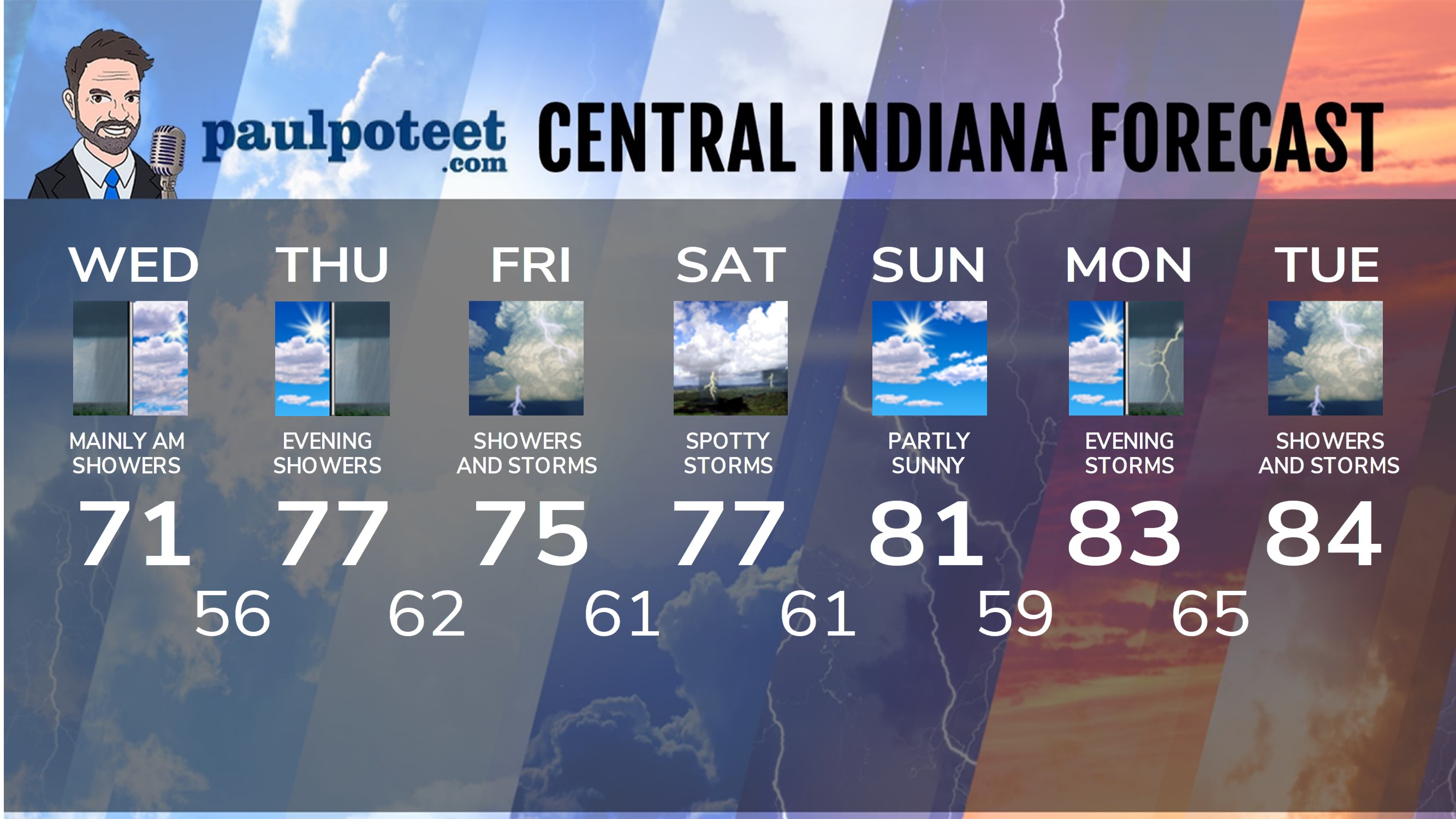
INDY SEVEN DAY FORECAST
Today: Mostly sunny and cooler. Breezy again, with gusts to 30 mph. High 47.
Tonight: Clear and colder. Chills in the upper teens and 20s overnight. Low 23.
Thursday: Partly sunny. Morning chills in the upper teens and 20s. High 45.
Thursday Night: Partly cloudy. Low 33.
Friday: Partly to mostly cloudy. Scattered light showers in the afternoon. High 62.
Friday Night: Scattered light showers. Low 34.
Saturday: Partly cloudy morning. Mostly sunny afternoon. High 45.
Saturday Night: Mostly clear. Low 28.
Sunday: Mostly to partly sunny. High 54.
Sunday Night: Partly cloudy. Low 41.
Monday: Mostly cloudy. High 65.
Monday Night: Showers. Low 49.
Tuesday: More rain. High 58.
Never miss me! Subscribe for free. My Huge Radar has real-time weather tracking, current temperatures, and severe weather watches and warnings. Get detailed Indiana conditions by clicking here. Click here to see my central Indiana 7-Day Forecast. Follow these links to get my forecasts for Lafayette, Muncie, Hendricks County, and Hamilton County. Need a second opinion? Click here for central Indiana National Weather Service forecasts. (Some charts via WeatherBELL.)


