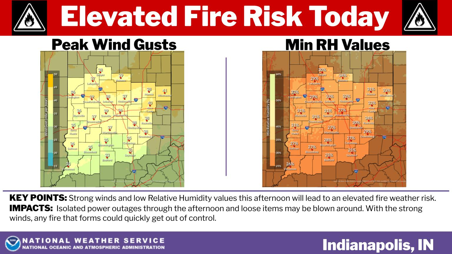
Mother Nature had a case of the Mondays yesterday, but the sun is back today, and so are the 50s. HOWEVER…there will be big breezes gusting to 40 mph in the afternoon.
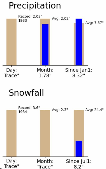
Indy’s trace of snow yesterday leaves us sitting at an 8.2″ total for the season. That’s almost exactly one third of where we should be.
Here’s a look at rain totals for the next week. An inch is possible, with the bulk of this coming Monday night into Tuesday.

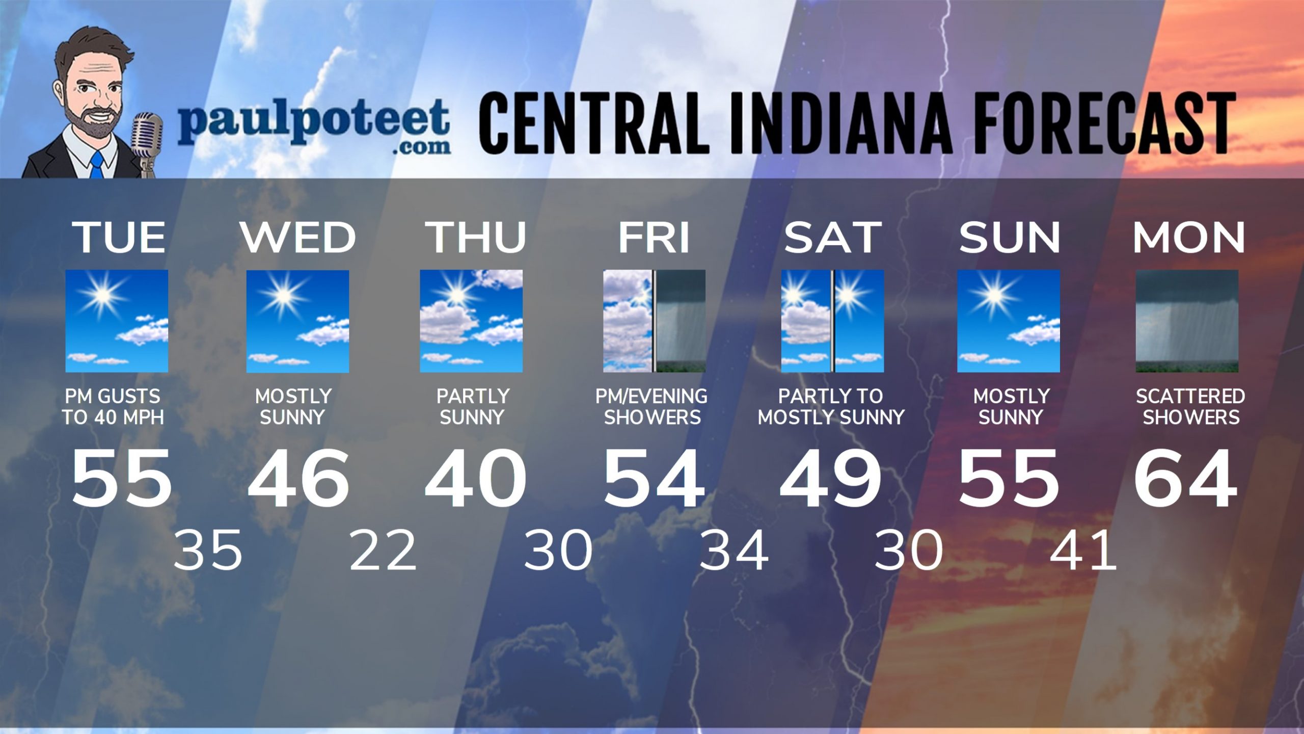
INDY SEVEN DAY FORECAST
Today: Mostly sunny, and not as cold. Afternoon wind gusts to 40 mph. Chills in the teens and 20s in the morning. High 55.
Tonight: Mostly clear. Low 35.
Wednesday: Mostly sunny. High 46.
Wednesday Night: Clear. Low 22.
Thursday: Partly sunny. High 40.
Thursday Night: Clouds increase. Low 30.
Friday: Mostly cloudy. Scattered light showers in the afternoon. High 54.
Friday Night: Scattered light showers. Low 34.
Saturday: Partly to mostly sunny. High 49.
Saturday Night: Mostly clear. Low 30.
Sunday: Mostly sunny. High 55.
Sunday Night: Partly cloudy. Low 41.
Monday: Mostly cloudy, with scattered showers. High 64.
Never miss me! Subscribe for free. My Huge Radar has real-time weather tracking, current temperatures, and severe weather watches and warnings. Get detailed Indiana conditions by clicking here. Click here to see my central Indiana 7-Day Forecast. Follow these links to get my forecasts for Lafayette, Muncie, Hendricks County, and Hamilton County. Need a second opinion? Click here for central Indiana National Weather Service forecasts. (Some charts via WeatherBELL.)


