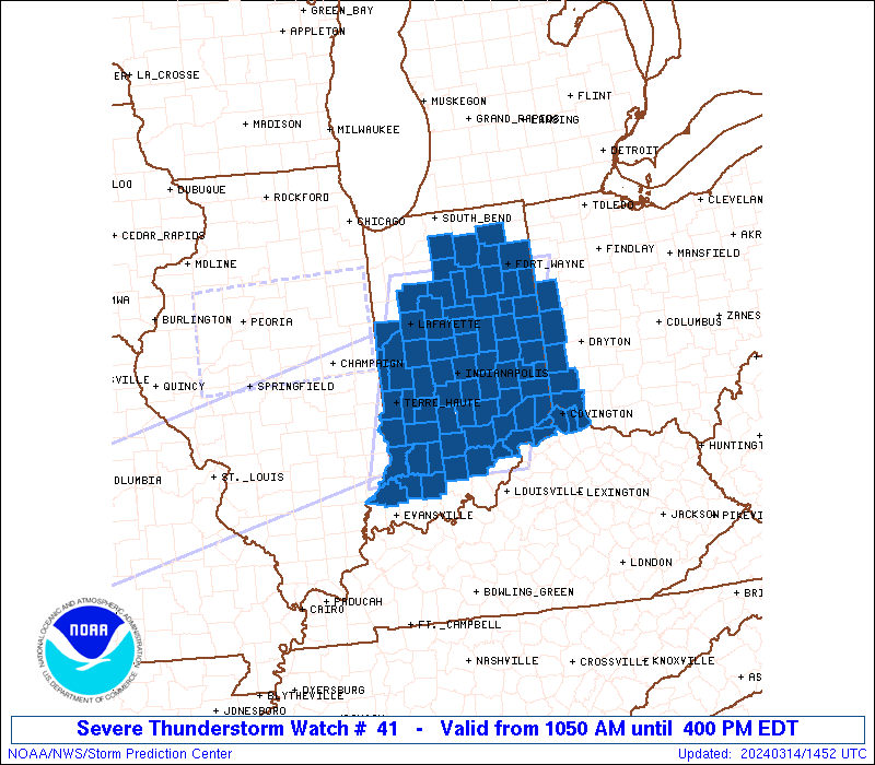
The NWS Storm Prediction Center has issued a

   * Severe Thunderstorm Watch for portions of
     much of Indiana
     far northern Kentucky
     parts of western Ohio

   * Effective this Thursday morning and afternoon from 1050 AM
     until 400 PM EDT.

   * Primary threats include...
     Scattered damaging wind gusts to 70 mph likely
     Scattered large hail and isolated very large hail events to 2
       inches in diameter possible
     A tornado or two possible

   SUMMARY...A broken band of thunderstorms is expected to continue
   intensifying this morning and into this afternoon, as it moves
   across Indiana and vicinity.  Large hail and damaging winds will be
   possible, along with potential for a couple of brief tornadoes
   associated with stronger cells within the broader line of storms.
Never miss me! Subscribe for free. My Huge Radar has real-time weather tracking, current temperatures, and severe weather watches and warnings. Get detailed Indiana conditions by clicking here. Click here to see my central Indiana 7-Day Forecast. Follow these links to get my forecasts for Lafayette, Muncie, Hendricks County, and Hamilton County. Need a second opinion? Click here for central Indiana National Weather Service forecasts. (Some charts via WeatherBELL.)


